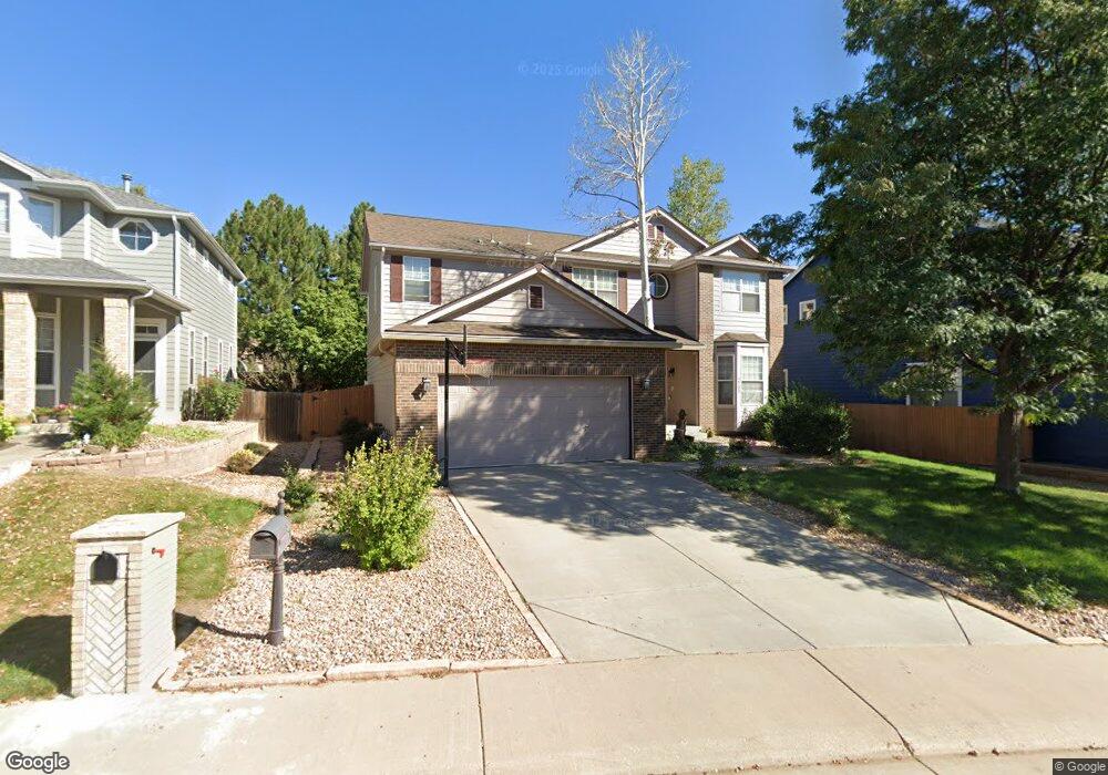
2795 E 132nd Cir Thornton, CO 80241
Signal Creek NeighborhoodEstimated Value: $602,000 - $671,000
3
Beds
3
Baths
4,241
Sq Ft
$149/Sq Ft
Est. Value
About This Home
This home is located at 2795 E 132nd Cir, Thornton, CO 80241 and is currently estimated at $630,510, approximately $148 per square foot. 2795 E 132nd Cir is a home located in Adams County with nearby schools including Tarver Elementary School, Century Middle School, and Horizon High School.
Ownership History
Date
Name
Owned For
Owner Type
Purchase Details
Closed on
Apr 15, 2009
Sold by
Paul Jacqueline K
Bought by
Plunkett Roger E and Plunkett Traci L
Current Estimated Value
Home Financials for this Owner
Home Financials are based on the most recent Mortgage that was taken out on this home.
Original Mortgage
$261,250
Outstanding Balance
$164,060
Interest Rate
5.14%
Mortgage Type
Unknown
Estimated Equity
$466,450
Purchase Details
Closed on
Feb 12, 1997
Sold by
Village Homes Of Colorado Inc
Bought by
Modrell Donna J
Home Financials for this Owner
Home Financials are based on the most recent Mortgage that was taken out on this home.
Original Mortgage
$179,150
Interest Rate
7.85%
Create a Home Valuation Report for This Property
The Home Valuation Report is an in-depth analysis detailing your home's value as well as a comparison with similar homes in the area
Home Values in the Area
Average Home Value in this Area
Purchase History
| Date | Buyer | Sale Price | Title Company |
|---|---|---|---|
| Plunkett Roger E | $275,000 | None Available | |
| Modrell Donna J | $223,998 | Land Title |
Source: Public Records
Mortgage History
| Date | Status | Borrower | Loan Amount |
|---|---|---|---|
| Open | Plunkett Roger E | $261,250 | |
| Previous Owner | Modrell Donna J | $179,150 |
Source: Public Records
Tax History
| Year | Tax Paid | Tax Assessment Tax Assessment Total Assessment is a certain percentage of the fair market value that is determined by local assessors to be the total taxable value of land and additions on the property. | Land | Improvement |
|---|---|---|---|---|
| 2025 | $4,342 | $43,250 | $8,840 | $34,410 |
| 2024 | $4,342 | $39,760 | $8,130 | $31,630 |
| 2023 | $4,298 | $45,670 | $8,390 | $37,280 |
| 2022 | $3,677 | $33,380 | $8,620 | $24,760 |
| 2021 | $3,800 | $33,380 | $8,620 | $24,760 |
| 2020 | $3,707 | $33,230 | $8,870 | $24,360 |
| 2019 | $3,715 | $33,230 | $8,870 | $24,360 |
| 2018 | $3,603 | $31,310 | $7,200 | $24,110 |
| 2017 | $3,276 | $31,310 | $7,200 | $24,110 |
| 2016 | $2,946 | $27,410 | $5,890 | $21,520 |
| 2015 | $2,941 | $27,410 | $5,890 | $21,520 |
| 2014 | $2,821 | $25,550 | $5,410 | $20,140 |
Source: Public Records
Map
Nearby Homes
- 2973 E 133rd Ln
- 2746 E 132nd Place
- 13337 Elizabeth Ct
- 58 Blue Heron Dr
- 12829 Cook Dr
- 2615 Signal Creek Dr
- 13064 Garfield Dr
- 2275 E 129th Ave
- 2942 E 135th Place
- 3670 E 128th Place
- 13055 Harrison Dr
- 2297 E 128th Ave
- 13488 Monroe St
- 3715 E 127th Way
- 13068 Harrison Dr
- 13064 Harrison Dr
- 3765 E 127th Way
- 2066 E 129th Ave
- 4087 E 133rd Cir
- 7 Sandpiper Cir
- 2799 E 132nd Cir
- 2793 E 132nd Cir
- 2805 E 132nd Ave
- 2789 E 132nd Cir
- 2942 E 133rd Cir
- 2798 E 132nd Cir
- 2825 E 132nd Ave
- 2952 E 133rd Cir
- 13252 Elizabeth St
- 2782 E 132nd Cir
- 2804 E 132nd Ave
- 2785 E 132nd Cir
- 13268 Elizabeth St
- 13251 Elizabeth St
- 2962 E 133rd Cir
- 2926 E 133rd Cir
- 13242 Elizabeth St
- 2772 E 132nd Cir
- 13261 Elizabeth St
- 2845 E 132nd Ave
Your Personal Tour Guide
Ask me questions while you tour the home.