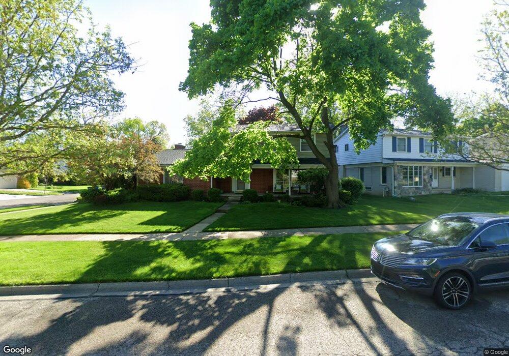
2796 Georgetown Blvd Ann Arbor, MI 48105
Orchard Hills-Maplewood NeighborhoodEstimated Value: $557,917 - $637,000
4
Beds
3
Baths
1,944
Sq Ft
$306/Sq Ft
Est. Value
About This Home
This home is located at 2796 Georgetown Blvd, Ann Arbor, MI 48105 and is currently estimated at $593,979, approximately $305 per square foot. 2796 Georgetown Blvd is a home located in Washtenaw County with nearby schools including Thurston Elementary School, Clague Middle School, and Huron High School.
Ownership History
Date
Name
Owned For
Owner Type
Purchase Details
Closed on
Feb 22, 2018
Sold by
Thompson Andrew M and Thompson Margaret T
Bought by
Thompson Andrew M and Thompson Margaret T
Current Estimated Value
Purchase Details
Closed on
Apr 13, 2006
Sold by
Thompson Andrew M and Thompson Margaret T
Bought by
Thompson Andrew M and Thompson Margaret T
Purchase Details
Closed on
Aug 4, 2000
Sold by
Batty K Kent
Bought by
Thompson Andrew M
Create a Home Valuation Report for This Property
The Home Valuation Report is an in-depth analysis detailing your home's value as well as a comparison with similar homes in the area
Home Values in the Area
Average Home Value in this Area
Purchase History
| Date | Buyer | Sale Price | Title Company |
|---|---|---|---|
| Thompson Andrew M | -- | None Available | |
| Thompson Andrew M | -- | None Available | |
| Thompson Andrew M | -- | None Available | |
| Thompson Andrew M | $266,000 | -- |
Source: Public Records
Tax History Compared to Growth
Tax History
| Year | Tax Paid | Tax Assessment Tax Assessment Total Assessment is a certain percentage of the fair market value that is determined by local assessors to be the total taxable value of land and additions on the property. | Land | Improvement |
|---|---|---|---|---|
| 2025 | $8,317 | $259,000 | $0 | $0 |
| 2024 | $7,745 | $245,800 | $0 | $0 |
| 2023 | $7,141 | $222,100 | $0 | $0 |
| 2022 | $7,782 | $208,800 | $0 | $0 |
| 2021 | $7,598 | $203,200 | $0 | $0 |
| 2020 | $7,445 | $193,200 | $0 | $0 |
| 2019 | $7,085 | $178,900 | $178,900 | $0 |
| 2018 | $6,985 | $167,200 | $0 | $0 |
| 2017 | $6,795 | $164,900 | $0 | $0 |
| 2016 | $6,556 | $135,883 | $0 | $0 |
| 2015 | $6,243 | $135,477 | $0 | $0 |
| 2014 | $6,243 | $131,245 | $0 | $0 |
| 2013 | -- | $131,245 | $0 | $0 |
Source: Public Records
Map
Nearby Homes
- 2782 Maitland Dr
- 3367 Burbank Dr
- 3024 Bolgos Cir Unit 303
- 3057 Barclay Way Unit 265
- 3039 Barclay Way Unit 256
- 2 Haverhill Ct
- 1 Westbury Ct
- 2656 Shefman Terrace
- 2856 Barclay Way Unit 38
- 0000 Nixon Rd
- 3252 Bolgos Cir
- 4763 Curtis
- 4990 Saddleridge
- 2605 Nadia Ct Unit 8
- 2901 Corston Rd
- 2824 Ridington Rd
- 2182 Yorktown Dr
- 3250 Brackley Dr
- 2805 Rathmore Ln
- 3056 N Spurway Dr
- 2784 Georgetown Blvd
- 0 Rumsey Dr
- 3205 Rumsey Dr
- 3188 Rumsey Dr
- 2776 Georgetown Blvd
- 3189 Rumsey Dr
- 3226 Rumsey Dr
- 3215 Rumsey Dr
- 2787 Georgetown Blvd
- 3174 Rumsey Dr
- 2779 Georgetown Blvd
- 2762 Georgetown Blvd
- 3175 Rumsey Dr
- 3227 Rumsey Dr
- 3162 Rumsey Dr
- 2767 Georgetown Blvd
- 3163 Rumsey Dr
- 2750 Georgetown Blvd
- 3150 Rumsey Dr
- 2751 Georgetown Blvd