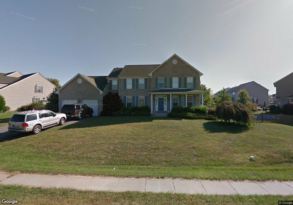
2799 Decatur Dr Adamstown, MD 21710
Estimated Value: $726,315 - $799,000
4
Beds
2
Baths
--
Sq Ft
0.36
Acres
About This Home
This home is located at 2799 Decatur Dr, Adamstown, MD 21710 and is currently estimated at $757,579. 2799 Decatur Dr is a home located in Frederick County with nearby schools including Carroll Manor Elementary School, Ballenger Creek Middle School, and Tuscarora High School.
Ownership History
Date
Name
Owned For
Owner Type
Purchase Details
Closed on
Aug 26, 2021
Sold by
Stephens Kenneth Earl
Bought by
Stephens Kenneth Earl and Wilson Elyse D
Current Estimated Value
Purchase Details
Closed on
Nov 30, 2015
Sold by
Stephens Kenneth Earl
Bought by
Stephen Kenneth Earl and Wilson Elyse D
Purchase Details
Closed on
Sep 4, 2015
Sold by
Wilson Gregory W and Wilson Elyse D
Bought by
Stephens Kenneth Earl
Home Financials for this Owner
Home Financials are based on the most recent Mortgage that was taken out on this home.
Original Mortgage
$408,035
Interest Rate
3.94%
Mortgage Type
VA
Purchase Details
Closed on
May 29, 2003
Sold by
Ausherman Hilda L
Bought by
Halton Timothy B and Halton Linda D
Create a Home Valuation Report for This Property
The Home Valuation Report is an in-depth analysis detailing your home's value as well as a comparison with similar homes in the area
Home Values in the Area
Average Home Value in this Area
Purchase History
| Date | Buyer | Sale Price | Title Company |
|---|---|---|---|
| Stephens Kenneth Earl | -- | -- | |
| Stephens Kenneth Earl | -- | None Listed On Document | |
| Stephen Kenneth Earl | -- | Attorney | |
| Stephens Kenneth Earl | $395,000 | Old Republic Natl Title Ins | |
| Halton Timothy B | $443,975 | -- |
Source: Public Records
Mortgage History
| Date | Status | Borrower | Loan Amount |
|---|---|---|---|
| Previous Owner | Stephens Kenneth Earl | $408,035 | |
| Closed | Halton Timothy B | -- |
Source: Public Records
Tax History Compared to Growth
Tax History
| Year | Tax Paid | Tax Assessment Tax Assessment Total Assessment is a certain percentage of the fair market value that is determined by local assessors to be the total taxable value of land and additions on the property. | Land | Improvement |
|---|---|---|---|---|
| 2025 | $6,896 | $607,200 | -- | -- |
| 2024 | $6,896 | $562,200 | $114,800 | $447,400 |
| 2023 | $6,386 | $542,267 | $0 | $0 |
| 2022 | $6,154 | $522,333 | $0 | $0 |
| 2021 | $5,842 | $502,400 | $114,800 | $387,600 |
| 2020 | $5,842 | $495,433 | $0 | $0 |
| 2019 | $5,761 | $488,467 | $0 | $0 |
| 2018 | $5,731 | $481,500 | $114,800 | $366,700 |
| 2017 | $5,420 | $481,500 | $0 | $0 |
| 2016 | $5,068 | $436,633 | $0 | $0 |
| 2015 | $5,068 | $414,200 | $0 | $0 |
| 2014 | $5,068 | $414,200 | $0 | $0 |
Source: Public Records
Map
Nearby Homes
- 5798 Morland Dr N
- 5523 Modly Ct
- 2735 Tuscarora St
- 2731 Tuscarora St
- 2730 Tuscarora St
- 2734 Tuscarora St
- 5880 Union Ridge Dr
- Macon II Plan at The Enclave at Carrollton Manor
- Adamstown Plan at The Enclave at Carrollton Manor
- Fayetteville Plan at The Enclave at Carrollton Manor
- Oban Plan at The Enclave at Carrollton Manor
- 000 Modly Ct
- 00 Modly Ct
- 00000 Modly Ct
- 0000 Modly Ct
- 2727 Bill Dorsey Blvd
- 2730 John Mills Rd
- 2422 Doubs Ct
- 3039 Ballenger Creek Pike
- 6230 Manor Woods Rd
- 2801 Decatur Dr
- 5600 Haddington Dr
- 5602 Haddington Dr
- 5820 Morland Dr N
- 2803 Decatur Dr
- 5818 Morland Dr N
- 5604 Haddington Dr
- 2795 Decatur Dr
- 5816 Morland Dr N
- 5606 Haddington Dr
- 5603 Haddington Dr
- 5814 Morland Dr N
- 2793 Decatur Dr
- 5608 Haddington Dr
- 2805 Decatur Dr
- 5819 Morland Dr N
- 5605 Haddington Dr
- 5812 Morland Dr N
- 5817 Morland Dr N
- 5610 Haddington Dr