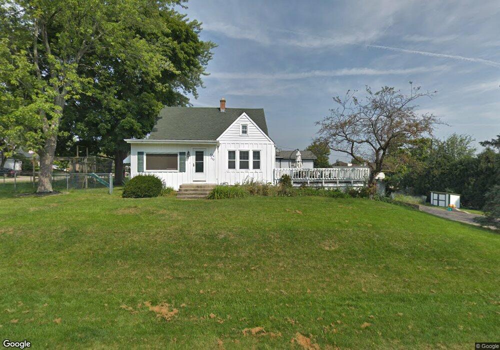
27W230 Nickolsen Ave Winfield, IL 60190
Estimated Value: $376,000 - $396,000
3
Beds
--
Bath
1,508
Sq Ft
$257/Sq Ft
Est. Value
About This Home
This home is located at 27W230 Nickolsen Ave, Winfield, IL 60190 and is currently estimated at $387,022, approximately $256 per square foot. 27W230 Nickolsen Ave is a home located in DuPage County with nearby schools including Winfield Central School, Winfield Primary School, and West Chicago Community High School.
Ownership History
Date
Name
Owned For
Owner Type
Purchase Details
Closed on
Aug 9, 2004
Sold by
Calkin Jonathan Dean and Calkin Staci Nicholl
Bought by
Phinney Raymond E and Phinney Camay M
Current Estimated Value
Home Financials for this Owner
Home Financials are based on the most recent Mortgage that was taken out on this home.
Original Mortgage
$231,000
Outstanding Balance
$90,170
Interest Rate
2.85%
Mortgage Type
Negative Amortization
Estimated Equity
$296,852
Purchase Details
Closed on
Oct 12, 1995
Sold by
American National Bk & Tr Co Of Chicago
Bought by
Calkin Jonathan Dean and Calkin Staci Nicholl
Home Financials for this Owner
Home Financials are based on the most recent Mortgage that was taken out on this home.
Original Mortgage
$127,200
Interest Rate
7.8%
Mortgage Type
Purchase Money Mortgage
Create a Home Valuation Report for This Property
The Home Valuation Report is an in-depth analysis detailing your home's value as well as a comparison with similar homes in the area
Home Values in the Area
Average Home Value in this Area
Purchase History
| Date | Buyer | Sale Price | Title Company |
|---|---|---|---|
| Phinney Raymond E | $257,000 | First American Title | |
| Calkin Jonathan Dean | $159,000 | -- |
Source: Public Records
Mortgage History
| Date | Status | Borrower | Loan Amount |
|---|---|---|---|
| Open | Phinney Raymond E | $231,000 | |
| Previous Owner | Calkin Jonathan Dean | $127,200 |
Source: Public Records
Tax History Compared to Growth
Tax History
| Year | Tax Paid | Tax Assessment Tax Assessment Total Assessment is a certain percentage of the fair market value that is determined by local assessors to be the total taxable value of land and additions on the property. | Land | Improvement |
|---|---|---|---|---|
| 2024 | $7,413 | $106,764 | $34,993 | $71,771 |
| 2023 | $7,073 | $97,510 | $31,960 | $65,550 |
| 2022 | $6,709 | $91,140 | $29,880 | $61,260 |
| 2021 | $6,308 | $87,360 | $28,640 | $58,720 |
| 2020 | $6,195 | $84,710 | $27,770 | $56,940 |
| 2019 | $6,143 | $80,660 | $26,440 | $54,220 |
| 2018 | $5,870 | $76,100 | $24,930 | $51,170 |
| 2017 | $5,714 | $72,310 | $23,690 | $48,620 |
| 2016 | $5,548 | $67,420 | $22,090 | $45,330 |
| 2015 | $5,435 | $62,410 | $20,450 | $41,960 |
| 2014 | $5,285 | $59,450 | $19,490 | $39,960 |
| 2013 | $5,209 | $61,620 | $20,200 | $41,420 |
Source: Public Records
Map
Nearby Homes
- 27W327 Williams St
- 0S732 Myrtle St
- 27W120 Williams St
- 0S650 Forest St
- 0S579 Robbins St
- 1s050 Shaffner Rd
- 27W0S Roosevelt Rd
- Lot 17,18,19 Roosevelt Rd
- 0S760 Cleveland St
- 27W423 Sunnyside Ave
- 3 Sunnyside Ave
- 2152 Belleau Woods Dr
- 27W020 Walz Way
- 1S710 Shaffner Rd
- 1S728 Shaffner Rd
- 1310 Yorkshire Woods Ct
- 2059 W Roosevelt Rd
- 1440 Stonebridge Cir Unit J10
- 1477 S County Farm Rd Unit 23F
- 27W180 Cooley Ave
- 0S717 Jefferson St
- 0S715 Jefferson St
- 0S711 Jefferson St
- 0S734 Robbins St
- 0S722 Robbins St
- 0S722 Jefferson St
- 27W256 Nickolsen Ave
- 27W179 Emerson Ct Unit 179
- 0S716 Robbins St
- 0S705 Jefferson St
- 0S716 Jefferson St
- 0S708 Robbins St
- 0S768 Jefferson Ct
- 0S746 Emerson Ct Unit 746
- 0S750 Emerson Ct Unit 750
- 0S754 Emerson Ct
- 0S762 Emerson Ct Unit 762
- 27W187 Emerson Ct Unit 187
- 27W262 Jefferson Ct Unit 262
- 27W182 Emerson Ct Unit 182