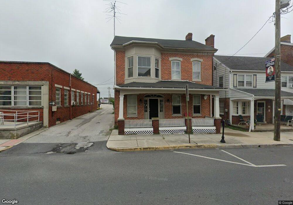
28 1/2 W King Street 1 2 Littlestown, PA 17340
Estimated Value: $237,000 - $267,000
3
Beds
2
Baths
1,949
Sq Ft
$130/Sq Ft
Est. Value
About This Home
This home is located at 28 1/2 W King Street 1 2, Littlestown, PA 17340 and is currently estimated at $253,567, approximately $130 per square foot. 28 1/2 W King Street 1 2 is a home located in Adams County with nearby schools including Rolling Acres El School, Maple Avenue Middle School, and Littlestown Senior High School.
Ownership History
Date
Name
Owned For
Owner Type
Purchase Details
Closed on
Dec 31, 2019
Sold by
Dickensheets Randy and Dickensheets Dianne
Bought by
Spg Capital Llc
Current Estimated Value
Home Financials for this Owner
Home Financials are based on the most recent Mortgage that was taken out on this home.
Original Mortgage
$91,500
Outstanding Balance
$80,844
Interest Rate
3.6%
Mortgage Type
New Conventional
Estimated Equity
$172,723
Purchase Details
Closed on
May 26, 2010
Sold by
Oaster Sonia L
Bought by
Dickensheets Randy and Dickensheets Diane
Create a Home Valuation Report for This Property
The Home Valuation Report is an in-depth analysis detailing your home's value as well as a comparison with similar homes in the area
Home Values in the Area
Average Home Value in this Area
Purchase History
| Date | Buyer | Sale Price | Title Company |
|---|---|---|---|
| Spg Capital Llc | $91,500 | None Available | |
| Dickensheets Randy | $50,000 | -- |
Source: Public Records
Mortgage History
| Date | Status | Borrower | Loan Amount |
|---|---|---|---|
| Open | Spg Capital Llc | $91,500 |
Source: Public Records
Tax History Compared to Growth
Tax History
| Year | Tax Paid | Tax Assessment Tax Assessment Total Assessment is a certain percentage of the fair market value that is determined by local assessors to be the total taxable value of land and additions on the property. | Land | Improvement |
|---|---|---|---|---|
| 2025 | $4,200 | $182,700 | $36,200 | $146,500 |
| 2024 | $4,047 | $182,700 | $36,200 | $146,500 |
| 2023 | $3,890 | $182,700 | $36,200 | $146,500 |
| 2022 | $3,867 | $182,700 | $36,200 | $146,500 |
| 2021 | $3,752 | $182,700 | $36,200 | $146,500 |
| 2020 | $3,701 | $182,400 | $36,200 | $146,200 |
| 2019 | $3,591 | $182,400 | $36,200 | $146,200 |
| 2018 | $3,525 | $182,400 | $36,200 | $146,200 |
| 2017 | $3,434 | $182,400 | $36,200 | $146,200 |
| 2016 | -- | $182,400 | $36,200 | $146,200 |
| 2015 | -- | $182,400 | $36,200 | $146,200 |
| 2014 | -- | $182,400 | $36,200 | $146,200 |
Source: Public Records
Map
Nearby Homes
- 115 Charles St
- 117 Charles St
- 129 W King St
- 61 E King St
- 22 Rita Marie Ave
- 211 E King St
- 140 Apple Grove Ln Unit 425
- 440 N Queen St
- 162 Newark St
- 161 Stoners Cir
- 449 Glenwyn Dr
- 41 Smith Cir
- 535 Lumber St
- 559 Lumber St
- 567 Lumber St
- 58 Windsor Ct
- 48 Windsor Ct
- 20c Locust Dr
- 0 Locust Dr Unit PAAD2015910
- 1024 Frederick Pike Unit 6
- 28 1/2 W King St
- 28 1/2 1/2 W King St
- 30 W King St
- 20 W King St Unit 1
- 18 W King St
- 21 W King St
- 40 W King St
- 27 W King St
- 27 W King St Unit D
- 29 W King St
- 21 Charles St Unit 2
- 111 Charles St
- 31 W King St
- 17 W King St
- 44 W King St
- 37 W King St
- 43 W King St
- 48 W King St
- 45 W King St Unit 8
- 0 W King St Unit 1001366976