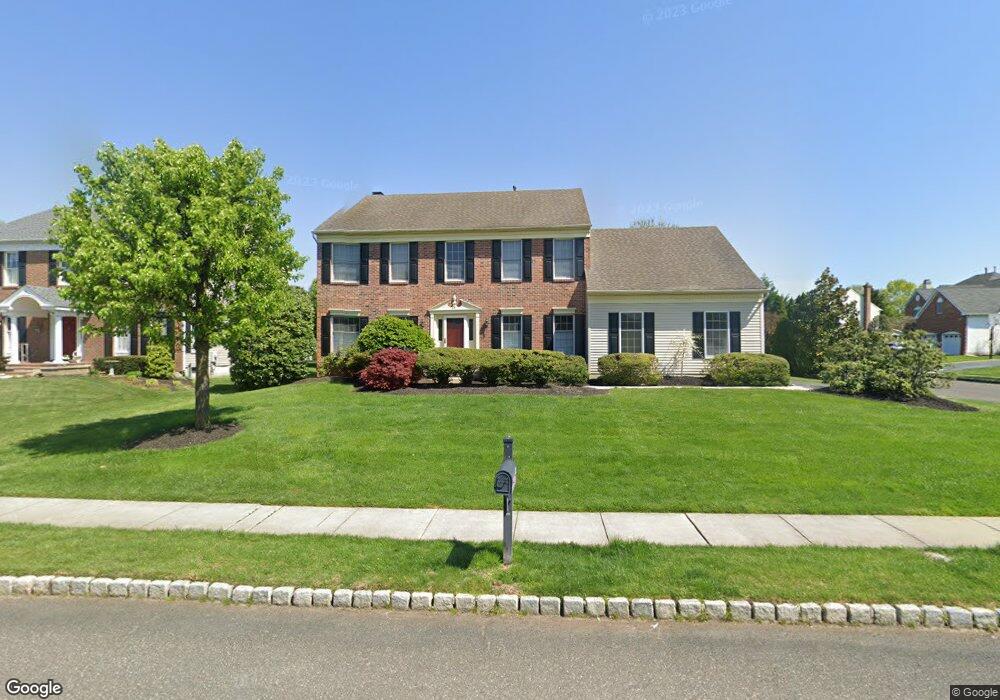
28 Apple Orchard Rd Moorestown, NJ 08057
Estimated Value: $932,824 - $1,105,000
--
Bed
--
Bath
2,436
Sq Ft
$419/Sq Ft
Est. Value
About This Home
This home is located at 28 Apple Orchard Rd, Moorestown, NJ 08057 and is currently estimated at $1,020,956, approximately $419 per square foot. 28 Apple Orchard Rd is a home located in Burlington County with nearby schools including South Valley Elementary School, Moorestown Upper Elementary School, and William Allen Middle School.
Ownership History
Date
Name
Owned For
Owner Type
Purchase Details
Closed on
Feb 14, 2023
Sold by
Serfes Konstantinos
Bought by
Magoulas Pauline
Current Estimated Value
Purchase Details
Closed on
Jun 30, 2004
Sold by
Gillece Richard J and Gillece Susan L
Bought by
Serfes Konstantinos and Serfes Pauline
Home Financials for this Owner
Home Financials are based on the most recent Mortgage that was taken out on this home.
Original Mortgage
$333,700
Interest Rate
4.87%
Mortgage Type
Purchase Money Mortgage
Purchase Details
Closed on
Feb 27, 1997
Sold by
Moorestown Hunt Lp
Bought by
Gillece Richard J and Gillece Susan L
Home Financials for this Owner
Home Financials are based on the most recent Mortgage that was taken out on this home.
Original Mortgage
$207,000
Interest Rate
7.77%
Create a Home Valuation Report for This Property
The Home Valuation Report is an in-depth analysis detailing your home's value as well as a comparison with similar homes in the area
Home Values in the Area
Average Home Value in this Area
Purchase History
| Date | Buyer | Sale Price | Title Company |
|---|---|---|---|
| Magoulas Pauline | -- | -- | |
| Serfes Konstantinos | $482,500 | Fidelity National Title | |
| Gillece Richard J | $284,115 | -- |
Source: Public Records
Mortgage History
| Date | Status | Borrower | Loan Amount |
|---|---|---|---|
| Previous Owner | Serfes Konstantinos | $333,700 | |
| Previous Owner | Gillece Richard J | $207,000 |
Source: Public Records
Tax History Compared to Growth
Tax History
| Year | Tax Paid | Tax Assessment Tax Assessment Total Assessment is a certain percentage of the fair market value that is determined by local assessors to be the total taxable value of land and additions on the property. | Land | Improvement |
|---|---|---|---|---|
| 2025 | $14,386 | $507,100 | $217,000 | $290,100 |
| 2024 | $13,950 | $507,100 | $217,000 | $290,100 |
| 2023 | $13,950 | $507,100 | $217,000 | $290,100 |
| 2022 | $13,808 | $507,100 | $217,000 | $290,100 |
| 2021 | $13,626 | $507,100 | $217,000 | $290,100 |
| 2020 | $13,540 | $507,100 | $217,000 | $290,100 |
| 2019 | $13,301 | $507,100 | $217,000 | $290,100 |
| 2018 | $12,941 | $507,100 | $217,000 | $290,100 |
| 2017 | $13,053 | $507,100 | $217,000 | $290,100 |
| 2016 | $13,007 | $507,100 | $217,000 | $290,100 |
| 2015 | $12,850 | $507,100 | $217,000 | $290,100 |
| 2014 | $12,201 | $507,100 | $217,000 | $290,100 |
Source: Public Records
Map
Nearby Homes
- 44 Brooks Rd
- 5 Murray Rd
- 97 Brooks Rd
- 700 Bentley Ct
- 628 Windsock Way
- 471 Windrow Clusters Dr Unit 23
- 693 Garwood Rd
- 453 Windrow Clusters Dr Unit 19
- 3 Whitetail Ct
- 40 Palmer Dr Unit 110
- 712 Kimberly Dr
- 635 E Main St Unit 5
- 744 Signal Light Rd
- 751 Garwood Rd
- 801 Cox Rd
- 633 E Main St Unit B7
- 901 Mcelwee Rd
- 408 N Stanwick Rd
- 331 Bridgeboro Rd
- 526 E Main St