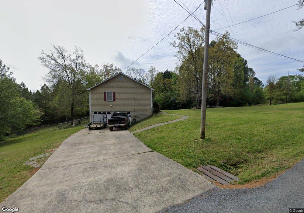
28 Atcheson Woods Path Dallas, GA 30132
East Paulding County NeighborhoodEstimated Value: $264,000 - $293,000
3
Beds
2
Baths
1,251
Sq Ft
$224/Sq Ft
Est. Value
About This Home
This home is located at 28 Atcheson Woods Path, Dallas, GA 30132 and is currently estimated at $279,989, approximately $223 per square foot. 28 Atcheson Woods Path is a home located in Paulding County with nearby schools including Northside Elementary School, Herschel Jones Middle School, and North Paulding High School.
Ownership History
Date
Name
Owned For
Owner Type
Purchase Details
Closed on
Feb 12, 2008
Sold by
Atcheson Travis H
Bought by
Atcheson Timothy L and Atcheson Timothy L
Current Estimated Value
Home Financials for this Owner
Home Financials are based on the most recent Mortgage that was taken out on this home.
Original Mortgage
$114,098
Outstanding Balance
$71,970
Interest Rate
6.06%
Mortgage Type
FHA
Estimated Equity
$208,019
Create a Home Valuation Report for This Property
The Home Valuation Report is an in-depth analysis detailing your home's value as well as a comparison with similar homes in the area
Home Values in the Area
Average Home Value in this Area
Purchase History
| Date | Buyer | Sale Price | Title Company |
|---|---|---|---|
| Atcheson Timothy L | $115,000 | -- |
Source: Public Records
Mortgage History
| Date | Status | Borrower | Loan Amount |
|---|---|---|---|
| Open | Atcheson Timothy L | $114,098 |
Source: Public Records
Tax History Compared to Growth
Tax History
| Year | Tax Paid | Tax Assessment Tax Assessment Total Assessment is a certain percentage of the fair market value that is determined by local assessors to be the total taxable value of land and additions on the property. | Land | Improvement |
|---|---|---|---|---|
| 2024 | $2,770 | $114,596 | $15,120 | $99,476 |
| 2023 | $2,823 | $110,792 | $14,720 | $96,072 |
| 2022 | $2,957 | $99,572 | $12,520 | $87,052 |
| 2021 | $2,257 | $75,996 | $10,720 | $65,276 |
| 2020 | $2,041 | $68,728 | $10,720 | $58,008 |
| 2019 | $1,982 | $65,784 | $10,240 | $55,544 |
| 2018 | $1,556 | $53,516 | $7,760 | $45,756 |
| 2017 | $1,480 | $50,316 | $7,760 | $42,556 |
| 2016 | $1,115 | $38,752 | $7,360 | $31,392 |
| 2015 | $1,043 | $35,744 | $6,600 | $29,144 |
| 2014 | $971 | $32,616 | $6,280 | $26,336 |
| 2013 | -- | $27,360 | $7,000 | $20,360 |
Source: Public Records
Map
Nearby Homes
- 000 Westminster Way
- 74 Riders Ridge
- 304 Oscar Way
- 69 Walraven Place
- 16 Riders Ridge
- 195 Harvard Place
- 70 Stallion Run
- 443 Brooks Rd
- The McGinnis Plan at Jones Ridge
- The Langford Plan at Jones Ridge
- The Ellijay Plan at Jones Ridge
- The Palmer Plan at Jones Ridge
- The James Plan at Jones Ridge
- The Lancaster Plan at Jones Ridge
- The Avery Plan at Jones Ridge
- 24 Polk Path
- 205 Hart Cir
- 18 Mountain Ct
- 272 Kades Cove Dr
- 0 Polk Ln Unit 25025134
- 344 Atcheson Rd
- 0 Atcheson Rd Unit 7149440
- 0 Atcheson Rd
- 375 Atcheson Rd
- 369 Atcheson Rd
- 306 Atcheson Rd
- 281 Atcheson Rd
- 214 Atcheson Woods Path
- 218 Atcheson Woods Path
- 77 Atcheson Woods Path
- 181 Atcheson Rd
- 210 Atcheson Rd
- 230 Atcheson Rd
- 271 Atcheson Woods Path
- 164 Atcheson Rd
- 484 Old Cartersville Rd
- 167 Patrick Dr
- 456 Old Cartersville Rd
- 161 Patrick Dr
- 398 Old Cartersville Rd