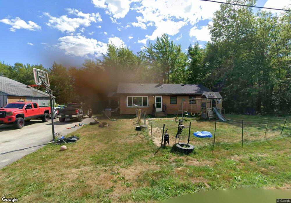
28 Big Ridge Rd Addison, ME 04606
Estimated Value: $157,332 - $270,000
Studio
--
Bath
1,120
Sq Ft
$200/Sq Ft
Est. Value
About This Home
This home is located at 28 Big Ridge Rd, Addison, ME 04606 and is currently estimated at $223,583, approximately $199 per square foot. 28 Big Ridge Rd is a home.
Ownership History
Date
Name
Owned For
Owner Type
Purchase Details
Closed on
Sep 12, 2014
Sold by
Machias Sb
Bought by
Federal National Mortgage Association
Current Estimated Value
Purchase Details
Closed on
Aug 28, 2013
Sold by
Machias Sb
Bought by
Alley John M
Purchase Details
Closed on
Aug 5, 2013
Sold by
Machias Sb
Bought by
Machias Sb
Purchase Details
Closed on
Sep 8, 2011
Sold by
Merchant Allan R and Usa Irs
Bought by
Machias Savings Bank
Create a Home Valuation Report for This Property
The Home Valuation Report is an in-depth analysis detailing your home's value as well as a comparison with similar homes in the area
Purchase History
We collect this data history from publicly available records. To have your information removed, we recommend requesting removal directly through your county’s website.
| Date | Buyer | Sale Price | Title Company |
|---|---|---|---|
| Federal National Mortgage Association | -- | -- | |
| Federal National Mortgage Association | -- | -- | |
| Alley John M | -- | -- | |
| Alley John M | -- | -- | |
| Machias Sb | -- | -- | |
| Machias Sb | -- | -- | |
| Machias Savings Bank | -- | -- | |
| Machias Savings Bank | -- | -- |
Source: Public Records
Tax History
| Year | Tax Paid | Tax Assessment Tax Assessment Total Assessment is a certain percentage of the fair market value that is determined by local assessors to be the total taxable value of land and additions on the property. | Land | Improvement |
|---|---|---|---|---|
| 2025 | $1,936 | $100,300 | $15,800 | $84,500 |
| 2024 | $1,878 | $100,300 | $15,800 | $84,500 |
| 2023 | $1,727 | $100,300 | $15,800 | $84,500 |
| 2022 | $1,652 | $99,500 | $15,000 | $84,500 |
| 2021 | $1,652 | $99,500 | $15,000 | $84,500 |
| 2020 | $1,592 | $99,500 | $15,000 | $84,500 |
| 2019 | $1,582 | $99,500 | $15,000 | $84,500 |
| 2018 | $1,582 | $99,500 | $15,000 | $84,500 |
| 2017 | $1,582 | $99,500 | $15,000 | $84,500 |
| 2016 | $1,456 | $99,700 | $15,000 | $84,700 |
| 2015 | $1,431 | $99,700 | $15,000 | $84,700 |
| 2014 | $1,336 | $99,700 | $15,000 | $84,700 |
| 2013 | $1,256 | $100,500 | $15,000 | $85,500 |
Source: Public Records
Map
Nearby Homes
- Map 12
- 1357 Indian River Rd
- 24 Basin Rd
- 40 Airport Rd
- 1489 Indian River Rd
- 1491 Indian River Rd
- Lot #1 Seaberry Landing Rd
- 60 W Wind Rd
- Lot #8 Seaberry Landing Rd
- Lot #3 Seaberry Landing Rd
- 0 Windward Way Unit 1
- Lot 1 Windward Way
- 55 Wilders Way
- 1655 Indian River Rd
- Lot #7 Highland Rd
- M17L21 Basin Rd
- map 17 Basin Rd Unit lot 24
- Lot #1 Inidan Head Shores
- Lot #2 Inidan Head Shores
- Lot #4 Indian Head Shores
- 8 Big Ridge Rd
- 19 Big Ridge Rd
- 36 Big Ridge Rd
- 48 Big Ridge Rd
- 1140 Indian River Rd
- 1153 Indian River Rd
- 1190 Indian River Rd
- 1154 Indian River Rd
- 59 Big Ridge Rd
- 3 Merchant Ln
- 1105 Indian River Rd
- 65 Big Ridge Rd
- 64 Big Ridge Rd
- 19 Merchant Ln
- 1101 Indian River Rd
- 20 Merchant Ln
- 1098 Indian River Rd
- Lot 7 Indian River Rd
- 102 Labrador Ln
- 12 Alley Ln
Your Personal Tour Guide
Ask me questions while you tour the home.