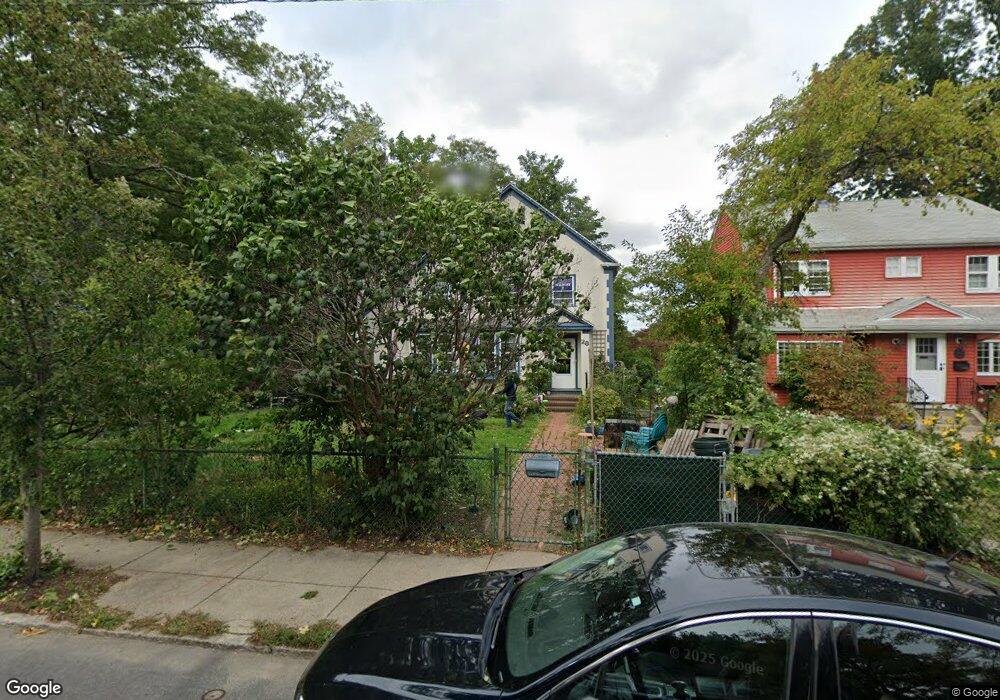
28 Bournedale Rd Jamaica Plain, MA 02130
Jamaica Plain NeighborhoodEstimated Value: $893,000 - $957,000
3
Beds
2
Baths
1,872
Sq Ft
$491/Sq Ft
Est. Value
About This Home
This home is located at 28 Bournedale Rd, Jamaica Plain, MA 02130 and is currently estimated at $919,904, approximately $491 per square foot. 28 Bournedale Rd is a home located in Suffolk County with nearby schools including Brooke Charter School Roslindale, The Croft School - Jamaica Plain, and St. Clare High School.
Ownership History
Date
Name
Owned For
Owner Type
Purchase Details
Closed on
May 29, 2001
Sold by
Ward Kenneth E
Bought by
Macchi Anthony F
Current Estimated Value
Home Financials for this Owner
Home Financials are based on the most recent Mortgage that was taken out on this home.
Original Mortgage
$297,900
Outstanding Balance
$110,063
Interest Rate
7.05%
Mortgage Type
Purchase Money Mortgage
Estimated Equity
$809,841
Purchase Details
Closed on
Jul 31, 1997
Sold by
Sullivan John P
Bought by
Ward Kenneth E and Green Anthony W
Home Financials for this Owner
Home Financials are based on the most recent Mortgage that was taken out on this home.
Original Mortgage
$171,000
Interest Rate
7.55%
Mortgage Type
Purchase Money Mortgage
Purchase Details
Closed on
Oct 18, 1994
Sold by
Buchanan James L
Bought by
Sullivan John P
Home Financials for this Owner
Home Financials are based on the most recent Mortgage that was taken out on this home.
Original Mortgage
$93,750
Interest Rate
8.43%
Mortgage Type
Purchase Money Mortgage
Create a Home Valuation Report for This Property
The Home Valuation Report is an in-depth analysis detailing your home's value as well as a comparison with similar homes in the area
Home Values in the Area
Average Home Value in this Area
Purchase History
| Date | Buyer | Sale Price | Title Company |
|---|---|---|---|
| Macchi Anthony F | $331,000 | -- | |
| Ward Kenneth E | $190,000 | -- | |
| Sullivan John P | $125,000 | -- |
Source: Public Records
Mortgage History
| Date | Status | Borrower | Loan Amount |
|---|---|---|---|
| Open | Macchi Anthony F | $297,900 | |
| Previous Owner | Ward Kenneth E | $171,000 | |
| Previous Owner | Sullivan John P | $93,750 |
Source: Public Records
Tax History Compared to Growth
Tax History
| Year | Tax Paid | Tax Assessment Tax Assessment Total Assessment is a certain percentage of the fair market value that is determined by local assessors to be the total taxable value of land and additions on the property. | Land | Improvement |
|---|---|---|---|---|
| 2025 | $9,279 | $801,300 | $241,200 | $560,100 |
| 2024 | $8,677 | $796,100 | $232,300 | $563,800 |
| 2023 | $7,989 | $743,900 | $217,100 | $526,800 |
| 2022 | $7,422 | $682,200 | $199,100 | $483,100 |
| 2021 | $7,068 | $662,400 | $193,300 | $469,100 |
| 2020 | $6,406 | $606,600 | $187,100 | $419,500 |
| 2019 | $6,090 | $577,800 | $153,000 | $424,800 |
| 2018 | $5,406 | $515,800 | $153,000 | $362,800 |
| 2017 | $5,357 | $505,900 | $153,000 | $352,900 |
| 2016 | $5,456 | $496,000 | $153,000 | $343,000 |
| 2015 | $5,050 | $417,000 | $145,300 | $271,700 |
| 2014 | $4,594 | $365,200 | $145,300 | $219,900 |
Source: Public Records
Map
Nearby Homes
- 50 Southbourne Rd
- 18-20 Northbourne Rd Unit 18
- 348-350 Hyde Park Ave Unit 2
- 31 Rodman St Unit 2
- 31 Rodman St Unit 1
- 158 Wachusett St Unit 3
- 71 Wyvern St
- 140 Wachusett St
- 36 Neponset Ave Unit 1
- 19 Delford St
- 19 Delford St Unit 1
- 24 Waterman Rd
- 4012 Washington St
- 178 Hyde Park Ave Unit 3
- 105 Neponset Ave Unit 105
- 103 Neponset Ave Unit 103A
- 103-105 Neponset Ave
- 4031 Washington St
- 187 Florence St Unit 2L
- 143-171 Hyde Park Ave Unit 169A
- 32 Bournedale Rd
- 26 Bournedale Rd
- 43 Northbourne Rd
- 43 Northbourne Rd Unit 1
- 47 Northbourne Rd
- 34 Bournedale Rd
- 39 Northbourne Rd
- 23 Bournedale Rd
- 27 Bournedale Rd
- 24 Bournedale Rd
- 51 Northbourne Rd
- 51 Northbourne Rd Unit 1
- 33 Bournedale Rd
- 35 Northbourne Rd
- 19 Bournedale Rd
- 36 Bournedale Rd
- 68 Southbourne Rd
- 68 Southbourne Rd Unit 9999
- 37 Bournedale Rd
- 66 Southbourne Rd