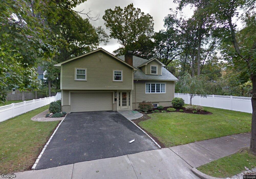
28 Brierfield Rd Newton Highlands, MA 02461
Newton Highlands NeighborhoodEstimated Value: $1,788,000 - $2,108,000
5
Beds
5
Baths
3,900
Sq Ft
$487/Sq Ft
Est. Value
About This Home
This home is located at 28 Brierfield Rd, Newton Highlands, MA 02461 and is currently estimated at $1,901,053, approximately $487 per square foot. 28 Brierfield Rd is a home located in Middlesex County with nearby schools including Countryside Elementary School, Charles E Brown Middle School, and Newton South High School.
Ownership History
Date
Name
Owned For
Owner Type
Purchase Details
Closed on
Nov 5, 2024
Sold by
Howe James E
Bought by
Howe James E and Howe Victoria
Current Estimated Value
Purchase Details
Closed on
Nov 19, 2004
Sold by
Barnstone Karen L and Barter Karen L
Bought by
Martin Deana Caira and Martin Keith P
Home Financials for this Owner
Home Financials are based on the most recent Mortgage that was taken out on this home.
Original Mortgage
$47,500
Interest Rate
5.8%
Mortgage Type
Purchase Money Mortgage
Purchase Details
Closed on
Sep 1, 2000
Sold by
Amicangioli James P and Amicangioli Cindy D
Bought by
Martin Keith P
Purchase Details
Closed on
Sep 26, 1989
Sold by
Arafe Robert H
Bought by
Amicangioli Cindy D
Create a Home Valuation Report for This Property
The Home Valuation Report is an in-depth analysis detailing your home's value as well as a comparison with similar homes in the area
Home Values in the Area
Average Home Value in this Area
Purchase History
| Date | Buyer | Sale Price | Title Company |
|---|---|---|---|
| Howe James E | -- | None Available | |
| Howe James E | -- | None Available | |
| Martin Deana Caira | $67,500 | -- | |
| Amicangioli Cindy D | $200,000 | -- | |
| Martin Deana Caira | $67,500 | -- | |
| Martin Keith P | $623,000 | -- | |
| Amicangioli Cindy D | $200,000 | -- |
Source: Public Records
Mortgage History
| Date | Status | Borrower | Loan Amount |
|---|---|---|---|
| Previous Owner | Amicangioli Cindy D | $417,000 | |
| Previous Owner | Martin Deana Caira | $47,500 |
Source: Public Records
Tax History Compared to Growth
Tax History
| Year | Tax Paid | Tax Assessment Tax Assessment Total Assessment is a certain percentage of the fair market value that is determined by local assessors to be the total taxable value of land and additions on the property. | Land | Improvement |
|---|---|---|---|---|
| 2025 | $14,594 | $1,489,200 | $917,100 | $572,100 |
| 2024 | $14,111 | $1,445,800 | $890,400 | $555,400 |
| 2023 | $13,250 | $1,301,600 | $680,400 | $621,200 |
| 2022 | $12,679 | $1,205,200 | $630,000 | $575,200 |
| 2021 | $12,234 | $1,137,000 | $594,300 | $542,700 |
| 2020 | $11,870 | $1,137,000 | $594,300 | $542,700 |
| 2019 | $11,536 | $1,103,900 | $577,000 | $526,900 |
| 2018 | $11,110 | $1,026,800 | $523,500 | $503,300 |
| 2017 | $10,772 | $968,700 | $493,900 | $474,800 |
| 2016 | $10,302 | $905,300 | $461,600 | $443,700 |
Source: Public Records
Map
Nearby Homes
- 116 Upland Ave
- 230 Upland Ave
- 1308 Walnut St
- 250 Woodcliff Rd
- 36 Cannon St
- 3 Glenmore Terrace Unit 2
- 1629 Centre St
- 125 Oakdale Rd
- 1623-1625 Centre St
- 1597 Centre St
- 1597 Centre St Unit 1
- 1151 Walnut St Unit 205
- 1151 Walnut St Unit 405
- 1151 Walnut St Unit 207
- 51 Carl St
- 56 Cloverdale Rd
- 200 Lincoln St
- 19 Selwyn Rd
- 671 Boylston St Unit 671
- 671 Boylston St