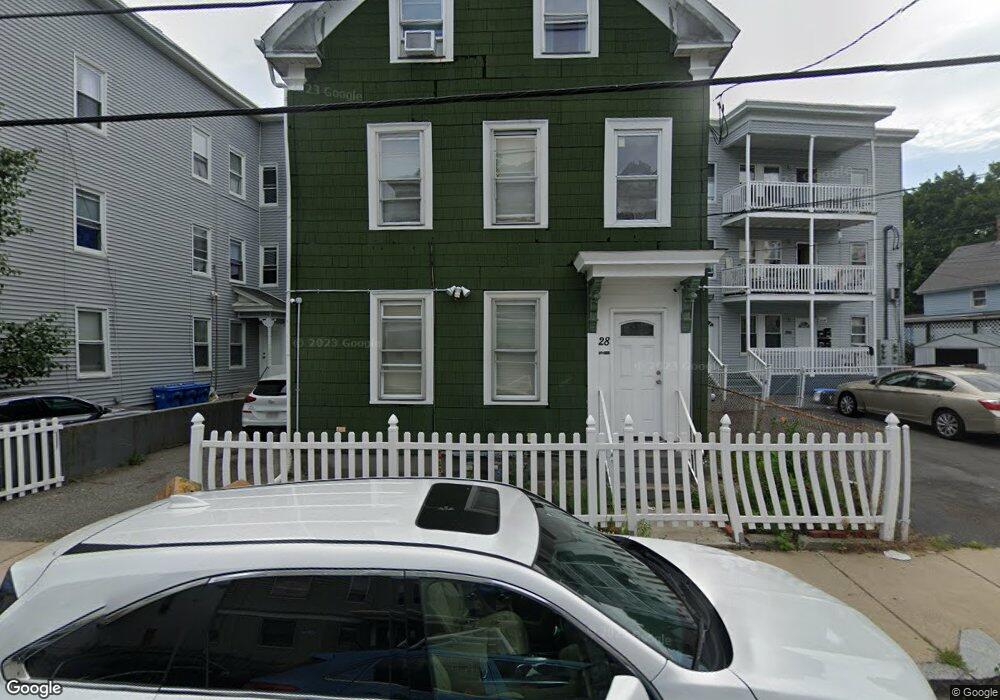
28 Brook St Lawrence, MA 01841
Downtown Lawrence NeighborhoodEstimated Value: $625,000 - $748,000
7
Beds
3
Baths
2,520
Sq Ft
$270/Sq Ft
Est. Value
About This Home
This home is located at 28 Brook St, Lawrence, MA 01841 and is currently estimated at $680,000, approximately $269 per square foot. 28 Brook St is a home located in Essex County with nearby schools including Olive Branch Elementary School, Hawkins Elementary SMART School, and School For Exceptional Studies.
Ownership History
Date
Name
Owned For
Owner Type
Purchase Details
Closed on
Oct 17, 2018
Sold by
Aguilera Carlos J
Bought by
Delossantos-Paredes G and Lopez-Delossatos Mileidy
Current Estimated Value
Home Financials for this Owner
Home Financials are based on the most recent Mortgage that was taken out on this home.
Original Mortgage
$347,700
Outstanding Balance
$302,590
Interest Rate
4.5%
Mortgage Type
New Conventional
Estimated Equity
$377,410
Purchase Details
Closed on
Apr 12, 1994
Sold by
Saracusa Philip M
Bought by
Aguilera Carlos J
Home Financials for this Owner
Home Financials are based on the most recent Mortgage that was taken out on this home.
Original Mortgage
$29,450
Interest Rate
7.27%
Mortgage Type
Purchase Money Mortgage
Purchase Details
Closed on
Aug 15, 1990
Sold by
Saracusa Filomena
Bought by
Saracusa Philip M
Create a Home Valuation Report for This Property
The Home Valuation Report is an in-depth analysis detailing your home's value as well as a comparison with similar homes in the area
Home Values in the Area
Average Home Value in this Area
Purchase History
| Date | Buyer | Sale Price | Title Company |
|---|---|---|---|
| Delossantos-Paredes G | $340,000 | -- | |
| Aguilera Carlos J | $28,000 | -- | |
| Saracusa Philip M | $120,000 | -- |
Source: Public Records
Mortgage History
| Date | Status | Borrower | Loan Amount |
|---|---|---|---|
| Open | Delossantos-Paredes G | $347,700 | |
| Previous Owner | Saracusa Philip M | $20,000 | |
| Previous Owner | Saracusa Philip M | $112,000 | |
| Previous Owner | Saracusa Philip M | $40,000 | |
| Previous Owner | Saracusa Philip M | $29,450 |
Source: Public Records
Tax History Compared to Growth
Tax History
| Year | Tax Paid | Tax Assessment Tax Assessment Total Assessment is a certain percentage of the fair market value that is determined by local assessors to be the total taxable value of land and additions on the property. | Land | Improvement |
|---|---|---|---|---|
| 2025 | $4,589 | $521,500 | $100,700 | $420,800 |
| 2024 | $4,037 | $436,400 | $105,800 | $330,600 |
| 2023 | $4,183 | $411,700 | $102,100 | $309,600 |
| 2022 | $3,853 | $336,800 | $96,300 | $240,500 |
| 2021 | $3,688 | $300,600 | $96,300 | $204,300 |
| 2020 | $3,535 | $284,400 | $80,300 | $204,100 |
| 2019 | $3,360 | $245,600 | $59,700 | $185,900 |
| 2018 | $3,189 | $222,700 | $54,100 | $168,600 |
| 2017 | $2,905 | $189,400 | $51,200 | $138,200 |
| 2016 | $2,773 | $178,800 | $40,000 | $138,800 |
| 2015 | $2,663 | $176,100 | $40,000 | $136,100 |
Source: Public Records
Map
Nearby Homes
- 65 Brook St
- 192 Union St
- 6 Brook St
- 100-102 E Haverhill St
- 89 Newbury St Unit 89B
- 91 Summer St Unit 3
- 32 Orchard St
- 42 Union St
- 35 Kendall St
- 167 Ferry 53 Mann St Unit 2,5,6
- 131A Lawrence St Unit 40
- 80 Ferry St Unit 80A
- 20 Knox St Unit 43
- 20 Knox St Unit 23
- 19-21 Pleasant Terrace
- 68 Wesley St
- 11 Lawrence St Unit 606
- 24 Boylston St
- 9 Boylston St
- 52 Howard St
- 28 Brook St Unit 2
- 28 Brook St Unit 3
- 24 Brook St
- 37-39 Brook St
- 22 Brook St
- 22 Brook St Unit 2
- 22 Brook St Unit 3
- 35 Brook St
- 37 Brook St Unit 39
- 30 Milford St
- 171 Union St
- 33 Brook St Unit 4
- 26 Milford St
- 38 Brook St
- 41 Brook St Unit 43
- 29 Brook St Unit 5
- 173-175 Union St
- 175 Union St
- 173 Union St Unit 175
- 27 Brook St