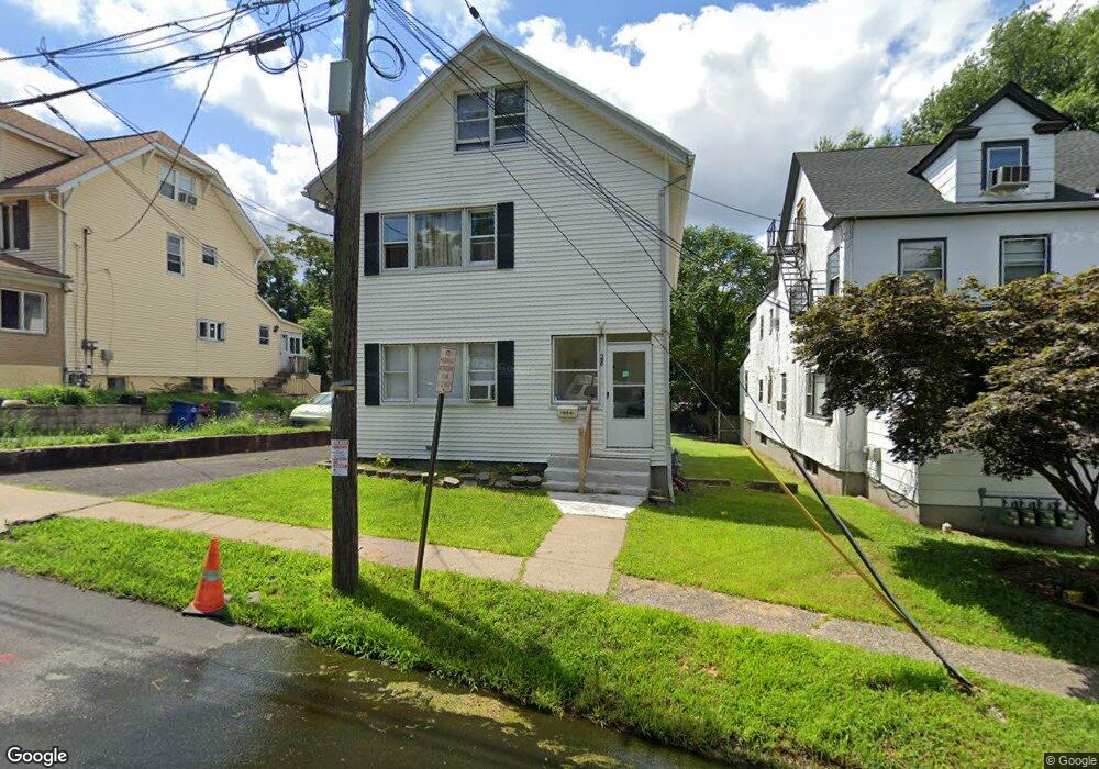
28 Cedar St Unit 1 Hillside, NJ 07205
Estimated Value: $455,000 - $637,000
2
Beds
1
Bath
2,240
Sq Ft
$249/Sq Ft
Est. Value
About This Home
This home is located at 28 Cedar St Unit 1, Hillside, NJ 07205 and is currently estimated at $557,431, approximately $248 per square foot. 28 Cedar St Unit 1 is a home located in Union County with nearby schools including Abram P. Morris-Saybrook Elementary School, Hurden Looker School, and Ola Edwards Community School.
Ownership History
Date
Name
Owned For
Owner Type
Purchase Details
Closed on
Jun 27, 2017
Sold by
Fannie Mae
Bought by
Paula Luciano J and Gonzalez Karla
Current Estimated Value
Home Financials for this Owner
Home Financials are based on the most recent Mortgage that was taken out on this home.
Original Mortgage
$244,870
Outstanding Balance
$201,226
Interest Rate
3.5%
Mortgage Type
FHA
Estimated Equity
$356,205
Purchase Details
Closed on
Sep 11, 2015
Sold by
Union County Sheriff
Bought by
Federal National Mortgageassociatio
Purchase Details
Closed on
Sep 29, 2000
Sold by
Mooney Elaine T and Hone Joanne C
Bought by
Velarde Cesar
Home Financials for this Owner
Home Financials are based on the most recent Mortgage that was taken out on this home.
Original Mortgage
$180,982
Interest Rate
7.89%
Mortgage Type
FHA
Create a Home Valuation Report for This Property
The Home Valuation Report is an in-depth analysis detailing your home's value as well as a comparison with similar homes in the area
Home Values in the Area
Average Home Value in this Area
Purchase History
| Date | Buyer | Sale Price | Title Company |
|---|---|---|---|
| Paula Luciano J | $178,000 | Old Republic Title Ins Co | |
| Federal National Mortgageassociatio | $1,000 | -- | |
| Velarde Cesar | $185,000 | -- |
Source: Public Records
Mortgage History
| Date | Status | Borrower | Loan Amount |
|---|---|---|---|
| Open | Paula Luciano J | $244,870 | |
| Previous Owner | Velarde Cesar | $180,982 |
Source: Public Records
Tax History
| Year | Tax Paid | Tax Assessment Tax Assessment Total Assessment is a certain percentage of the fair market value that is determined by local assessors to be the total taxable value of land and additions on the property. | Land | Improvement |
|---|---|---|---|---|
| 2025 | $11,628 | $140,900 | $70,000 | $70,900 |
| 2024 | $11,290 | $140,900 | $70,000 | $70,900 |
| 2023 | $11,290 | $140,900 | $70,000 | $70,900 |
| 2022 | $11,186 | $140,900 | $70,000 | $70,900 |
| 2021 | $11,113 | $140,900 | $70,000 | $70,900 |
| 2020 | $11,048 | $140,900 | $70,000 | $70,900 |
| 2019 | $10,834 | $140,900 | $70,000 | $70,900 |
| 2018 | $10,725 | $140,900 | $70,000 | $70,900 |
| 2017 | $10,660 | $140,900 | $70,000 | $70,900 |
| 2016 | $10,648 | $140,900 | $70,000 | $70,900 |
| 2015 | $10,553 | $140,900 | $70,000 | $70,900 |
| 2014 | $10,387 | $140,900 | $70,000 | $70,900 |
Source: Public Records
Map
Nearby Homes
- 75 Hillside Ave
- 24 Hollywood Ave
- 1318 State St
- 1406 Maple Ave
- 1229 Robert St
- 1204 Salem Ave
- 1414 Boa Place Unit 2
- 1200 Salem Ave
- 1437 Parkview Terrace
- 1444 N Broad St
- 1504 Munn Ave
- 1250 N Broad St Unit A1
- 137 Fairbanks St
- 1431 Compton Terrace
- 128 Baltimore Ave
- 345 Sanford Ave
- 149 Baltimore Ave
- 161 Virginia St
- 1038 Fairview Place
- 1018 John Glenn Dr
Your Personal Tour Guide
Ask me questions while you tour the home.