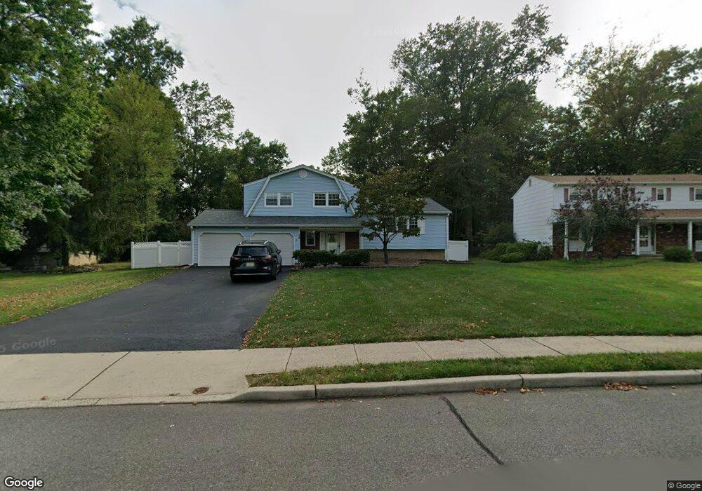
28 Christopher Ave Kendall Park, NJ 08824
Estimated Value: $642,000 - $725,000
--
Bed
--
Bath
1,948
Sq Ft
$351/Sq Ft
Est. Value
About This Home
This home is located at 28 Christopher Ave, Kendall Park, NJ 08824 and is currently estimated at $682,971, approximately $350 per square foot. 28 Christopher Ave is a home located in Middlesex County with nearby schools including Brunswick Acres Elementary School, Crossroads South Middle School, and South Brunswick High School.
Ownership History
Date
Name
Owned For
Owner Type
Purchase Details
Closed on
Apr 24, 2023
Sold by
Migliore Stephen and Migliore Rita
Bought by
Patel Karankumar and Patel Vixitaben
Current Estimated Value
Home Financials for this Owner
Home Financials are based on the most recent Mortgage that was taken out on this home.
Original Mortgage
$546,250
Outstanding Balance
$530,158
Interest Rate
6.28%
Mortgage Type
New Conventional
Estimated Equity
$152,813
Purchase Details
Closed on
Aug 24, 1987
Bought by
Migliore Stephen and Migliore Rita
Create a Home Valuation Report for This Property
The Home Valuation Report is an in-depth analysis detailing your home's value as well as a comparison with similar homes in the area
Home Values in the Area
Average Home Value in this Area
Purchase History
| Date | Buyer | Sale Price | Title Company |
|---|---|---|---|
| Patel Karankumar | $575,000 | None Listed On Document | |
| Migliore Stephen | $219,900 | -- |
Source: Public Records
Mortgage History
| Date | Status | Borrower | Loan Amount |
|---|---|---|---|
| Open | Patel Karankumar | $546,250 |
Source: Public Records
Tax History Compared to Growth
Tax History
| Year | Tax Paid | Tax Assessment Tax Assessment Total Assessment is a certain percentage of the fair market value that is determined by local assessors to be the total taxable value of land and additions on the property. | Land | Improvement |
|---|---|---|---|---|
| 2025 | $10,641 | $195,400 | $83,500 | $111,900 |
| 2024 | $10,049 | $195,400 | $83,500 | $111,900 |
| 2023 | $10,049 | $191,400 | $83,500 | $107,900 |
| 2022 | $9,754 | $191,400 | $83,500 | $107,900 |
| 2021 | $7,502 | $191,400 | $83,500 | $107,900 |
| 2020 | $9,807 | $191,400 | $83,500 | $107,900 |
| 2019 | $9,893 | $191,400 | $83,500 | $107,900 |
| 2018 | $9,570 | $191,400 | $83,500 | $107,900 |
| 2017 | $9,555 | $191,400 | $83,500 | $107,900 |
| 2016 | $9,453 | $191,400 | $83,500 | $107,900 |
| 2015 | $9,166 | $191,400 | $83,500 | $107,900 |
| 2014 | $9,019 | $191,400 | $83,500 | $107,900 |
Source: Public Records
Map
Nearby Homes
- 9 Donald Ave
- 69 Fisher Dr
- 1 Lyon La
- 1 Lyon Ln
- 41 Aspen Dr
- 107 Finnegan Ln
- 16 Barbara St
- 44 Crabapple Ln
- 6 Joan St
- 9 Beekman Rd
- 65 Townsend Ct Unit 213
- 65 Townsend Ct
- 13 Pear Tree Ln
- 0 Finnegans Ln Ave B Unit NJMX2010364
- 107 Rachel Ct
- 139 Rachel Ct Unit D1
- 75 Pear Tree Ln Unit 10C
- 147 Rachel Ct
- 1321 Tupelo Ct
- 205 Rachel Ct
- 30 Christopher Ave
- 26 Christopher Ave
- 40 Matthew Ave
- 27 Christopher Ave
- 29 Christopher Ave
- 25 Christopher Ave
- 42 Matthew Ave
- 42A Matthew Ave
- 31 Christopher Ave
- 22 Christopher Ave
- 23 Christopher Ave
- 26 James Ave
- 24 James Ave
- 20 Christopher Ave
- 41 Matthew Ave
- 21 Christopher Ave
- 28 James Ave
- 22 James Ave
- 17 Oakey Dr
- 15 Oakey Dr