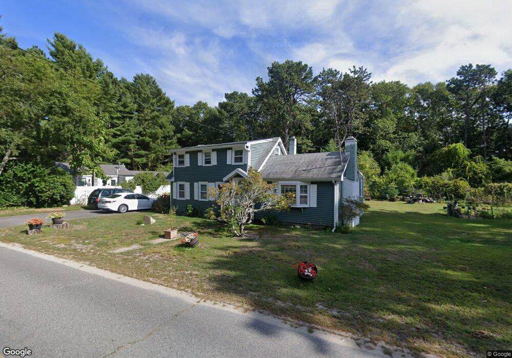
28 Crooked River Rd Wareham, MA 02571
Estimated Value: $434,624 - $504,000
3
Beds
1
Bath
1,216
Sq Ft
$375/Sq Ft
Est. Value
About This Home
This home is located at 28 Crooked River Rd, Wareham, MA 02571 and is currently estimated at $455,906, approximately $374 per square foot. 28 Crooked River Rd is a home located in Plymouth County.
Ownership History
Date
Name
Owned For
Owner Type
Purchase Details
Closed on
Oct 24, 2025
Sold by
Pierce Imogene C
Bought by
Pierce Mcdonald Rt and Mcdonald
Current Estimated Value
Purchase Details
Closed on
Feb 28, 2005
Sold by
Douglas Karen E
Bought by
Pierce Imogene Coco
Home Financials for this Owner
Home Financials are based on the most recent Mortgage that was taken out on this home.
Original Mortgage
$40,350
Interest Rate
5.66%
Purchase Details
Closed on
Jan 11, 1991
Sold by
Liffers Henry F Est
Bought by
Douglas Karen E
Create a Home Valuation Report for This Property
The Home Valuation Report is an in-depth analysis detailing your home's value as well as a comparison with similar homes in the area
Home Values in the Area
Average Home Value in this Area
Purchase History
| Date | Buyer | Sale Price | Title Company |
|---|---|---|---|
| Pierce Mcdonald Rt | -- | -- | |
| Pierce Imogene Coco | $269,000 | -- | |
| Pierce Imogene Coco | $269,000 | -- | |
| Douglas Karen E | $60,000 | -- | |
| Douglas Karen E | $60,000 | -- |
Source: Public Records
Mortgage History
| Date | Status | Borrower | Loan Amount |
|---|---|---|---|
| Previous Owner | Douglas Karen E | $43,000 | |
| Previous Owner | Douglas Karen E | $40,350 | |
| Previous Owner | Douglas Karen E | $215,200 |
Source: Public Records
Tax History Compared to Growth
Tax History
| Year | Tax Paid | Tax Assessment Tax Assessment Total Assessment is a certain percentage of the fair market value that is determined by local assessors to be the total taxable value of land and additions on the property. | Land | Improvement |
|---|---|---|---|---|
| 2025 | $3,515 | $337,300 | $122,800 | $214,500 |
| 2024 | $3,518 | $313,300 | $96,600 | $216,700 |
| 2023 | $3,141 | $278,400 | $87,700 | $190,700 |
| 2022 | $3,141 | $238,300 | $87,700 | $150,600 |
| 2021 | $3,110 | $231,200 | $87,700 | $143,500 |
| 2020 | $2,972 | $224,100 | $87,700 | $136,400 |
| 2019 | $2,962 | $222,900 | $86,800 | $136,100 |
| 2018 | $2,770 | $203,200 | $86,800 | $116,400 |
| 2017 | $2,666 | $198,200 | $86,800 | $111,400 |
| 2016 | $2,577 | $190,500 | $86,500 | $104,000 |
| 2015 | $2,490 | $190,500 | $86,500 | $104,000 |
| 2014 | $2,440 | $189,900 | $86,500 | $103,400 |
Source: Public Records
Map
Nearby Homes
- 13 Parkwood Dr
- 19 Datewood St
- 10 Dowd Ave
- 7 Cranberry Ln
- 0 Squaw's Path
- 10 Oak St
- 4 Penny Ln
- 11 Turner Ave
- 65 Great Neck Rd
- 8 Cottage St
- 124 Minot Ave Unit 1
- 4 Ross Ave
- 1 Gibbs Ball Park Rd
- 10 Over Jordan Rd
- 45 Main St Unit 38
- 8 Over Jordan Rd
- 14 Over Jordan Rd
- 12 Linwood Ave
- 7 Knowles Ave
- 17 5th St
- 30 Crooked River Rd
- 26 Crooked River Rd
- 21 Crooked River Rd
- 32 Crooked River Rd
- 23 Crooked River Rd
- 19 Crooked River Rd
- 19 Crooked River Rd
- 24 Crooked River Rd
- 15 Crooked River Rd
- 20 Crooked River Rd
- 17 Crooked River Rd
- 13 Crooked River Rd
- 11 Crooked River Rd
- 14 Crooked River Rd
- 9 Crooked River Rd
- 1 Jacks Marsh Ln
- 1 Jacks Marsh Ln
- 12 Crooked River Rd
- 7 Crooked River Rd
- 5 Crooked River Rd