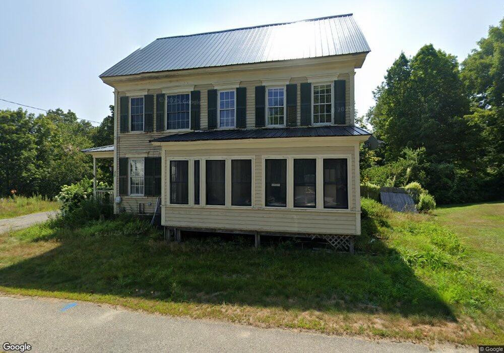
28 Elm St Parsonsfield, ME 04047
Estimated Value: $341,000 - $454,000
3
Beds
2
Baths
2,267
Sq Ft
$178/Sq Ft
Est. Value
About This Home
This home is located at 28 Elm St, Parsonsfield, ME 04047 and is currently estimated at $403,814, approximately $178 per square foot. 28 Elm St is a home located in York County.
Ownership History
Date
Name
Owned For
Owner Type
Purchase Details
Closed on
Dec 9, 2008
Sold by
Hare Christine A
Bought by
Hare Christine A and Newlyn Andrea K
Current Estimated Value
Purchase Details
Closed on
Oct 17, 2006
Sold by
Hawkes Katherine A and Hawkes Paul J
Bought by
Hare Christine A
Home Financials for this Owner
Home Financials are based on the most recent Mortgage that was taken out on this home.
Original Mortgage
$174,600
Interest Rate
10%
Mortgage Type
Commercial
Create a Home Valuation Report for This Property
The Home Valuation Report is an in-depth analysis detailing your home's value as well as a comparison with similar homes in the area
Home Values in the Area
Average Home Value in this Area
Purchase History
| Date | Buyer | Sale Price | Title Company |
|---|---|---|---|
| Hare Christine A | -- | -- | |
| Hare Christine A | -- | -- |
Source: Public Records
Mortgage History
| Date | Status | Borrower | Loan Amount |
|---|---|---|---|
| Previous Owner | Hare Christine A | $174,600 |
Source: Public Records
Tax History Compared to Growth
Tax History
| Year | Tax Paid | Tax Assessment Tax Assessment Total Assessment is a certain percentage of the fair market value that is determined by local assessors to be the total taxable value of land and additions on the property. | Land | Improvement |
|---|---|---|---|---|
| 2024 | $3,042 | $181,060 | $44,950 | $136,110 |
| 2023 | $2,933 | $181,060 | $44,950 | $136,110 |
| 2022 | $2,806 | $181,060 | $44,950 | $136,110 |
| 2021 | $2,797 | $181,060 | $44,950 | $136,110 |
| 2020 | $2,743 | $181,060 | $44,950 | $136,110 |
| 2019 | $2,698 | $181,060 | $44,950 | $136,110 |
| 2017 | $2,698 | $181,060 | $44,950 | $136,110 |
| 2016 | $2,698 | $181,060 | $44,950 | $136,110 |
| 2015 | $2,716 | $181,060 | $44,950 | $136,110 |
| 2013 | $2,643 | $181,060 | $44,950 | $136,110 |
Source: Public Records
Map
Nearby Homes
- 12 Main St
- 32 Summer St
- 122 Ossipee Trail
- 35 Pine St
- 248 Spec Pond Rd
- 266 S Hiram Rd
- 206 Gilman Rd
- R3-32 Ossipee Trail
- 272 Tripptown Rd
- 761 Pendexter Rd
- 62 Eastman Hill Rd
- 42AC Ben Gilpatrick Rd
- 00 Brownfield Rd
- 696 S Hiram Rd
- 96 Maple St
- 839 Brownfield Rd
- Lot #00 North Rd
- Lot# 01 North Rd
- Lot #02 North Rd
- 0 S River Ln Unit 1641807