Estimated Value: $737,742 - $863,000
3
Beds
4
Baths
2,993
Sq Ft
$266/Sq Ft
Est. Value
About This Home
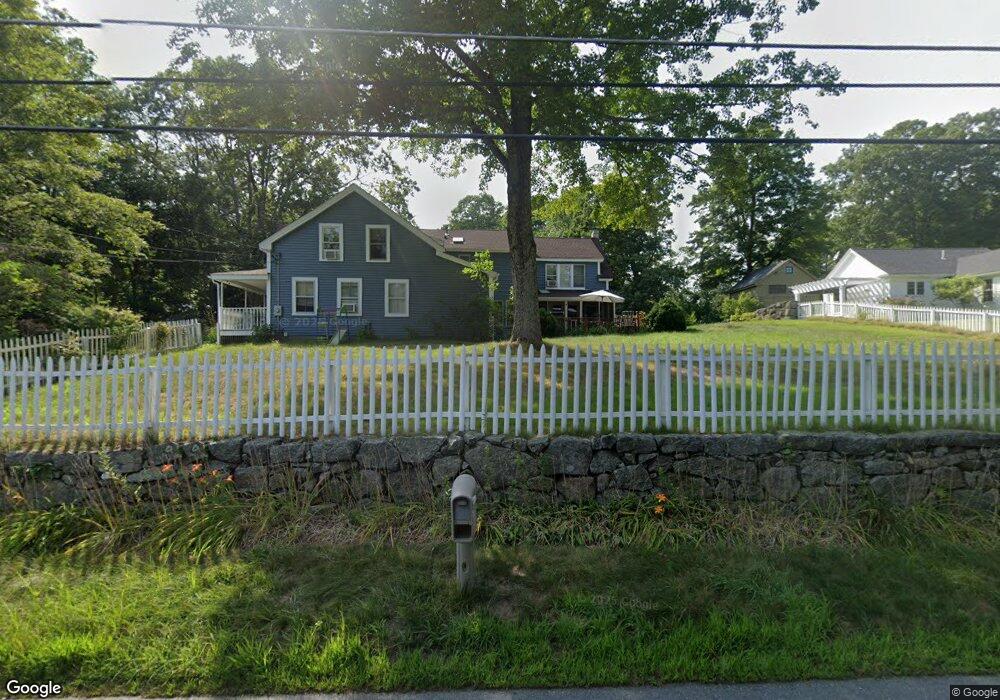
This home is located at 28 Elm St, Upton, MA 01568 and is currently estimated at $797,436, approximately $266 per square foot. 28 Elm St is a home located in Worcester County with nearby schools including Nipmuc Regional High School and Touchstone Community School.
Ownership History
Date
Name
Owned For
Owner Type
Purchase Details
Closed on
Aug 16, 2016
Sold by
Covino Paul F and Covino Anne E
Bought by
Covino Peter and Covino Sarah A
Current Estimated Value
Home Financials for this Owner
Home Financials are based on the most recent Mortgage that was taken out on this home.
Original Mortgage
$280,000
Outstanding Balance
$220,972
Interest Rate
3.48%
Mortgage Type
New Conventional
Estimated Equity
$576,464
Purchase Details
Closed on
Sep 5, 1989
Sold by
Wittmer Douglas
Bought by
Covino Paul
Create a Home Valuation Report for This Property
The Home Valuation Report is an in-depth analysis detailing your home's value as well as a comparison with similar homes in the area
Home Values in the Area
Average Home Value in this Area
Purchase History
| Date | Buyer | Sale Price | Title Company |
|---|---|---|---|
| Covino Peter | $400,000 | -- | |
| Covino Paul | $190,800 | -- |
Source: Public Records
Mortgage History
| Date | Status | Borrower | Loan Amount |
|---|---|---|---|
| Open | Covino Peter | $280,000 | |
| Previous Owner | Covino Paul | $100,000 | |
| Previous Owner | Covino Paul | $25,000 |
Source: Public Records
Tax History
| Year | Tax Paid | Tax Assessment Tax Assessment Total Assessment is a certain percentage of the fair market value that is determined by local assessors to be the total taxable value of land and additions on the property. | Land | Improvement |
|---|---|---|---|---|
| 2025 | $8,483 | $645,100 | $206,100 | $439,000 |
| 2024 | $8,301 | $606,800 | $186,500 | $420,300 |
| 2023 | $5,038 | $363,200 | $153,700 | $209,500 |
| 2022 | $6,091 | $363,200 | $153,700 | $209,500 |
| 2021 | $6,255 | $388,200 | $155,100 | $233,100 |
| 2020 | $6,296 | $365,600 | $136,700 | $228,900 |
| 2019 | $6,038 | $348,800 | $130,200 | $218,600 |
| 2018 | $5,908 | $342,900 | $124,300 | $218,600 |
| 2017 | $5,630 | $310,000 | $115,100 | $194,900 |
| 2016 | $5,492 | $295,900 | $121,700 | $174,200 |
| 2015 | $4,870 | $287,300 | $121,700 | $165,600 |
| 2014 | $4,683 | $276,300 | $114,900 | $161,400 |
Source: Public Records
Map
Nearby Homes
- 31 Elm St
- 7 Fieldstone Dr Unit 7
- 6 Fieldstone Dr Unit 6
- 8 Maple St
- 130 High St
- 29 Cider Mill Ln
- 49 Grove St
- 78 Milford St
- 13 Plain St
- 4 Hazeltine Rd
- 6 Wood St
- 72 Main St
- 74 Warren St
- 1 Knowlton Cir Unit 1
- 36 Knowlton Cir Unit 1
- 51 Knowlton Cir Unit 51
- 135 Main St
- 13 Jonathans Way
- 18 Boot Shop Rd Unit 40
- 12 Boot Shop Rd Unit 37
Your Personal Tour Guide
Ask me questions while you tour the home.