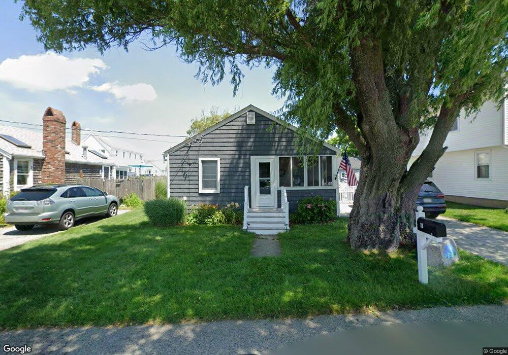
28 Everson Rd Marshfield, MA 02050
Ocean Bluff-Brant Rock NeighborhoodEstimated Value: $480,000 - $599,000
2
Beds
1
Bath
744
Sq Ft
$717/Sq Ft
Est. Value
About This Home
This home is located at 28 Everson Rd, Marshfield, MA 02050 and is currently estimated at $533,485, approximately $717 per square foot. 28 Everson Rd is a home located in Plymouth County with nearby schools including Daniel Webster, Furnace Brook Middle School, and Marshfield High School.
Ownership History
Date
Name
Owned For
Owner Type
Purchase Details
Closed on
Feb 1, 2008
Sold by
Jj Rt and Deady Joseph
Bought by
Howell Raymond and Howell Amy L
Current Estimated Value
Home Financials for this Owner
Home Financials are based on the most recent Mortgage that was taken out on this home.
Original Mortgage
$186,000
Interest Rate
6.18%
Mortgage Type
Purchase Money Mortgage
Purchase Details
Closed on
May 23, 2000
Sold by
Curtis Wesley A
Bought by
Jj Rt and Deady Joseph
Home Financials for this Owner
Home Financials are based on the most recent Mortgage that was taken out on this home.
Original Mortgage
$85,750
Interest Rate
8.19%
Mortgage Type
Purchase Money Mortgage
Purchase Details
Closed on
May 26, 1994
Sold by
Mcmanus Margaret M and Mcmanus John B
Bought by
Curtis Wesley A
Home Financials for this Owner
Home Financials are based on the most recent Mortgage that was taken out on this home.
Original Mortgage
$62,800
Interest Rate
8.22%
Mortgage Type
Purchase Money Mortgage
Purchase Details
Closed on
Jun 3, 1993
Sold by
Keane John B
Bought by
Mcmanus Margaret M
Create a Home Valuation Report for This Property
The Home Valuation Report is an in-depth analysis detailing your home's value as well as a comparison with similar homes in the area
Home Values in the Area
Average Home Value in this Area
Purchase History
| Date | Buyer | Sale Price | Title Company |
|---|---|---|---|
| Howell Raymond | $232,500 | -- | |
| Jj Rt | $122,500 | -- | |
| Curtis Wesley A | $78,500 | -- | |
| Mcmanus Margaret M | $37,000 | -- |
Source: Public Records
Mortgage History
| Date | Status | Borrower | Loan Amount |
|---|---|---|---|
| Open | Mcmanus Margaret M | $160,000 | |
| Closed | Mcmanus Margaret M | $186,000 | |
| Previous Owner | Mcmanus Margaret M | $85,750 | |
| Previous Owner | Mcmanus Margaret M | $62,800 |
Source: Public Records
Tax History
| Year | Tax Paid | Tax Assessment Tax Assessment Total Assessment is a certain percentage of the fair market value that is determined by local assessors to be the total taxable value of land and additions on the property. | Land | Improvement |
|---|---|---|---|---|
| 2025 | $4,370 | $441,400 | $317,600 | $123,800 |
| 2024 | $4,308 | $414,600 | $297,800 | $116,800 |
| 2023 | $4,116 | $364,600 | $268,000 | $96,600 |
| 2022 | $4,116 | $317,800 | $228,300 | $89,500 |
| 2021 | $3,851 | $292,000 | $218,400 | $73,600 |
| 2020 | $3,443 | $258,300 | $188,600 | $69,700 |
| 2019 | $3,404 | $254,400 | $188,600 | $65,800 |
| 2018 | $3,401 | $254,400 | $188,600 | $65,800 |
| 2017 | $3,136 | $228,600 | $178,700 | $49,900 |
| 2016 | $3,034 | $218,600 | $168,700 | $49,900 |
| 2015 | $2,905 | $218,600 | $168,700 | $49,900 |
| 2014 | $2,904 | $218,500 | $168,700 | $49,800 |
Source: Public Records
Map
Nearby Homes
- 30 Everson Rd
- 24 Everson Rd
- 20 Everson Rd
- 20 Everson Rd Unit Weekly Rent
- 20 Everson Rd Unit 20
- 20 Everson Rd Unit 1 & only
- 20 Everson Rd
- 20 Everson Winter Rental
- 623 Ocean St
- 36 Everson Rd
- 627 Ocean St
- 27 Everson Rd
- 23 Everson Rd
- 31 Everson Rd
- 615 Ocean St
- 615 Ocean St (2016 Summer Rental)
- 19 Everson Rd
- 40 Everson Rd
- 40 Everson Rd
- 631 Ocean St
Your Personal Tour Guide
Ask me questions while you tour the home.