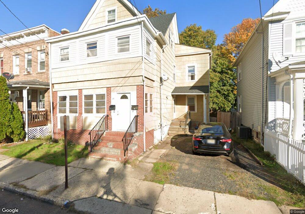
28 Fisher Ave Bound Brook, NJ 08805
Estimated Value: $434,000 - $624,000
--
Bed
--
Bath
2,564
Sq Ft
$215/Sq Ft
Est. Value
About This Home
This home is located at 28 Fisher Ave, Bound Brook, NJ 08805 and is currently estimated at $551,391, approximately $215 per square foot. 28 Fisher Ave is a home located in Somerset County with nearby schools including LaMonte Annex Elementary School, Lafayette Elementary School, and Bound Brook High School.
Ownership History
Date
Name
Owned For
Owner Type
Purchase Details
Closed on
Mar 21, 2022
Sold by
Woerner and Kimberly
Bought by
28 Fisher Llc
Current Estimated Value
Home Financials for this Owner
Home Financials are based on the most recent Mortgage that was taken out on this home.
Original Mortgage
$350,000
Interest Rate
5.27%
Mortgage Type
Construction
Purchase Details
Closed on
Jan 15, 1997
Sold by
Estate Of Alexander Melesurgo
Bought by
Woerner Michael and Woerner Kimberly
Home Financials for this Owner
Home Financials are based on the most recent Mortgage that was taken out on this home.
Original Mortgage
$72,000
Interest Rate
7.5%
Create a Home Valuation Report for This Property
The Home Valuation Report is an in-depth analysis detailing your home's value as well as a comparison with similar homes in the area
Home Values in the Area
Average Home Value in this Area
Purchase History
| Date | Buyer | Sale Price | Title Company |
|---|---|---|---|
| 28 Fisher Llc | $230,000 | Clear Skies Title | |
| Woerner Michael | $80,000 | -- |
Source: Public Records
Mortgage History
| Date | Status | Borrower | Loan Amount |
|---|---|---|---|
| Previous Owner | 28 Fisher Llc | $350,000 | |
| Previous Owner | Woerner Michael | $72,000 |
Source: Public Records
Tax History Compared to Growth
Tax History
| Year | Tax Paid | Tax Assessment Tax Assessment Total Assessment is a certain percentage of the fair market value that is determined by local assessors to be the total taxable value of land and additions on the property. | Land | Improvement |
|---|---|---|---|---|
| 2025 | $8,096 | $382,600 | $173,600 | $209,000 |
| 2024 | $8,096 | $356,800 | $153,600 | $203,200 |
| 2023 | $7,713 | $327,100 | $128,600 | $198,500 |
| 2022 | $7,277 | $292,500 | $103,600 | $188,900 |
| 2021 | $7,485 | $266,000 | $73,600 | $192,400 |
| 2020 | $7,032 | $227,800 | $53,600 | $174,200 |
| 2019 | $6,726 | $207,800 | $33,600 | $174,200 |
| 2018 | $5,608 | $168,200 | $33,600 | $134,600 |
| 2017 | $5,597 | $164,100 | $33,600 | $130,500 |
| 2016 | $6,203 | $183,200 | $13,600 | $169,600 |
| 2015 | $7,615 | $230,000 | $13,600 | $216,400 |
| 2014 | $7,884 | $230,000 | $13,600 | $216,400 |
Source: Public Records
Map
Nearby Homes
- 34 van Keuren Ave Unit 38
- 40 van Keuren Ave Unit 42
- 105 La Monte Ave
- 130 W High St Unit 132
- 126 W High St
- 432 Talmage Ave
- 2 Drake St
- 102 W Franklin St
- 542 Wheatland Ave
- 512 W 2nd St
- 510 Dalay Place
- 307 W Union Ave
- 320 Church St
- 208 Sanders Ave
- 112-114 E Union Ave
- 112 E Union Ave
- 520 Winsor St
- 14 E Maple Ave
- 206 Bathgate Ave
- 165 Prospect St
- 26 Fisher Ave
- 30 Fisher Ave Unit 301/2
- 24 Fisher Ave
- 32 Fisher Ave
- 129 Vosseller Ave
- 127 Vosseller Ave
- 131 Vosseller Ave
- 22 Fisher Ave
- 34 Fisher Ave
- 125 Vosseller Ave
- 23-25 Fisher Ave
- 133 Vosseller Ave
- 23 Fisher Ave Unit 25
- 27 Fisher Ave Unit 29
- 123 Vosseller Ave
- 21 Fisher Ave
- 18 Fisher Ave
- 36 Fisher Ave
- 141 Vosseller Ave
- 10 Pine St