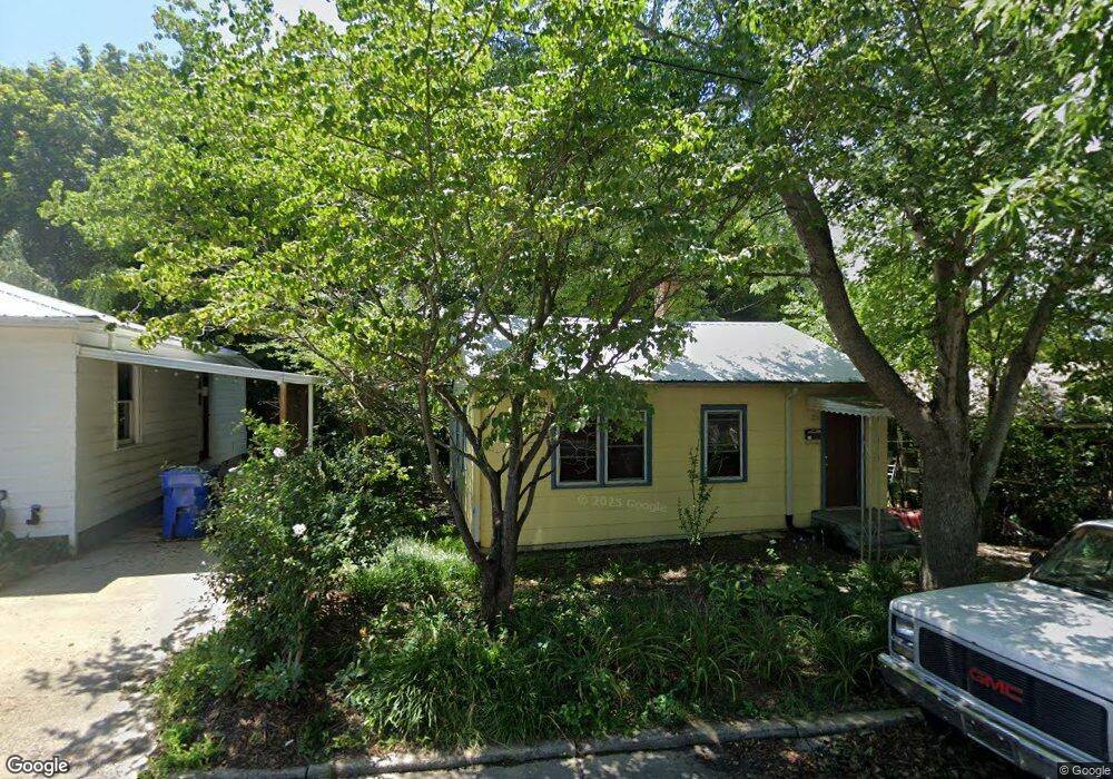
28 Jarrett St Asheville, NC 28806
West Asheville NeighborhoodEstimated Value: $348,033 - $410,000
2
Beds
1
Bath
896
Sq Ft
$426/Sq Ft
Est. Value
About This Home
This home is located at 28 Jarrett St, Asheville, NC 28806 and is currently estimated at $382,008, approximately $426 per square foot. 28 Jarrett St is a home located in Buncombe County with nearby schools including Hall Fletcher Elementary, Isaac Dickson Elementary, and Ira B Jones Elementary.
Ownership History
Date
Name
Owned For
Owner Type
Purchase Details
Closed on
Sep 16, 2002
Sold by
Flack George T
Bought by
Johnson Todd H and Johnson Naomi E
Current Estimated Value
Purchase Details
Closed on
Mar 9, 2001
Sold by
Lambert Gary W
Bought by
Flack George T
Home Financials for this Owner
Home Financials are based on the most recent Mortgage that was taken out on this home.
Original Mortgage
$60,000
Interest Rate
7.02%
Create a Home Valuation Report for This Property
The Home Valuation Report is an in-depth analysis detailing your home's value as well as a comparison with similar homes in the area
Home Values in the Area
Average Home Value in this Area
Purchase History
| Date | Buyer | Sale Price | Title Company |
|---|---|---|---|
| Johnson Todd H | $82,500 | -- | |
| Flack George T | -- | -- |
Source: Public Records
Mortgage History
| Date | Status | Borrower | Loan Amount |
|---|---|---|---|
| Previous Owner | Flack George T | $60,000 |
Source: Public Records
Tax History Compared to Growth
Tax History
| Year | Tax Paid | Tax Assessment Tax Assessment Total Assessment is a certain percentage of the fair market value that is determined by local assessors to be the total taxable value of land and additions on the property. | Land | Improvement |
|---|---|---|---|---|
| 2025 | $2,250 | $217,800 | $95,500 | $122,300 |
| 2024 | $2,250 | $217,800 | $95,500 | $122,300 |
| 2023 | $2,250 | $217,800 | $95,500 | $122,300 |
| 2022 | $2,172 | $217,800 | $0 | $0 |
| 2021 | $2,172 | $217,800 | $0 | $0 |
| 2020 | $1,976 | $183,300 | $0 | $0 |
| 2019 | $1,976 | $183,300 | $0 | $0 |
| 2018 | $1,976 | $183,300 | $0 | $0 |
| 2017 | $1,994 | $122,600 | $0 | $0 |
| 2016 | $1,507 | $122,600 | $0 | $0 |
| 2015 | $1,507 | $122,600 | $0 | $0 |
| 2014 | $1,488 | $122,600 | $0 | $0 |
Source: Public Records
Map
Nearby Homes
- 18 Jarrett St
- 54 Louisiana Ave
- 55 Herron Ave
- 56 Brevard Rd
- 18 Sand Hill Rd
- 75 Nevada Ave
- 30 Sand Hill Rd
- 68 1/2 Nevada Ave
- 197 Brucemont Cir
- 99 Nevada Ave
- 31 Oakwood St
- 60 Dorchester Ave
- 91 Virginia Ave
- 74 Brucemont Cir
- 141 Louisiana Ave
- 20 Cloyes St
- 5 Orrinel Way
- 199 Pennsylvania Ave
- 99999 State St
- 7 Mauricet Ln