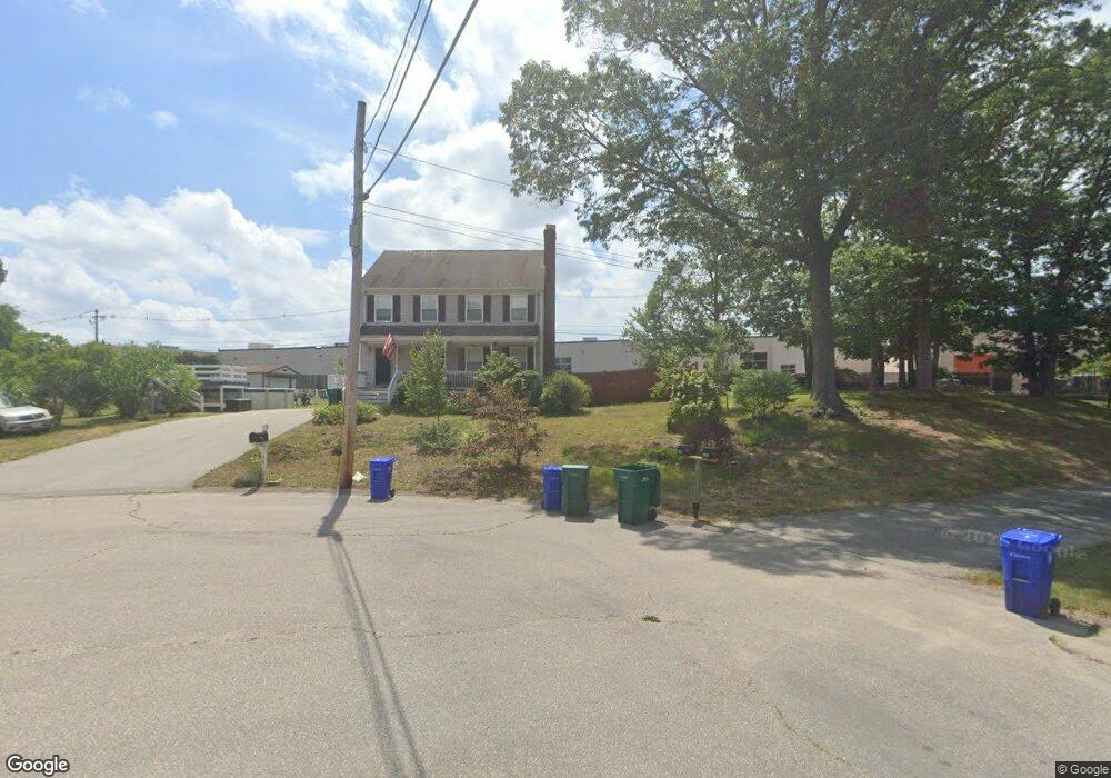
28 Jarson Ln Attleboro, MA 02703
Estimated Value: $491,000 - $574,000
3
Beds
3
Baths
1,620
Sq Ft
$334/Sq Ft
Est. Value
About This Home
This home is located at 28 Jarson Ln, Attleboro, MA 02703 and is currently estimated at $541,815, approximately $334 per square foot. 28 Jarson Ln is a home located in Bristol County with nearby schools including Hill-Roberts Elementary School, Robert J. Coelho Middle School, and Attleboro High School.
Ownership History
Date
Name
Owned For
Owner Type
Purchase Details
Closed on
Apr 29, 1996
Sold by
Wb Constr & Dev Inc
Bought by
Hayward Donald S and Hayward Leigh A
Current Estimated Value
Home Financials for this Owner
Home Financials are based on the most recent Mortgage that was taken out on this home.
Original Mortgage
$121,300
Interest Rate
7.81%
Mortgage Type
Purchase Money Mortgage
Create a Home Valuation Report for This Property
The Home Valuation Report is an in-depth analysis detailing your home's value as well as a comparison with similar homes in the area
Home Values in the Area
Average Home Value in this Area
Purchase History
| Date | Buyer | Sale Price | Title Company |
|---|---|---|---|
| Hayward Donald S | $127,750 | -- |
Source: Public Records
Mortgage History
| Date | Status | Borrower | Loan Amount |
|---|---|---|---|
| Open | Hayward Donald S | $197,600 | |
| Closed | Hayward Donald S | $41,229 | |
| Closed | Hayward Donald S | $30,999 | |
| Closed | Hayward Donald S | $121,300 |
Source: Public Records
Tax History Compared to Growth
Tax History
| Year | Tax Paid | Tax Assessment Tax Assessment Total Assessment is a certain percentage of the fair market value that is determined by local assessors to be the total taxable value of land and additions on the property. | Land | Improvement |
|---|---|---|---|---|
| 2025 | $5,473 | $436,100 | $166,800 | $269,300 |
| 2024 | $5,297 | $416,100 | $150,200 | $265,900 |
| 2023 | $5,566 | $406,600 | $151,700 | $254,900 |
| 2022 | $4,992 | $345,500 | $144,400 | $201,100 |
| 2021 | $4,724 | $319,200 | $139,000 | $180,200 |
| 2020 | $4,413 | $303,100 | $132,900 | $170,200 |
| 2019 | $4,578 | $323,300 | $130,300 | $193,000 |
| 2018 | $4,276 | $288,500 | $126,600 | $161,900 |
| 2017 | $4,112 | $282,600 | $123,400 | $159,200 |
| 2016 | $3,966 | $267,600 | $115,200 | $152,400 |
| 2015 | $4,111 | $279,500 | $115,200 | $164,300 |
| 2014 | $3,508 | $236,200 | $110,200 | $126,000 |
Source: Public Records
Map
Nearby Homes
- 36-38 Jarson Ln
- 31 Terry Dr
- 65 Cedarbrook Rd
- 548 Kenyon Ave Unit 25
- 548 Kenyon Ave Unit 27
- 15 Archer St
- 460 Collins St Unit 38
- 97 Wendell St
- 4 Mott Dr
- 103 Clews St
- 15 Don Ct
- 980 Newport Ave
- 35 Cushman St
- 26 Blackburn St
- 116 Stearns St
- 660 Cottage St Unit 6
- 139 Hackett Ave
- 50 Stearns St
- 139 Tweed St
- 50 Pullman Ave Unit B
- 20 Jarson Ln
- 12 Jarson Ln
- 43 Jarson Ln
- 27 Jarson Ln
- 19 Jarson Ln
- 131 Captain Courtois Dr
- 36 Jarson Ln Unit 38
- 123 Captain Courtois Dr
- 11 Jarson Ln
- 35 Jarson Ln
- 115 Captain Courtois Dr
- 108 George Ide Dr
- 100 George Ide Dr
- 16 Elmina Dr
- 124 George Ide Dr
- 17 Elmina Dr
- 10 Elmina Dr
- 92 George Ide Dr
- 11 Elmina Dr
- 109 George Ide Dr