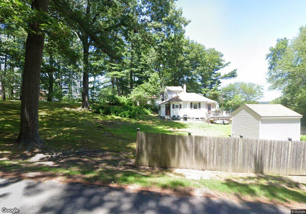
28 Lake Dr Wilbraham, MA 01095
Estimated Value: $310,000 - $369,000
3
Beds
1
Bath
1,335
Sq Ft
$253/Sq Ft
Est. Value
About This Home
This home is located at 28 Lake Dr, Wilbraham, MA 01095 and is currently estimated at $338,250, approximately $253 per square foot. 28 Lake Dr is a home located in Hampden County with nearby schools including Minnechaug Regional High School, St. John the Baptist School, and Wilbraham & Monson Academy.
Ownership History
Date
Name
Owned For
Owner Type
Purchase Details
Closed on
Oct 26, 2015
Sold by
Quinn Dennis and Quinn Beverly
Bought by
Paige Danielle G
Current Estimated Value
Home Financials for this Owner
Home Financials are based on the most recent Mortgage that was taken out on this home.
Original Mortgage
$201,020
Outstanding Balance
$158,700
Interest Rate
3.9%
Mortgage Type
New Conventional
Estimated Equity
$179,550
Purchase Details
Closed on
Mar 28, 2008
Sold by
Babineau James V and Babineau Rita D
Bought by
Quinn Dennis and Quinn Beverly
Home Financials for this Owner
Home Financials are based on the most recent Mortgage that was taken out on this home.
Original Mortgage
$144,000
Interest Rate
5.76%
Mortgage Type
Purchase Money Mortgage
Purchase Details
Closed on
Dec 28, 2006
Sold by
Babineau Rita D
Bought by
Babineau James
Create a Home Valuation Report for This Property
The Home Valuation Report is an in-depth analysis detailing your home's value as well as a comparison with similar homes in the area
Home Values in the Area
Average Home Value in this Area
Purchase History
| Date | Buyer | Sale Price | Title Company |
|---|---|---|---|
| Paige Danielle G | $197,000 | -- | |
| Quinn Dennis | $180,000 | -- | |
| Babineau James | -- | -- |
Source: Public Records
Mortgage History
| Date | Status | Borrower | Loan Amount |
|---|---|---|---|
| Open | Paige Danielle G | $201,020 | |
| Previous Owner | Quinn Dennis | $144,000 |
Source: Public Records
Tax History Compared to Growth
Tax History
| Year | Tax Paid | Tax Assessment Tax Assessment Total Assessment is a certain percentage of the fair market value that is determined by local assessors to be the total taxable value of land and additions on the property. | Land | Improvement |
|---|---|---|---|---|
| 2025 | $4,645 | $259,800 | $100,400 | $159,400 |
| 2024 | $4,453 | $240,700 | $100,400 | $140,300 |
| 2023 | $4,395 | $235,000 | $100,400 | $134,600 |
| 2022 | $4,428 | $216,100 | $98,200 | $117,900 |
| 2021 | $3,809 | $165,900 | $87,800 | $78,100 |
| 2020 | $3,713 | $165,900 | $87,800 | $78,100 |
| 2019 | $3,617 | $165,900 | $87,800 | $78,100 |
| 2018 | $3,496 | $154,400 | $87,800 | $66,600 |
| 2017 | $3,397 | $154,400 | $87,800 | $66,600 |
| 2016 | $3,454 | $159,900 | $97,500 | $62,400 |
| 2015 | $3,339 | $159,900 | $97,500 | $62,400 |
Source: Public Records
Map
Nearby Homes
- 4 Hillcrest Dr
- 35 Lake Dr
- 54 High Pine Cir
- 79 High Pine Cir
- 69 High Pine Cir
- 46 Washington Rd
- 2 Vista Rd
- 28 Decorie Dr
- 19 Linwood Dr
- 6 Teak Terrace Unit 24
- 2 Bayberry Dr Unit 51
- 20 Old Orchard Rd
- 88-90 Miller St
- 10 Forest Glade Dr
- 99 Sandalwood Dr Unit site 00
- 57 Sandalwood Dr Unit site 61
- 103 Sandalwood Dr Unit site 00
- 182 Mountain Rd
- 111 Sandalwood Dr Unit site 00
- 4 Lance Ln