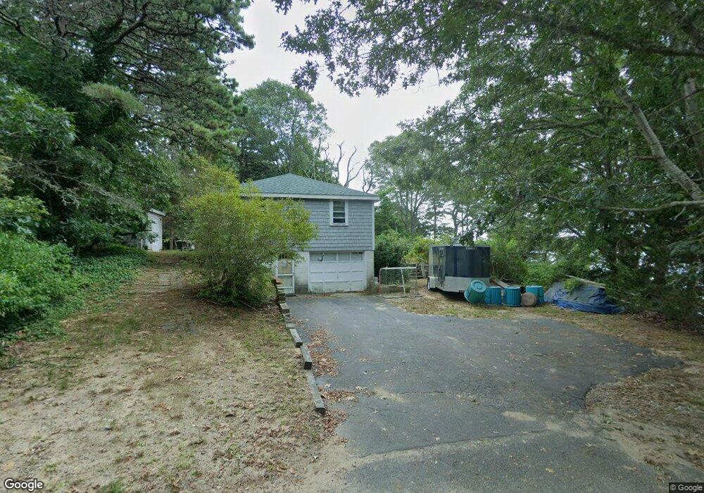
28 Longview Dr Yarmouth Port, MA 02675
Yarmouth Port NeighborhoodEstimated Value: $743,000 - $1,081,000
3
Beds
2
Baths
1,008
Sq Ft
$912/Sq Ft
Est. Value
About This Home
This home is located at 28 Longview Dr, Yarmouth Port, MA 02675 and is currently estimated at $919,364, approximately $912 per square foot. 28 Longview Dr is a home located in Barnstable County with nearby schools including Dennis-Yarmouth Regional High School and St. Pius X. School.
Ownership History
Date
Name
Owned For
Owner Type
Purchase Details
Closed on
May 27, 1988
Sold by
Est Millerd Clyde T
Bought by
Hanscom George P
Current Estimated Value
Home Financials for this Owner
Home Financials are based on the most recent Mortgage that was taken out on this home.
Original Mortgage
$200,000
Interest Rate
10.18%
Mortgage Type
Purchase Money Mortgage
Create a Home Valuation Report for This Property
The Home Valuation Report is an in-depth analysis detailing your home's value as well as a comparison with similar homes in the area
Home Values in the Area
Average Home Value in this Area
Purchase History
| Date | Buyer | Sale Price | Title Company |
|---|---|---|---|
| Hanscom George P | $250,000 | -- |
Source: Public Records
Mortgage History
| Date | Status | Borrower | Loan Amount |
|---|---|---|---|
| Closed | Hanscom George P | $200,000 |
Source: Public Records
Tax History Compared to Growth
Tax History
| Year | Tax Paid | Tax Assessment Tax Assessment Total Assessment is a certain percentage of the fair market value that is determined by local assessors to be the total taxable value of land and additions on the property. | Land | Improvement |
|---|---|---|---|---|
| 2025 | $6,303 | $890,200 | $609,600 | $280,600 |
| 2024 | $5,817 | $788,200 | $530,400 | $257,800 |
| 2023 | $5,481 | $675,800 | $447,300 | $228,500 |
| 2022 | $5,357 | $583,500 | $401,500 | $182,000 |
| 2021 | $5,081 | $531,500 | $377,200 | $154,300 |
| 2020 | $4,979 | $497,900 | $360,200 | $137,700 |
| 2019 | $4,828 | $478,000 | $360,200 | $117,800 |
| 2018 | $4,733 | $460,000 | $342,200 | $117,800 |
| 2017 | $4,609 | $460,000 | $342,200 | $117,800 |
| 2016 | $4,591 | $460,000 | $342,200 | $117,800 |
| 2015 | $4,503 | $448,500 | $342,200 | $106,300 |
Source: Public Records
Map
Nearby Homes
- 4 Ebb Rd
- 153 Bayridge Dr
- 118 Driftwood Ln
- 17 Margate Ln
- 129 Driftwood Ln
- 15 Captain Jud Rd
- 13 Covey Dr
- 111 Merchant Ave
- 17 Fairmount Rd
- 17 Fairmount Rd
- 10 Joanne Dr
- 7 Vinland Dr
- 25 Skerry Rd
- 4 Old Colony Way
- 6 Nimble Hill Dr
- 1 Norseman Dr
- 62 Old Fish House Rd
- 59 Main St Unit 19-2
- 59 Route 6a Unit 29-4
- 6 Hawthorn St
- 24 Longview Dr
- 27 Longview Dr
- 20 Longview Dr
- 29 Peter Oliver Rd
- 25 Peter Oliver Rd
- 4 Leslie Ln
- 35 Peter Oliver Rd
- 19 Peter Oliver Rd
- 7 Leslie Ln
- 16 Longview Dr
- 8 Leslie Ln
- 32 Peter Oliver Rd
- 36 Peter Oliver Rd
- 15 Longview Dr
- 15 Peter Oliver Rd
- 40 Peter Oliver Rd
- 98 Alfred Metcalf Dr
- 11 Leslie Ln
- 12 Leslie Ln
- 22 Peter Oliver Rd