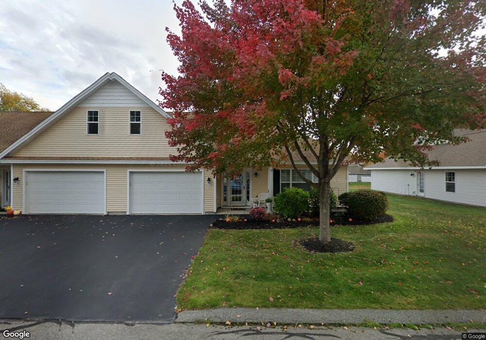
28 Macintosh Ln Unit 32 Old Orchard Beach, ME 04064
Estimated Value: $523,000 - $539,744
2
Beds
2
Baths
1,700
Sq Ft
$312/Sq Ft
Est. Value
About This Home
This home is located at 28 Macintosh Ln Unit 32, Old Orchard Beach, ME 04064 and is currently estimated at $531,186, approximately $312 per square foot. 28 Macintosh Ln Unit 32 is a home located in York County with nearby schools including Jameson Elementary School, Loranger Memorial School, and Old Orchard Beach High School.
Ownership History
Date
Name
Owned For
Owner Type
Purchase Details
Closed on
Aug 31, 2015
Sold by
Sharp Pauline J
Bought by
Nash Charles J and Nash Mary L
Current Estimated Value
Purchase Details
Closed on
Feb 12, 2008
Sold by
Cha Builders Llc
Bought by
Sharp Pauline J
Home Financials for this Owner
Home Financials are based on the most recent Mortgage that was taken out on this home.
Original Mortgage
$155,000
Interest Rate
6.2%
Mortgage Type
Unknown
Create a Home Valuation Report for This Property
The Home Valuation Report is an in-depth analysis detailing your home's value as well as a comparison with similar homes in the area
Home Values in the Area
Average Home Value in this Area
Purchase History
| Date | Buyer | Sale Price | Title Company |
|---|---|---|---|
| Nash Charles J | -- | -- | |
| Sharp Pauline J | -- | -- |
Source: Public Records
Mortgage History
| Date | Status | Borrower | Loan Amount |
|---|---|---|---|
| Previous Owner | Sharp Pauline J | $155,000 |
Source: Public Records
Tax History Compared to Growth
Tax History
| Year | Tax Paid | Tax Assessment Tax Assessment Total Assessment is a certain percentage of the fair market value that is determined by local assessors to be the total taxable value of land and additions on the property. | Land | Improvement |
|---|---|---|---|---|
| 2024 | $5,367 | $493,300 | $73,200 | $420,100 |
| 2023 | $5,169 | $453,400 | $73,200 | $380,200 |
| 2022 | $4,633 | $378,500 | $48,800 | $329,700 |
| 2021 | $4,411 | $311,500 | $48,800 | $262,700 |
| 2020 | $4,419 | $286,600 | $48,800 | $237,800 |
| 2019 | $4,442 | $286,600 | $48,800 | $237,800 |
| 2018 | $4,422 | $289,000 | $48,800 | $240,200 |
| 2017 | $3,867 | $246,300 | $48,800 | $197,500 |
| 2016 | $3,675 | $237,700 | $48,800 | $188,900 |
| 2015 | $3,608 | $237,700 | $48,800 | $188,900 |
| 2014 | $3,537 | $237,700 | $48,800 | $188,900 |
| 2013 | $3,214 | $232,900 | $48,800 | $184,100 |
Source: Public Records
Map
Nearby Homes
- 78 Ryefield Dr
- 5 Wilson Dr
- 3 Bayberry Dr
- 74 Macintosh Ln
- 4 Kavanaugh Rd
- 7 Stanley St
- 2 Stanley St
- 203 Saco Ave
- 52 Wild Dunes Way Unit 1A
- 52 Wild Dunes Way Unit 17B
- 5 Oregon Ave Unit 210
- 161 Saco Ave Unit 113
- 39 Smithwheel Rd Unit 1
- 39 Smithwheel Rd Unit 24
- 39 Smithwheel Rd Unit 34
- 8 Smithwheel Rd Unit 8A
- 10 Ocean Park Rd Unit 5
- 11 Smithwheel Rd Unit 15
- 83 Wild Dunes Way
- 3 Old Orchard Rd Unit 7
- 28 Macintosh Ln
- 30 Macintosh Ln
- 32 Macintosh Ln
- 26 Macintosh Ln
- 19 Macintosh Ln
- 21 Macintosh Ln
- 34 Macintosh Ln
- 45 Kavanaugh Rd
- 23 Macintosh Ln
- 17 Macintosh Ln
- 47 Kavanaugh Rd
- 24 Macintosh Ln
- 43 Kavanaugh Rd
- 36 Macintosh Ln
- 15 Macintosh Ln
- 15 Macintosh Ln
- 15 Macintosh Ln Unit 15
- 25 Macintosh Ln
- 49 Kavanaugh Rd
- 41 Kavanaugh Rd