
Seller's Agent in 2025
Lillian Lograsso
J. Barrett & Company
(978) 479-2250
28 Total Sales

Estimated Value: $875,000 - $915,097
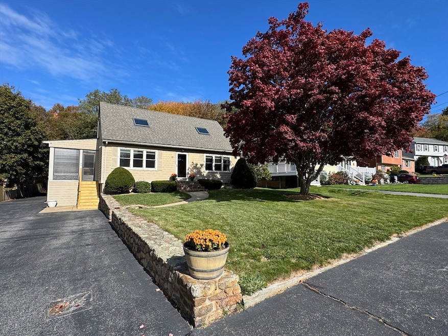
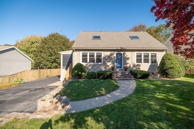
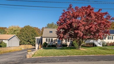
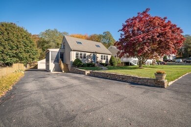
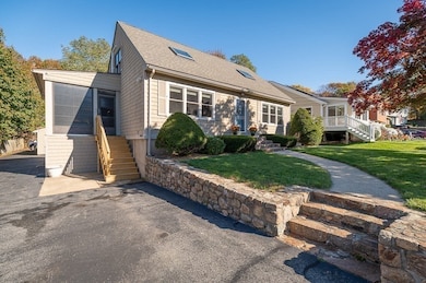
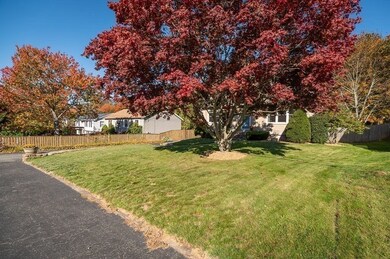
Nestled in a highly sought-after neighborhood, this charming post-and-beam home, built by Maine Post & Beam in 1980, combines timeless design with modern updates. The home features a beautifully remodeled kitchen/dining complete with a center island and contemporary finishes including quartzite counters and high-end appliances.. The open floor plan, hardwood floors and exposed beams create a warm and inviting atmosphere, perfect for both relaxation and entertaining! The main floor offers a spacious bedroom, a renovated full bath, & a welcoming living room. Upstairs, you'll find two generous bedrooms with soaring cathedral ceilings and a renovated full bath! The lower level offers a unique in law space including a kitchen, full bath, bedroom & spacious living room or family room! Bonuses: Detached large garage and shed, 3 season sunroom/enclosed porch, loads of off street parking, amazing front and back yard, and just steps to the gorgeous and scenic reservoir. Classic & Timeless!
| Date | Buyer | Sale Price | Title Company |
|---|---|---|---|
| Belhumeur R T | $880,000 | -- | |
| Alves Daniele | -- | -- | |
| Alves Daniele | $350,000 | -- |
| Date | Status | Borrower | Loan Amount |
|---|---|---|---|
| Previous Owner | Alves Daniele | $300,000 | |
| Previous Owner | Alves Daniele | $300,000 | |
| Previous Owner | Alves Daniele | $150,000 |
| Date | Event | Price | List to Sale | Price per Sq Ft |
|---|---|---|---|---|
| 11/18/2025 11/18/25 | Sold | $880,000 | -2.1% | $360 / Sq Ft |
| 10/29/2025 10/29/25 | Pending | -- | -- | -- |
| 10/26/2025 10/26/25 | For Sale | $899,000 | -- | $368 / Sq Ft |
| Year | Tax Paid | Tax Assessment Tax Assessment Total Assessment is a certain percentage of the fair market value that is determined by local assessors to be the total taxable value of land and additions on the property. | Land | Improvement |
|---|---|---|---|---|
| 2025 | $6,548 | $673,700 | $193,800 | $479,900 |
| 2024 | $6,600 | $678,300 | $184,500 | $493,800 |
| 2023 | $6,402 | $604,500 | $164,800 | $439,700 |
| 2022 | $5,815 | $495,700 | $143,300 | $352,400 |
| 2021 | $5,897 | $474,000 | $130,300 | $343,700 |
| 2020 | $5,682 | $460,800 | $130,300 | $330,500 |
| 2019 | $5,614 | $442,400 | $130,300 | $312,100 |
| 2018 | $5,487 | $424,400 | $130,300 | $294,100 |
| 2017 | $5,279 | $400,200 | $124,100 | $276,100 |
| 2016 | $5,219 | $383,500 | $129,400 | $254,100 |
| 2015 | $4,988 | $365,400 | $129,400 | $236,000 |
Seller's Agent in 2025
Lillian Lograsso
J. Barrett & Company
(978) 479-2250
28 Total Sales
C
Buyer's Agent in 2025
Catherine Belhumeur
J. Barrett & Company
10 Total Sales
Source: MLS Property Information Network (MLS PIN)
MLS Number: 73448002
APN: GLOU-000188-000038
Disclaimer: Certain information contained herein is derived from information provided by parties other than Homes.com. All information provided is deemed reliable, but is not guaranteed to be accurate and should be independently verified.
![]() The property listing data and information, or the Images, set forth herein were provided to MLS Property Information Network, Inc. from third party sources, including sellers, lessors and public records, and were compiled by MLS Property Information Network, Inc. The property listing data and information, and the Images, are for the personal, non-commercial use of consumers having a good faith interest in purchasing or leasing listed properties of the type displayed to them and may not be used for any purpose other than to identify prospective properties which such consumers may have a good faith interest in purchasing or leasing. MLS Property Information Network, Inc. and its subscribers disclaim any and all representations and warranties as to the accuracy of the property listing data and information, or as to the accuracy of any of the Images, set forth herein.
The property listing data and information, or the Images, set forth herein were provided to MLS Property Information Network, Inc. from third party sources, including sellers, lessors and public records, and were compiled by MLS Property Information Network, Inc. The property listing data and information, and the Images, are for the personal, non-commercial use of consumers having a good faith interest in purchasing or leasing listed properties of the type displayed to them and may not be used for any purpose other than to identify prospective properties which such consumers may have a good faith interest in purchasing or leasing. MLS Property Information Network, Inc. and its subscribers disclaim any and all representations and warranties as to the accuracy of the property listing data and information, or as to the accuracy of any of the Images, set forth herein.
Ask me questions while you tour the home.