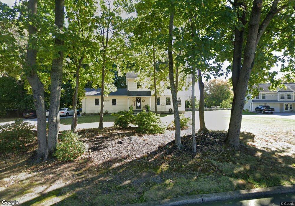
28 Monroe St Waterford, CT 06385
Estimated Value: $398,000 - $439,000
3
Beds
2
Baths
1,600
Sq Ft
$263/Sq Ft
Est. Value
About This Home
This home is located at 28 Monroe St, Waterford, CT 06385 and is currently estimated at $420,148, approximately $262 per square foot. 28 Monroe St is a home located in New London County with nearby schools including Clark Lane Middle School, Waterford High School, and New London High School Multi-Magnet Campus.
Ownership History
Date
Name
Owned For
Owner Type
Purchase Details
Closed on
Apr 18, 2001
Sold by
Turgeon Guy R
Bought by
Donovan Dawn M
Current Estimated Value
Home Financials for this Owner
Home Financials are based on the most recent Mortgage that was taken out on this home.
Original Mortgage
$161,910
Interest Rate
6.9%
Mortgage Type
Purchase Money Mortgage
Create a Home Valuation Report for This Property
The Home Valuation Report is an in-depth analysis detailing your home's value as well as a comparison with similar homes in the area
Home Values in the Area
Average Home Value in this Area
Purchase History
| Date | Buyer | Sale Price | Title Company |
|---|---|---|---|
| Donovan Dawn M | $179,900 | -- |
Source: Public Records
Mortgage History
| Date | Status | Borrower | Loan Amount |
|---|---|---|---|
| Open | Donovan Dawn M | $240,000 | |
| Closed | Donovan Dawn M | $52,100 | |
| Closed | Donovan Dawn M | $165,000 | |
| Closed | Donovan Dawn M | $161,910 |
Source: Public Records
Tax History Compared to Growth
Tax History
| Year | Tax Paid | Tax Assessment Tax Assessment Total Assessment is a certain percentage of the fair market value that is determined by local assessors to be the total taxable value of land and additions on the property. | Land | Improvement |
|---|---|---|---|---|
| 2025 | $4,768 | $204,100 | $70,690 | $133,410 |
| 2024 | $4,551 | $204,100 | $70,690 | $133,410 |
| 2023 | $4,327 | $204,100 | $70,690 | $133,410 |
| 2022 | $4,629 | $167,970 | $49,660 | $118,310 |
| 2021 | $4,643 | $167,970 | $49,660 | $118,310 |
| 2020 | $4,681 | $167,970 | $49,660 | $118,310 |
| 2019 | $4,700 | $167,970 | $49,660 | $118,310 |
| 2018 | $4,606 | $167,970 | $49,660 | $118,310 |
| 2017 | $4,655 | $172,200 | $52,580 | $119,620 |
| 2016 | $4,612 | $172,200 | $52,580 | $119,620 |
| 2015 | $4,448 | $172,200 | $52,580 | $119,620 |
| 2014 | $4,271 | $172,200 | $52,580 | $119,620 |
Source: Public Records
Map
Nearby Homes
- 68 Clark Ln
- 24 Pine St
- 35 Pine St
- 12 Pine St
- 213 Boston Post Rd
- 54 Rope Ferry Rd Unit C55
- 54 Rope Ferry Rd Unit D72
- 54 Rope Ferry Rd Unit C45
- 2 Faye St
- 5 Windy Ridge Place Unit 5
- 77 Colman St
- 18 W Pleasant St
- 835 Bank St
- 152 Blydenburg Ave
- 34 Ivy Hill Rd
- 7 Ivy Hill Rd
- 26 Jefferson Ave
- 26 Ivy Hill Rd
- 270 Boston Post Rd Unit 22
- 270 Boston Post Rd Unit TRLR 6