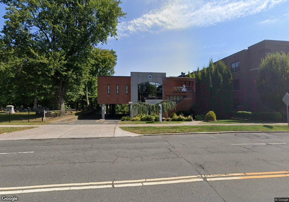
28 N Main St West Hartford, CT 06107
Estimated Value: $6,682,062
--
Bed
1
Bath
9,811
Sq Ft
$681/Sq Ft
Est. Value
About This Home
This home is located at 28 N Main St, West Hartford, CT 06107 and is currently estimated at $6,682,062, approximately $681 per square foot. 28 N Main St is a home located in Hartford County with nearby schools including Bugbee School, King Philip Middle School, and Hall High School.
Ownership History
Date
Name
Owned For
Owner Type
Purchase Details
Closed on
Dec 28, 2017
Sold by
Rosenfield Hollander A
Bought by
North Main Holdings Ll
Current Estimated Value
Home Financials for this Owner
Home Financials are based on the most recent Mortgage that was taken out on this home.
Original Mortgage
$995,500
Outstanding Balance
$840,298
Interest Rate
3.95%
Mortgage Type
Credit Line Revolving
Estimated Equity
$5,841,764
Purchase Details
Closed on
Jan 17, 1989
Sold by
Shelton Philip A
Bought by
Rosenfield Hallander
Home Financials for this Owner
Home Financials are based on the most recent Mortgage that was taken out on this home.
Original Mortgage
$1,500,000
Interest Rate
10.39%
Mortgage Type
Commercial
Create a Home Valuation Report for This Property
The Home Valuation Report is an in-depth analysis detailing your home's value as well as a comparison with similar homes in the area
Home Values in the Area
Average Home Value in this Area
Purchase History
| Date | Buyer | Sale Price | Title Company |
|---|---|---|---|
| North Main Holdings Ll | -- | -- | |
| Rosenfield Hallander | $1,500,000 | -- |
Source: Public Records
Mortgage History
| Date | Status | Borrower | Loan Amount |
|---|---|---|---|
| Open | North Main Holdings Ll | $995,500 | |
| Previous Owner | Rosenfield Hallander | $1,500,000 |
Source: Public Records
Tax History Compared to Growth
Tax History
| Year | Tax Paid | Tax Assessment Tax Assessment Total Assessment is a certain percentage of the fair market value that is determined by local assessors to be the total taxable value of land and additions on the property. | Land | Improvement |
|---|---|---|---|---|
| 2025 | $44,072 | $984,200 | $584,920 | $399,280 |
| 2024 | $41,681 | $984,200 | $584,920 | $399,280 |
| 2023 | $40,273 | $984,200 | $584,920 | $399,280 |
| 2022 | $40,037 | $984,200 | $584,920 | $399,280 |
| 2021 | $38,890 | $916,790 | $508,550 | $408,240 |
| 2020 | $39,858 | $953,540 | $508,550 | $444,990 |
| 2019 | $39,858 | $953,540 | $508,550 | $444,990 |
| 2018 | $39,095 | $953,540 | $508,550 | $444,990 |
| 2017 | $39,133 | $953,540 | $508,550 | $444,990 |
| 2016 | $36,286 | $918,400 | $567,140 | $351,260 |
| 2015 | $35,184 | $918,400 | $567,140 | $351,260 |
| 2014 | $34,321 | $918,400 | $567,140 | $351,260 |
Source: Public Records
Map
Nearby Homes
- 42 N Main St Unit 78
- 183 Loomis Dr Unit 104
- 37 Sylvan Ave
- 889 Farmington Ave Unit 4E
- 31 Robin Rd Unit 102
- 1110 Trout Brook Dr
- 18 Robin Rd Unit 1
- 97 Robin Rd
- 89 N Main St
- 119 Robin Rd
- 101 N Main St
- 126 Robin Rd
- 95 Clifton Ave
- 473 Fern St
- 2 Arapahoe Rd Unit 308
- 2 Arapahoe Rd Unit 415
- 2 Arapahoe Rd Unit 611
- 2 Arapahoe Rd Unit 613
- 2 Arapahoe Rd Unit 311
- 2 Arapahoe Rd Unit 312
- 24 N Main St
- 24 N Main St Unit 1F
- 24 N Main St Unit 3D
- 24 N Main St Unit 2F
- 24 N Main St Unit 3A
- 27 Loomis Dr
- 27 Loomis Dr
- 42 N Main St Unit 65
- 42 N Main St Unit 45
- 38 N Main St Unit 13
- 42 N Main St Unit T
- 42 N Main St Unit R
- 42 N Main St Unit P
- 42 N Main St Unit M
- 42 N Main St Unit L
- 42 N Main St Unit K
- 42 N Main St Unit J
- 42 N Main St Unit H
- 42 N Main St Unit G
- 42 N Main St Unit F