Estimated Value: $520,737 - $595,000
3
Beds
1
Bath
1,295
Sq Ft
$437/Sq Ft
Est. Value
About This Home
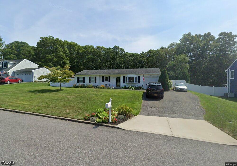
This home is located at 28 Pheasant Valley Dr, Coram, NY 11727 and is currently estimated at $566,184, approximately $437 per square foot. 28 Pheasant Valley Dr is a home located in Suffolk County with nearby schools including Longwood Middle School, Longwood Junior High School, and Longwood Senior High School.
Ownership History
Date
Name
Owned For
Owner Type
Purchase Details
Closed on
Sep 11, 2007
Sold by
Donato Joseph
Bought by
Short Corinne and Short Michael
Current Estimated Value
Purchase Details
Closed on
Apr 12, 2005
Sold by
Heavey Patrick and Heavey Jean
Bought by
Donato Joseph
Purchase Details
Closed on
Nov 14, 2000
Sold by
Petrulli James S and Petrulli Peggy Anne
Bought by
Heavey Patrick and Heavey Jean
Home Financials for this Owner
Home Financials are based on the most recent Mortgage that was taken out on this home.
Original Mortgage
$168,950
Interest Rate
7.78%
Mortgage Type
FHA
Create a Home Valuation Report for This Property
The Home Valuation Report is an in-depth analysis detailing your home's value as well as a comparison with similar homes in the area
Home Values in the Area
Average Home Value in this Area
Purchase History
We collect this data history from publicly available records. To have your information removed, we recommend requesting removal directly through your county’s website.
| Date | Buyer | Sale Price | Title Company |
|---|---|---|---|
| Short Corinne | $344,000 | -- | |
| Donato Joseph | $338,130 | Thomas Zaccharia | |
| Heavey Patrick | $170,500 | -- |
Source: Public Records
Mortgage History
We collect this data history from publicly available records. To have your information removed, we recommend requesting removal directly through your county’s website.
| Date | Status | Borrower | Loan Amount |
|---|---|---|---|
| Previous Owner | Heavey Patrick | $168,950 |
Source: Public Records
Tax History
| Year | Tax Paid | Tax Assessment Tax Assessment Total Assessment is a certain percentage of the fair market value that is determined by local assessors to be the total taxable value of land and additions on the property. | Land | Improvement |
|---|---|---|---|---|
| 2025 | $10,318 | $2,495 | $300 | $2,195 |
| 2024 | $10,318 | $2,495 | $300 | $2,195 |
| 2023 | $10,318 | $2,495 | $300 | $2,195 |
| 2022 | $9,121 | $2,495 | $300 | $2,195 |
| 2021 | $9,121 | $2,495 | $300 | $2,195 |
| 2020 | $9,375 | $2,495 | $300 | $2,195 |
| 2019 | $9,375 | $0 | $0 | $0 |
| 2018 | $8,889 | $2,495 | $300 | $2,195 |
| 2017 | $8,889 | $2,495 | $300 | $2,195 |
| 2016 | $8,785 | $2,495 | $300 | $2,195 |
| 2015 | -- | $2,495 | $300 | $2,195 |
| 2014 | -- | $2,495 | $300 | $2,195 |
Source: Public Records
Map
Nearby Homes
- 5 White Oak Ct Unit 5
- 56 Pennaquid Rd
- 14 Gaetano Ln
- 19 Ascot Place
- 2 Hamilton Ct
- 11 Dorchester Dr
- 5 Wedgewood Dr
- 981 Old Town Rd
- 5 Canterbury Dr
- 11 Royal Dr
- 12 Westmoylan Ln
- 21 Halston Ln
- 19 Hartsdale Ln
- 71 Elm Ave
- 263 N Bicycle Path
- 36 Holly Hill Ln
- 73 Elm Ave
- 1984 Route 112
- 29 Harwood Way
- 1 Linden St
- 26 Pheasant Valley Dr
- 30 Pheasant Valley Dr
- 27 Pheasant Valley Dr
- 25 Pheasant Valley Dr
- 24 Pheasant Valley Dr
- 23 Pheasant Valley Dr
- 22 Pheasant Valley Dr
- 23 White Oak Ct
- 25 White Oak Ct Unit 25
- 20 Pheasant Valley Dr
- 27 White Oak Ct
- 21 Pheasant Valley Dr
- 17 Rudys Ln
- 28 White Oak Ct Unit 28
- 18 Pheasant Valley Dr Unit Studio Apartment
- 18 Pheasant Valley Dr
- 19 White Oak Ct
- 14 White Oak Ct Unit 14
- 14 White Oak Ct
- 19 Rudys Ln
Your Personal Tour Guide
Ask me questions while you tour the home.