Estimated Value: $924,995 - $1,111,000
4
Beds
3
Baths
2,944
Sq Ft
$345/Sq Ft
Est. Value
About This Home
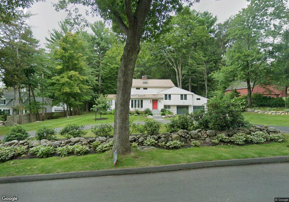
This home is located at 28 Pope Rd, Acton, MA 01720 and is currently estimated at $1,014,499, approximately $344 per square foot. 28 Pope Rd is a home located in Middlesex County with nearby schools including Acton-Boxborough Regional High School, Nashoba Brooks School, and Concord Academy.
Ownership History
Date
Name
Owned For
Owner Type
Purchase Details
Closed on
Aug 19, 2013
Sold by
Burum Belinda B and Burum Douglas P
Bought by
Douglas P Burum Lt and Burum Douglas P
Current Estimated Value
Purchase Details
Closed on
Jun 4, 1987
Sold by
Est Centauro Joseph
Bought by
Burum Douglas P
Home Financials for this Owner
Home Financials are based on the most recent Mortgage that was taken out on this home.
Original Mortgage
$145,000
Interest Rate
10.38%
Mortgage Type
Purchase Money Mortgage
Create a Home Valuation Report for This Property
The Home Valuation Report is an in-depth analysis detailing your home's value as well as a comparison with similar homes in the area
Home Values in the Area
Average Home Value in this Area
Purchase History
| Date | Buyer | Sale Price | Title Company |
|---|---|---|---|
| Douglas P Burum Lt | -- | -- | |
| Burum Douglas P | $195,500 | -- |
Source: Public Records
Mortgage History
| Date | Status | Borrower | Loan Amount |
|---|---|---|---|
| Previous Owner | Burum Douglas P | $145,000 |
Source: Public Records
Tax History
| Year | Tax Paid | Tax Assessment Tax Assessment Total Assessment is a certain percentage of the fair market value that is determined by local assessors to be the total taxable value of land and additions on the property. | Land | Improvement |
|---|---|---|---|---|
| 2025 | $13,636 | $795,100 | $347,600 | $447,500 |
| 2024 | $12,781 | $766,700 | $347,600 | $419,100 |
| 2023 | $12,445 | $708,700 | $315,900 | $392,800 |
| 2022 | $11,789 | $606,100 | $274,600 | $331,500 |
| 2021 | $11,499 | $568,400 | $254,400 | $314,000 |
| 2020 | $11,050 | $574,300 | $254,400 | $319,900 |
| 2019 | $10,686 | $551,700 | $254,400 | $297,300 |
| 2018 | $10,512 | $542,400 | $254,400 | $288,000 |
| 2017 | $10,249 | $537,700 | $254,400 | $283,300 |
| 2016 | $10,071 | $523,700 | $254,400 | $269,300 |
| 2015 | $9,898 | $519,600 | $254,400 | $265,200 |
| 2014 | $9,750 | $501,300 | $254,400 | $246,900 |
Source: Public Records
Map
Nearby Homes
- 1 Bayberry Rd
- 187 Great Rd Unit A1
- 134 Pope Rd
- 245 Oak Hill Cir
- 303 School St
- 104 Channing Rd
- 27 Forest Rd
- 60 Lawsbrook Rd
- 56 Isaac Davis Rd
- 709 Main St
- 491 Main St
- 853 Strawberry Hill Rd
- 59 Lexington Dr
- 42 Sunnyside Ln
- 79-81 Assabet Ave
- 65 Summit St
- 524 Main St
- 46 Taylor Rd
- 15 Davis Rd Unit B-8
- 11 Davis Rd Unit A5
Your Personal Tour Guide
Ask me questions while you tour the home.