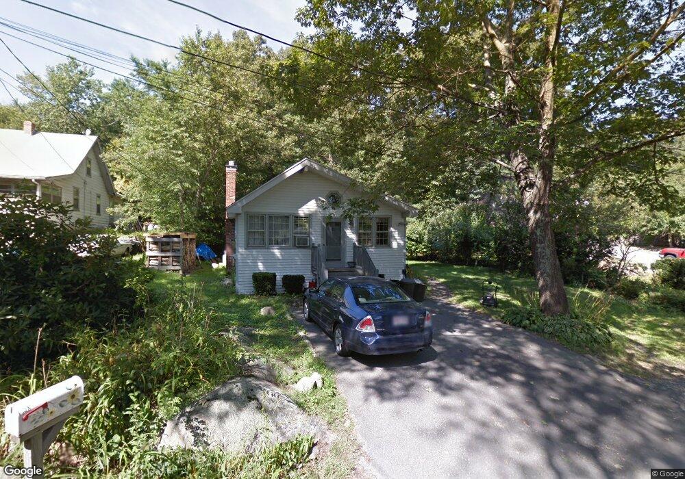
28 Riverside Dr North Reading, MA 01864
Estimated Value: $561,000 - $729,000
2
Beds
1
Bath
1,077
Sq Ft
$574/Sq Ft
Est. Value
About This Home
This home is located at 28 Riverside Dr, North Reading, MA 01864 and is currently estimated at $618,399, approximately $574 per square foot. 28 Riverside Dr is a home located in Middlesex County with nearby schools including Batchelder School, North Reading Middle School, and North Reading High School.
Ownership History
Date
Name
Owned For
Owner Type
Purchase Details
Closed on
Mar 15, 2006
Sold by
Martino Ann
Bought by
Taffe Michael L and Taffe Susan C
Current Estimated Value
Home Financials for this Owner
Home Financials are based on the most recent Mortgage that was taken out on this home.
Original Mortgage
$200,000
Outstanding Balance
$113,698
Interest Rate
6.27%
Mortgage Type
Purchase Money Mortgage
Estimated Equity
$504,701
Purchase Details
Closed on
Jan 25, 1994
Sold by
Connors Margaret C and Daly Timothy R
Bought by
Martino Ann
Purchase Details
Closed on
Apr 8, 1987
Sold by
Bradley James S
Bought by
Burns James H
Home Financials for this Owner
Home Financials are based on the most recent Mortgage that was taken out on this home.
Original Mortgage
$106,400
Interest Rate
9.02%
Mortgage Type
Purchase Money Mortgage
Create a Home Valuation Report for This Property
The Home Valuation Report is an in-depth analysis detailing your home's value as well as a comparison with similar homes in the area
Home Values in the Area
Average Home Value in this Area
Purchase History
| Date | Buyer | Sale Price | Title Company |
|---|---|---|---|
| Taffe Michael L | $312,500 | -- | |
| Martino Ann | $143,000 | -- | |
| Burns James H | $133,000 | -- |
Source: Public Records
Mortgage History
| Date | Status | Borrower | Loan Amount |
|---|---|---|---|
| Open | Taffe Michael L | $200,000 | |
| Previous Owner | Burns James H | $124,800 | |
| Previous Owner | Burns James H | $106,400 | |
| Previous Owner | Burns James H | $59,600 |
Source: Public Records
Tax History
| Year | Tax Paid | Tax Assessment Tax Assessment Total Assessment is a certain percentage of the fair market value that is determined by local assessors to be the total taxable value of land and additions on the property. | Land | Improvement |
|---|---|---|---|---|
| 2025 | $6,902 | $528,500 | $349,600 | $178,900 |
| 2024 | $6,701 | $507,300 | $329,400 | $177,900 |
| 2023 | $6,249 | $446,700 | $303,000 | $143,700 |
| 2022 | $6,180 | $412,000 | $275,200 | $136,800 |
| 2021 | $10,893 | $369,100 | $250,100 | $119,000 |
Source: Public Records
Map
Nearby Homes
- 2 Wedge Ct Unit 2
- 14 Niblick Way
- 1466 Main St
- 6 White Ln
- 19 Fairway Ln Unit 53
- 9 Stableford Ct Unit 9
- 6 Cabral Dr
- 15 Fairway Ln Unit 55
- 15 Fairway Ln
- 10 Fairway Ln
- 5 Stableford Ct Unit 11
- 40 Glen Dr
- 12 Couture Way
- 1 Couture Way
- 16 Anglewood Ln
- 35 Catherine Dr
- 6 Glen Dr
- 220 Swan Pond Rd
- 53 Park St
- 23 Hamilton Rd
Your Personal Tour Guide
Ask me questions while you tour the home.