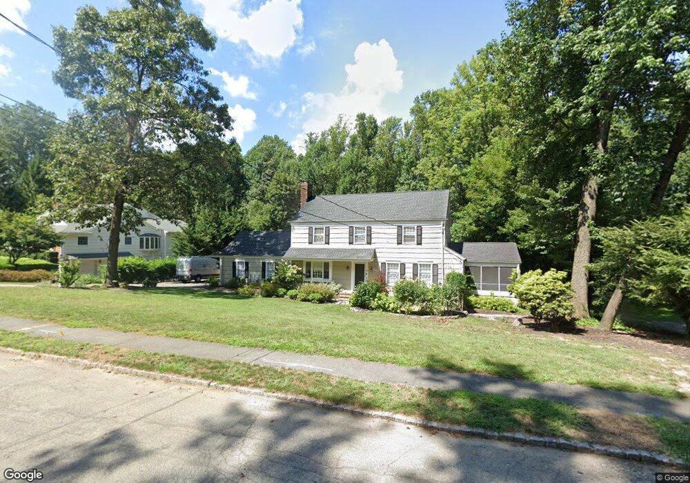
28 Rolling Hill Dr Morristown, NJ 07960
Estimated Value: $967,074 - $1,086,000
4
Beds
3
Baths
2,158
Sq Ft
$477/Sq Ft
Est. Value
About This Home
This home is located at 28 Rolling Hill Dr, Morristown, NJ 07960 and is currently estimated at $1,029,769, approximately $477 per square foot. 28 Rolling Hill Dr is a home located in Morris County with nearby schools including Hillcrest School, Thomas Jefferson School, and Alexander Hamilton School.
Ownership History
Date
Name
Owned For
Owner Type
Purchase Details
Closed on
Dec 5, 2014
Sold by
Garrett James and Garrett Cynthia
Bought by
Trombetta Peter J and Riker Susan
Current Estimated Value
Home Financials for this Owner
Home Financials are based on the most recent Mortgage that was taken out on this home.
Original Mortgage
$493,000
Outstanding Balance
$378,469
Interest Rate
3.98%
Mortgage Type
New Conventional
Estimated Equity
$651,300
Purchase Details
Closed on
Sep 14, 2000
Sold by
Carroll James Albert and Carroll Joan Lorraine
Bought by
Garrett James and Garrett Cynthia
Home Financials for this Owner
Home Financials are based on the most recent Mortgage that was taken out on this home.
Original Mortgage
$382,500
Interest Rate
7.75%
Create a Home Valuation Report for This Property
The Home Valuation Report is an in-depth analysis detailing your home's value as well as a comparison with similar homes in the area
Home Values in the Area
Average Home Value in this Area
Purchase History
| Date | Buyer | Sale Price | Title Company |
|---|---|---|---|
| Trombetta Peter J | $665,000 | Foundation Title Llc | |
| Garrett James | $510,000 | Commonwealth Land Title Ins |
Source: Public Records
Mortgage History
| Date | Status | Borrower | Loan Amount |
|---|---|---|---|
| Open | Trombetta Peter J | $493,000 | |
| Previous Owner | Garrett James | $382,500 |
Source: Public Records
Tax History Compared to Growth
Tax History
| Year | Tax Paid | Tax Assessment Tax Assessment Total Assessment is a certain percentage of the fair market value that is determined by local assessors to be the total taxable value of land and additions on the property. | Land | Improvement |
|---|---|---|---|---|
| 2025 | $10,931 | $546,000 | $275,000 | $271,000 |
| 2024 | $10,947 | $546,000 | $275,000 | $271,000 |
| 2023 | $10,947 | $546,000 | $275,000 | $271,000 |
| 2022 | $10,440 | $546,000 | $275,000 | $271,000 |
| 2021 | $10,440 | $546,000 | $275,000 | $271,000 |
| 2020 | $10,167 | $546,000 | $275,000 | $271,000 |
| 2019 | $10,008 | $546,000 | $275,000 | $271,000 |
| 2018 | $9,899 | $546,000 | $275,000 | $271,000 |
| 2017 | $9,833 | $546,000 | $275,000 | $271,000 |
| 2016 | $9,681 | $546,000 | $275,000 | $271,000 |
| 2015 | $10,410 | $410,500 | $195,000 | $215,500 |
| 2014 | $10,097 | $403,400 | $195,000 | $208,400 |
Source: Public Records
Map
Nearby Homes
- 282 Mount Kemble Ave
- 97 Skyline Dr
- 4 Old Harter Rd
- 237 Mount Kemble Ave
- 22 Mountainside Dr
- 2 Blackwell Ave
- 24 Spring Brook Rd
- 9 Dorothy Dr
- 1 Twin Oaks Ln
- 6 Brookfield Way
- 9 Valley View Rd
- 143 Hillcrest Ave
- 26 Brookfield Way
- 10 Westminster Place
- 6 Ash Ln
- 11 Shadowbrook Ln
- 9 Wren Ct
- 51 Mount Kemble Ave Unit 405
- 7 Sherwood Dr
- 16 Dellwood Ave
- 30 Rolling Hill Dr
- 33 Rolling Hill Dr
- 24 Rolling Hill Dr
- 32 Rolling Hill Dr
- 31 Rolling Hill Dr
- 35 Rolling Hill Dr
- 29 Rolling Hill Dr
- 22 Rolling Hill Dr
- 34 Rolling Hill Dr
- 37 Rolling Hill Dr
- 27 Rolling Hill Dr
- 11 Forest Dr
- 15 Forest Dr
- 9 Forest Dr
- 39 Rolling Hill Dr
- 20 Rolling Hill Dr
- 1 Forest Dr
- 17 Forest Dr
- 5 Forest Dr
- 3 Forest Dr