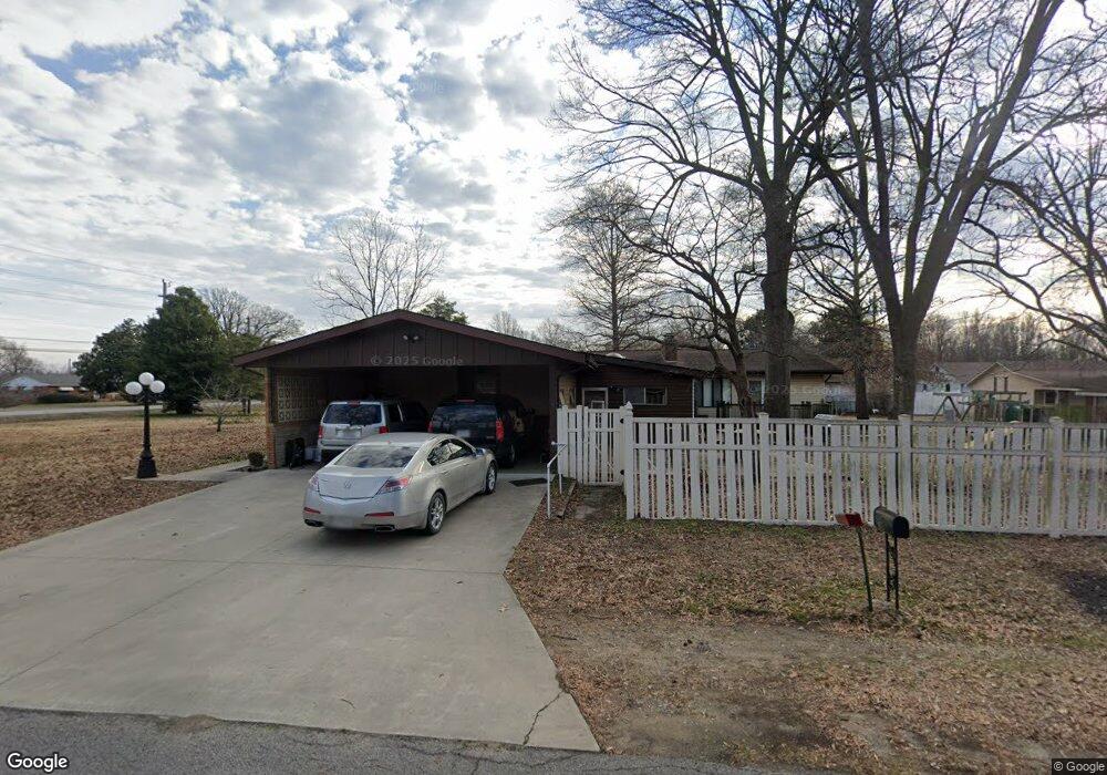
28 S Davis Rd East Prairie, MO 63845
Estimated Value: $199,324 - $332,000
--
Bed
--
Bath
2,792
Sq Ft
$91/Sq Ft
Est. Value
About This Home
This home is located at 28 S Davis Rd, East Prairie, MO 63845 and is currently estimated at $253,581, approximately $90 per square foot. 28 S Davis Rd is a home with nearby schools including R. A. Doyle Elementary School, A. J. Martin Elementary School, and East Prairie Junior High School.
Ownership History
Date
Name
Owned For
Owner Type
Purchase Details
Closed on
Jan 21, 2025
Sold by
Mencer Flying Llc
Bought by
Nordwald Robert and Nordwald Shaelynn White
Current Estimated Value
Home Financials for this Owner
Home Financials are based on the most recent Mortgage that was taken out on this home.
Original Mortgage
$230,500
Outstanding Balance
$223,962
Interest Rate
5.84%
Mortgage Type
New Conventional
Estimated Equity
$29,619
Purchase Details
Closed on
May 19, 2022
Sold by
Davis Charlene L
Bought by
Mencer Flying Llc
Home Financials for this Owner
Home Financials are based on the most recent Mortgage that was taken out on this home.
Original Mortgage
$187,935
Interest Rate
5.25%
Mortgage Type
New Conventional
Create a Home Valuation Report for This Property
The Home Valuation Report is an in-depth analysis detailing your home's value as well as a comparison with similar homes in the area
Home Values in the Area
Average Home Value in this Area
Purchase History
| Date | Buyer | Sale Price | Title Company |
|---|---|---|---|
| Nordwald Robert | -- | None Listed On Document | |
| Nordwald Robert | -- | None Listed On Document | |
| Mencer Flying Llc | $217,000 | None Listed On Document |
Source: Public Records
Mortgage History
| Date | Status | Borrower | Loan Amount |
|---|---|---|---|
| Open | Nordwald Robert | $230,500 | |
| Closed | Nordwald Robert | $230,500 | |
| Previous Owner | Mencer Flying Llc | $187,935 |
Source: Public Records
Tax History Compared to Growth
Tax History
| Year | Tax Paid | Tax Assessment Tax Assessment Total Assessment is a certain percentage of the fair market value that is determined by local assessors to be the total taxable value of land and additions on the property. | Land | Improvement |
|---|---|---|---|---|
| 2024 | $1,649 | $31,010 | $0 | $0 |
| 2023 | $1,651 | $31,010 | $0 | $0 |
| 2022 | $1,411 | $26,490 | $0 | $0 |
| 2021 | $1,281 | $24,070 | $0 | $0 |
| 2020 | $1,281 | $24,070 | $0 | $0 |
| 2019 | $1,281 | $24,050 | $0 | $0 |
| 2018 | $1,105 | $23,070 | $0 | $0 |
| 2016 | $0 | $23,070 | $0 | $23,070 |
Source: Public Records
Map
Nearby Homes
- 2565 W Highway 80
- 209 S Davis Rd
- 200 Margaret Dr
- 112 Cynthia St
- 49 Alesia Dr
- 211 W Olive St
- 207 W Olive St
- 212 Millar St
- 405 S Kirkendall St
- 201 E Maple St
- 908 Millar St
- 407 Wilbur St
- 517 Herring St
- 81 S 523rd Rd
- 226 Sandy Ln
- 702 S 525th Rd
- 17 Cardinal Ln
- 0 County Road 714
- 20 & 30 Artic Ln
- 1608 County Road 711
- 993 County Highway 740
- 67 S Dutch Dr
- 71 S Davis Rd
- 2528 W Highway 80
- 50 S Gullion Rd
- 980 W Washington St
- 2560 W Highway 80
- 50 S Dutch Dr
- 102 S Davis Dr
- 2500 W Highway 80
- 64 S Dutch Dr
- 1001 W Washington St
- 47 S Gullion Rd
- 101 S Dutch Dr
- 90 S Dutch Dr
- 124 S Davis Rd
- 910 W Washington St
- 106 Powers St
- 2639 W Highway 80
- 121 S Dutch Dr