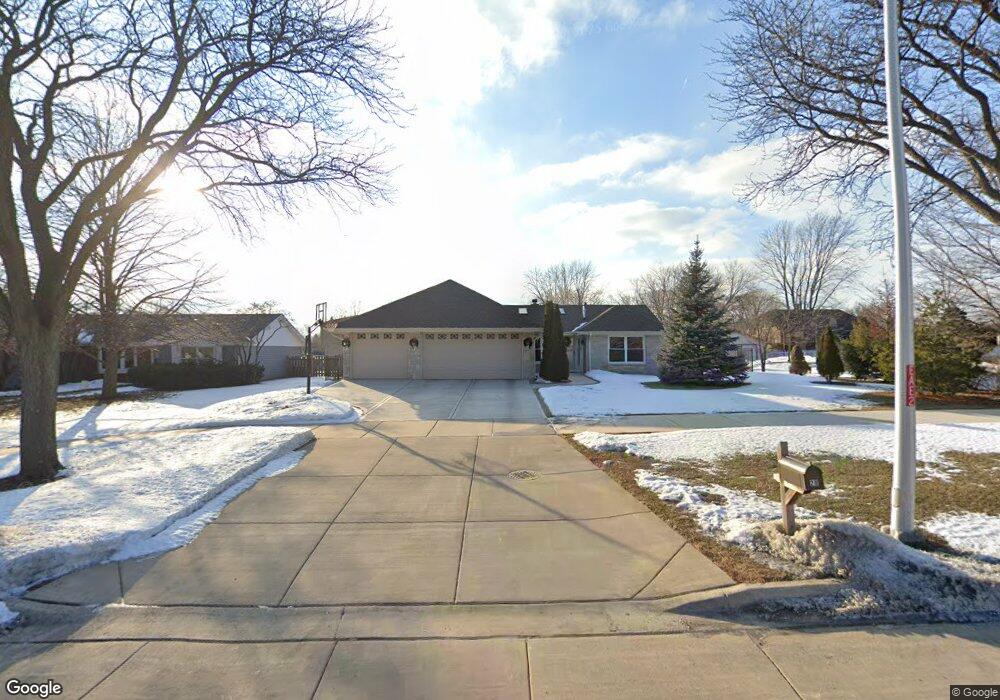
28 S Walnut Ln Schaumburg, IL 60193
West Schaumburg NeighborhoodEstimated Value: $420,000 - $464,805
3
Beds
2
Baths
1,906
Sq Ft
$234/Sq Ft
Est. Value
About This Home
This home is located at 28 S Walnut Ln, Schaumburg, IL 60193 and is currently estimated at $445,201, approximately $233 per square foot. 28 S Walnut Ln is a home located in Cook County with nearby schools including Campanelli Elementary School, Jane Addams Junior High School, and Hoffman Estates High School.
Ownership History
Date
Name
Owned For
Owner Type
Purchase Details
Closed on
Nov 14, 2005
Sold by
Oken Lucille F
Bought by
Bulat Rafal and Bulat Urszula
Current Estimated Value
Home Financials for this Owner
Home Financials are based on the most recent Mortgage that was taken out on this home.
Original Mortgage
$282,150
Outstanding Balance
$156,103
Interest Rate
6.2%
Mortgage Type
Unknown
Estimated Equity
$289,098
Create a Home Valuation Report for This Property
The Home Valuation Report is an in-depth analysis detailing your home's value as well as a comparison with similar homes in the area
Home Values in the Area
Average Home Value in this Area
Purchase History
| Date | Buyer | Sale Price | Title Company |
|---|---|---|---|
| Bulat Rafal | $297,000 | First American Title Ins Co |
Source: Public Records
Mortgage History
| Date | Status | Borrower | Loan Amount |
|---|---|---|---|
| Open | Bulat Rafal | $282,150 |
Source: Public Records
Tax History Compared to Growth
Tax History
| Year | Tax Paid | Tax Assessment Tax Assessment Total Assessment is a certain percentage of the fair market value that is determined by local assessors to be the total taxable value of land and additions on the property. | Land | Improvement |
|---|---|---|---|---|
| 2024 | $9,233 | $33,397 | $9,744 | $23,653 |
| 2023 | $9,665 | $39,000 | $9,744 | $29,256 |
| 2022 | $9,665 | $39,000 | $9,744 | $29,256 |
| 2021 | $5,505 | $21,492 | $7,003 | $14,489 |
| 2020 | $5,478 | $21,492 | $7,003 | $14,489 |
| 2019 | $5,482 | $23,880 | $7,003 | $16,877 |
| 2018 | $5,147 | $20,584 | $5,785 | $14,799 |
| 2017 | $5,490 | $21,963 | $5,785 | $16,178 |
| 2016 | $5,377 | $21,963 | $5,785 | $16,178 |
| 2015 | $5,510 | $21,040 | $5,176 | $15,864 |
| 2014 | $5,749 | $21,999 | $5,176 | $16,823 |
| 2013 | $5,584 | $21,999 | $5,176 | $16,823 |
Source: Public Records
Map
Nearby Homes
- 1939 Weston Ln
- 135 S Walnut Ln
- 227 S Walnut Ln
- 136 Caryville Ln
- 1933 Whittier Ln
- 231 Webster Ln
- 124 Westover Ln
- 2317 Broadway Ln
- 2404 Baldwin Ct
- 8181 Northway Dr
- 133 White Branch Ct S Unit 539
- 413 Linsey Ave
- 2128 Hitching Post Ln
- 8138 N Carrolton Ct
- 1614 Kingston Ln
- 198 Camden Ct Unit Z2
- 508 N Walnut Ln
- 200 Columbia Ct Unit 5
- 454 Willington Dr
- 100 Ellington Dr
- 32 S Walnut Ln
- 2006 Sherborn Ln
- 2010 Sherborn Ln
- 33 S Walnut Ln
- 1938 Wayland Ln
- 101 Lynnfield Ln
- 19 S Walnut Ln
- 2014 Sherborn Ln
- 1937 Wayland Ln
- 15 S Walnut Ln Unit 2
- 1938 Weston Ln
- 2020 Sherborn Ln
- 110 S Walnut Ln
- 100 Lynnfield Ln
- 105 Lynnfield Ln
- 11 S Walnut Ln
- 1928 Wayland Ct
- 1930 Wayland Ln
- 1933 Wayland Ln
- 1934 Weston Ln