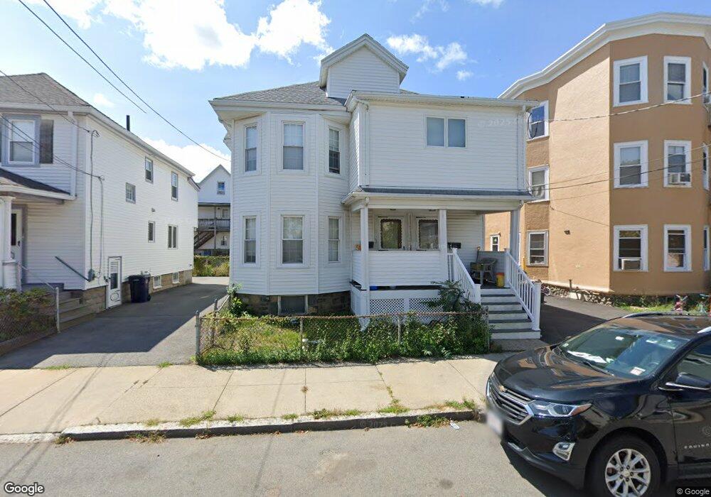
28 Sea St Everett, MA 02149
Glendale NeighborhoodEstimated Value: $813,000 - $1,014,000
4
Beds
2
Baths
2,452
Sq Ft
$376/Sq Ft
Est. Value
About This Home
This home is located at 28 Sea St, Everett, MA 02149 and is currently estimated at $923,165, approximately $376 per square foot. 28 Sea St is a home located in Middlesex County with nearby schools including Malden High School and Malden Catholic.
Ownership History
Date
Name
Owned For
Owner Type
Purchase Details
Closed on
Sep 4, 2001
Sold by
Lanzi Paul A and Lanzi Kristin
Bought by
Leblanc Karen A
Current Estimated Value
Home Financials for this Owner
Home Financials are based on the most recent Mortgage that was taken out on this home.
Original Mortgage
$299,250
Interest Rate
7.06%
Mortgage Type
Purchase Money Mortgage
Purchase Details
Closed on
Oct 23, 1997
Sold by
Resnick Ruth F
Bought by
Lanzi Paul A and Lanzi Kristin
Home Financials for this Owner
Home Financials are based on the most recent Mortgage that was taken out on this home.
Original Mortgage
$157,250
Interest Rate
7.48%
Mortgage Type
Purchase Money Mortgage
Create a Home Valuation Report for This Property
The Home Valuation Report is an in-depth analysis detailing your home's value as well as a comparison with similar homes in the area
Home Values in the Area
Average Home Value in this Area
Purchase History
| Date | Buyer | Sale Price | Title Company |
|---|---|---|---|
| Leblanc Karen A | $315,000 | -- | |
| Lanzi Paul A | $148,000 | -- |
Source: Public Records
Mortgage History
| Date | Status | Borrower | Loan Amount |
|---|---|---|---|
| Open | Lanzi Paul A | $299,000 | |
| Closed | Leblanc Karen A | $299,250 | |
| Previous Owner | Lanzi Paul A | $173,825 | |
| Previous Owner | Lanzi Paul A | $157,250 |
Source: Public Records
Tax History
| Year | Tax Paid | Tax Assessment Tax Assessment Total Assessment is a certain percentage of the fair market value that is determined by local assessors to be the total taxable value of land and additions on the property. | Land | Improvement |
|---|---|---|---|---|
| 2025 | $10,111 | $887,700 | $238,400 | $649,300 |
| 2024 | $9,228 | $805,200 | $208,900 | $596,300 |
| 2023 | $8,982 | $762,500 | $199,800 | $562,700 |
| 2022 | $6,918 | $667,800 | $190,700 | $477,100 |
| 2021 | $6,209 | $629,100 | $170,800 | $458,300 |
| 2020 | $6,519 | $612,700 | $170,800 | $441,900 |
| 2019 | $6,887 | $556,300 | $162,600 | $393,700 |
| 2018 | $6,730 | $488,400 | $141,700 | $346,700 |
| 2017 | $6,413 | $444,100 | $127,200 | $316,900 |
| 2016 | $6,070 | $420,100 | $113,500 | $306,600 |
| 2015 | $5,680 | $388,800 | $102,400 | $286,400 |
Source: Public Records
Map
Nearby Homes
- 5 Mason St
- 39 Broadway Unit 305
- 881 Broadway Unit 44
- 112 Hadley St
- 859 Broadway Unit 15
- 102 Suffolk St
- 13 Coolidge St
- 53 Sycamore St
- 528 Ferry St
- 19 Mills St
- 51 Adams Ave
- 101 Waite St Unit B5
- 272-274 Cross St Unit 4
- 272-274 Cross St Unit 3
- 17 Jones St Unit 2
- 557 Salem St Unit 3
- 557 Salem St Unit 4
- 44-46 Myrtle St
- 10 Dell St
- 211 Elm St
Your Personal Tour Guide
Ask me questions while you tour the home.