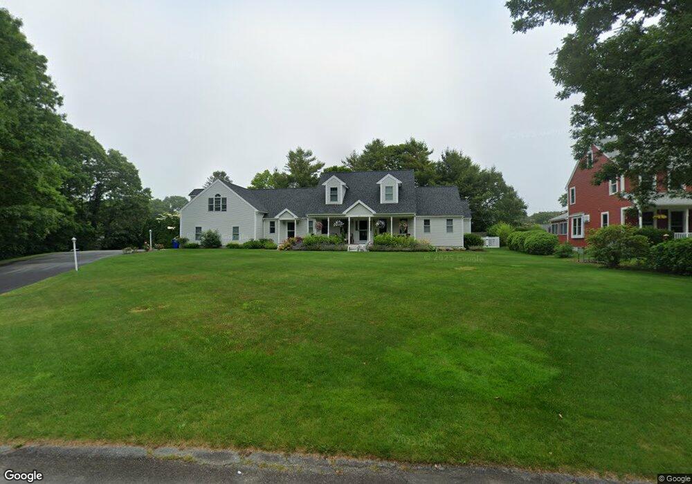
28 Seabreeze Dr Bourne, MA 2532
Estimated Value: $911,000 - $1,393,000
3
Beds
4
Baths
3,612
Sq Ft
$318/Sq Ft
Est. Value
About This Home
This home is located at 28 Seabreeze Dr, Bourne, MA 2532 and is currently estimated at $1,147,810, approximately $317 per square foot. 28 Seabreeze Dr is a home located in Barnstable County with nearby schools including Bourne High School, St Margaret Regional School, and Cadence Academy Preschool - Bourne.
Ownership History
Date
Name
Owned For
Owner Type
Purchase Details
Closed on
Jul 22, 2015
Sold by
Molly E Oconnor T E and Molly Oconnor
Bought by
Molly E Oconnor T E and Molly Oconnor
Current Estimated Value
Home Financials for this Owner
Home Financials are based on the most recent Mortgage that was taken out on this home.
Original Mortgage
$316,500
Outstanding Balance
$247,391
Interest Rate
4.01%
Mortgage Type
New Conventional
Estimated Equity
$900,419
Purchase Details
Closed on
Oct 22, 2009
Sold by
Oconnor Molly
Bought by
Christopher M Oconnor M and Christopher Oconnor
Purchase Details
Closed on
Sep 20, 2006
Sold by
Oconnor Christopher M and Oconnor Molly
Bought by
Oconnor Molly
Purchase Details
Closed on
Nov 2, 1999
Sold by
Doherty John J and Doherty Joyce A
Bought by
Oconnor Christopher M
Create a Home Valuation Report for This Property
The Home Valuation Report is an in-depth analysis detailing your home's value as well as a comparison with similar homes in the area
Purchase History
| Date | Buyer | Sale Price | Title Company |
|---|---|---|---|
| Molly E Oconnor T E | -- | -- | |
| Molly E Oconnor T E | -- | -- | |
| Christopher M Oconnor M | -- | -- | |
| Christopher M Oconnor M | -- | -- | |
| Oconnor Molly | -- | -- | |
| Oconnor Molly | -- | -- | |
| Oconnor Molly | -- | -- | |
| Oconnor Christopher M | $70,000 | -- | |
| Oconnor Christopher M | $70,000 | -- |
Source: Public Records
Mortgage History
| Date | Status | Borrower | Loan Amount |
|---|---|---|---|
| Open | Molly E Oconnor T E | $316,500 | |
| Closed | Molly E Oconnor T E | $316,500 | |
| Previous Owner | Oconnor Christopher M | $440,000 |
Source: Public Records
Tax History
| Year | Tax Paid | Tax Assessment Tax Assessment Total Assessment is a certain percentage of the fair market value that is determined by local assessors to be the total taxable value of land and additions on the property. | Land | Improvement |
|---|---|---|---|---|
| 2025 | $8,677 | $1,111,000 | $267,100 | $843,900 |
| 2024 | $7,569 | $943,800 | $254,300 | $689,500 |
| 2023 | $7,423 | $842,600 | $225,100 | $617,500 |
| 2022 | $7,014 | $695,100 | $199,200 | $495,900 |
| 2021 | $6,814 | $632,700 | $181,300 | $451,400 |
| 2020 | $6,493 | $604,600 | $179,600 | $425,000 |
| 2019 | $6,361 | $605,200 | $199,500 | $405,700 |
| 2018 | $6,123 | $580,900 | $190,000 | $390,900 |
| 2017 | $5,925 | $575,200 | $188,200 | $387,000 |
| 2016 | $5,552 | $546,500 | $169,400 | $377,100 |
| 2015 | -- | $521,400 | $144,300 | $377,100 |
Source: Public Records
Map
Nearby Homes
- 35 Benedict Rd
- 60 Bourne Neck Dr
- 5 Zoli Ln
- 203 County Rd
- 46 Holt Rd Unit B
- 46 Holt Rd
- 13 Laurel Hill Ct
- 40-A Lafayette Ave
- 4 Van Bummel Rd
- 44 Cotuit Rd
- 2 Applewood Ct
- 5 Sea Knoll Ct
- 56 Rip Van Winkle Way
- 12 Turnberry Rd Unit 12
- 60 Sandwich Rd
- 38 Old Bridge Rd
- 4 Hollyhock Knoll Ct Unit 4
- 4 Hollyhock Knoll Ct Unit 4
- 3 Fairway Dr Unit F
- 3 Honora Ln Unit 3
- 28 Sea Breeze Dr
- 26 Sea Breeze Dr
- 25 Presidents Rd
- 25 Presidents Rd
- 30 Sea Breeze Dr
- 30 Seabreeze Dr
- 29 Presidents Rd
- 15 Presidents Rd
- 27 Seabreeze Dr
- 15 Presidents Rd
- 27 Sea Breeze Dr
- 37 Presidents Rd
- 9 Presidents Rd
- 37 Presidents Rd
- 25 Sea Breeze Dr
- 24 Seabreeze Dr
- 32 Seabreeze Dr
- 24 Sea Breeze Dr
- 32 Sea Breeze Dr
- 33 Sea Breeze Dr
Your Personal Tour Guide
Ask me questions while you tour the home.