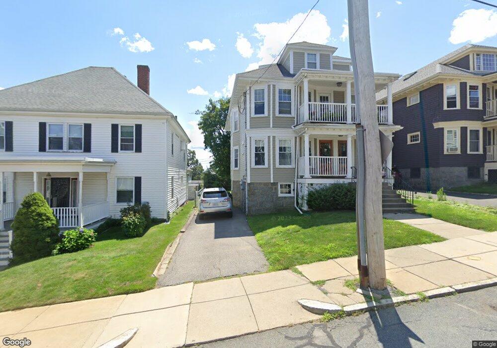
28 South Munroe Terrace Unit 30 Dorchester, MA 02122
Neponset-Port Norfolk NeighborhoodEstimated Value: $975,000 - $1,229,850
5
Beds
3
Baths
3,017
Sq Ft
$370/Sq Ft
Est. Value
About This Home
This home is located at 28 South Munroe Terrace Unit 30, Dorchester, MA 02122 and is currently estimated at $1,115,463, approximately $369 per square foot. 28 South Munroe Terrace Unit 30 is a home located in Suffolk County with nearby schools including Neighborhood House Charter School and Helen Y. Davis Leadership Academy Charter Public School.
Ownership History
Date
Name
Owned For
Owner Type
Purchase Details
Closed on
Nov 19, 2018
Sold by
Barry Christopher R and Barry Kristina E
Bought by
28 & 30 S Munroe Ter Llc
Current Estimated Value
Purchase Details
Closed on
May 18, 2015
Sold by
Mary R Cavanagh Irt
Bought by
Barry Christopher R and Barry Kristina E
Home Financials for this Owner
Home Financials are based on the most recent Mortgage that was taken out on this home.
Original Mortgage
$401,250
Interest Rate
3.69%
Mortgage Type
New Conventional
Purchase Details
Closed on
Dec 9, 2008
Sold by
Cavanagh Mary R
Bought by
Mary R Cavanagh 2008 I
Create a Home Valuation Report for This Property
The Home Valuation Report is an in-depth analysis detailing your home's value as well as a comparison with similar homes in the area
Home Values in the Area
Average Home Value in this Area
Purchase History
| Date | Buyer | Sale Price | Title Company |
|---|---|---|---|
| 28 & 30 S Munroe Ter Llc | -- | -- | |
| Barry Christopher R | $530,000 | -- | |
| Mary R Cavanagh 2008 I | -- | -- |
Source: Public Records
Mortgage History
| Date | Status | Borrower | Loan Amount |
|---|---|---|---|
| Previous Owner | Barry Christopher R | $401,250 |
Source: Public Records
Tax History Compared to Growth
Tax History
| Year | Tax Paid | Tax Assessment Tax Assessment Total Assessment is a certain percentage of the fair market value that is determined by local assessors to be the total taxable value of land and additions on the property. | Land | Improvement |
|---|---|---|---|---|
| 2025 | $12,568 | $1,085,300 | $271,700 | $813,600 |
| 2024 | $11,146 | $1,022,600 | $220,500 | $802,100 |
| 2023 | $10,269 | $956,100 | $206,200 | $749,900 |
| 2022 | $10,002 | $919,300 | $198,200 | $721,100 |
| 2021 | $9,343 | $875,600 | $188,800 | $686,800 |
| 2020 | $8,647 | $818,800 | $182,900 | $635,900 |
| 2019 | $7,992 | $758,300 | $139,800 | $618,500 |
| 2018 | $7,789 | $743,200 | $139,800 | $603,400 |
| 2017 | $6,798 | $641,915 | $132,810 | $509,105 |
| 2016 | $4,798 | $436,200 | $139,800 | $296,400 |
| 2015 | $4,720 | $389,800 | $132,900 | $256,900 |
| 2014 | $4,247 | $337,600 | $132,900 | $204,700 |
Source: Public Records
Map
Nearby Homes
- 217 Neponset Ave Unit 33
- 3 N Munroe Terrace
- 223 Neponset Ave Unit 2
- 108 King St Unit 3
- 104 King St Unit 2
- 96 King St Unit 1
- 60 Houghton St Unit 62
- 36 Mckone St Unit 2
- 36 Mckone St
- 36 Mckone St Unit 1
- 4 Payne St Unit 5
- 6 Agawam St
- 8 Mckone St
- 34 Houghton St
- 51 Coffey St Unit 51C
- 543 Adams St Unit 24
- 41 King St Unit 1
- 114 Wrentham St Unit 1
- 381 Adams St Unit 2
- 381 Adams St Unit 1
- 30 S Munroe Terrace
- 28 S Munroe Terrace Unit 1
- 28 S Munroe Terrace
- 32-34 S Munroe Terrace
- 32 South Munroe Terrace Unit 34
- 24 South Munroe Terrace
- 36 S Munroe Terrace Unit 2
- 38 South Munroe Terrace
- 36 S Munroe Terrace Unit 36
- 36-38 S Munroe Terrace Unit 1
- 36-38 S Munroe Terrace Unit 1,36
- 36 South Munroe Terrace Unit 38
- 6 Saint Clare Rd
- 22 S Munroe Terrace
- 22 South Munroe Terrace
- 34 S Munroe Terrace Unit 2
- 47-49 Boutwell St
- 47-49 Boutwell St Unit 49
- 47-49 Boutwell St Unit 1
- 47 Boutwell St Unit 49