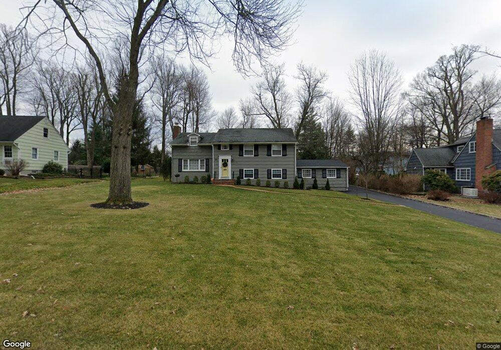
28 Springridge Dr Berkeley Heights, NJ 07922
Estimated Value: $1,077,922 - $1,450,000
Studio
--
Bath
2,898
Sq Ft
$443/Sq Ft
Est. Value
About This Home
This home is located at 28 Springridge Dr, Berkeley Heights, NJ 07922 and is currently estimated at $1,282,481, approximately $442 per square foot. 28 Springridge Dr is a home located in Union County with nearby schools including Columbia Middle School, Governor Livingston High School, and Scotch Plains Baptist Christian Day School.
Ownership History
Date
Name
Owned For
Owner Type
Purchase Details
Closed on
May 13, 2021
Sold by
Phair Robert Shane and Phair Hyeyoung
Bought by
Cosner Ross and Cosner Sushmita
Current Estimated Value
Home Financials for this Owner
Home Financials are based on the most recent Mortgage that was taken out on this home.
Original Mortgage
$637,000
Outstanding Balance
$575,466
Interest Rate
2.9%
Mortgage Type
New Conventional
Estimated Equity
$707,015
Purchase Details
Closed on
Sep 3, 2020
Sold by
Hrobsky Kenneth H and Hrobsky Diane M
Bought by
Phair Robert Shane and Pahir Hyeyoung
Home Financials for this Owner
Home Financials are based on the most recent Mortgage that was taken out on this home.
Original Mortgage
$785,000
Interest Rate
2.8%
Mortgage Type
Purchase Money Mortgage
Purchase Details
Closed on
Oct 2, 1998
Sold by
Hrobsky Kenneth H and Hrobsky Diane M
Bought by
Hrobsky Kenneth H and Hrobsky Diane M
Create a Home Valuation Report for This Property
The Home Valuation Report is an in-depth analysis detailing your home's value as well as a comparison with similar homes in the area
Home Values in the Area
Average Home Value in this Area
Purchase History
| Date | Buyer | Sale Price | Title Company |
|---|---|---|---|
| Cosner Ross | $910,000 | Acres Land Title Agency Inc | |
| Cosner Ross | $910,000 | Chicago Title | |
| Phair Robert Shane | $850,000 | Title Masters Llc | |
| Hrobsky Kenneth H | -- | -- |
Source: Public Records
Mortgage History
| Date | Status | Borrower | Loan Amount |
|---|---|---|---|
| Open | Cosner Ross | $637,000 | |
| Closed | Cosner Ross | $637,000 | |
| Previous Owner | Phair Robert Shane | $785,000 |
Source: Public Records
Tax History
| Year | Tax Paid | Tax Assessment Tax Assessment Total Assessment is a certain percentage of the fair market value that is determined by local assessors to be the total taxable value of land and additions on the property. | Land | Improvement |
|---|---|---|---|---|
| 2025 | $14,589 | $343,300 | $171,500 | $171,800 |
| 2024 | $14,378 | $340,300 | $171,500 | $168,800 |
| 2023 | $14,378 | $340,300 | $171,500 | $168,800 |
| 2022 | $14,289 | $340,300 | $171,500 | $168,800 |
| 2021 | $14,211 | $340,300 | $171,500 | $168,800 |
| 2020 | $13,723 | $326,900 | $171,500 | $155,400 |
| 2019 | $13,655 | $326,900 | $171,500 | $155,400 |
| 2018 | $13,370 | $326,900 | $171,500 | $155,400 |
| 2017 | $13,207 | $326,900 | $171,500 | $155,400 |
| 2016 | $12,975 | $326,900 | $171,500 | $155,400 |
| 2015 | $12,903 | $326,900 | $171,500 | $155,400 |
| 2014 | $12,566 | $326,900 | $171,500 | $155,400 |
Source: Public Records
Map
Nearby Homes
- 52 Coolidge Dr
- 70 Sycamore Ave
- 646 Mountain Ave
- 664 Plainfield Ave
- 220 Horseshoe Rd
- 27 Brambling Road Carriages
- 41 Brambling Rd
- 42 Arden Ct
- 317 Plainfield Ave
- 126 Emerson Ln
- 235 Plainfield Ave
- 50 Pinewood Crescent
- 85 Appletree Row
- 53 Sherbrook Dr
- 126 Snyder Ave
- 239 Washington St
- 916 Valley Rd
- 142 Diamond Hill Rd
- 10 Wolford Ct
- 10 Twin Brooks Ct
- 28 Spring Ridge Dr
- 36 Spring Ridge Dr
- 36 Springridge Dr
- 20 Springridge Dr
- 43 Woodwild Way
- 55 Woodwild Way
- 44 Spring Ridge Dr
- 44 Springridge Dr
- 35 Woodwild Way
- 21 Spring Ridge Dr
- 31 Springridge Dr
- 8 Springridge Dr
- 607 Snyder Ave
- 21 Springridge Dr
- 39 Springridge Dr
- 615 Snyder Ave
- 19 Springridge Dr
- 47 Springridge Dr
- 27 Woodwild Way
- 623 Snyder Ave
Your Personal Tour Guide
Ask me questions while you tour the home.