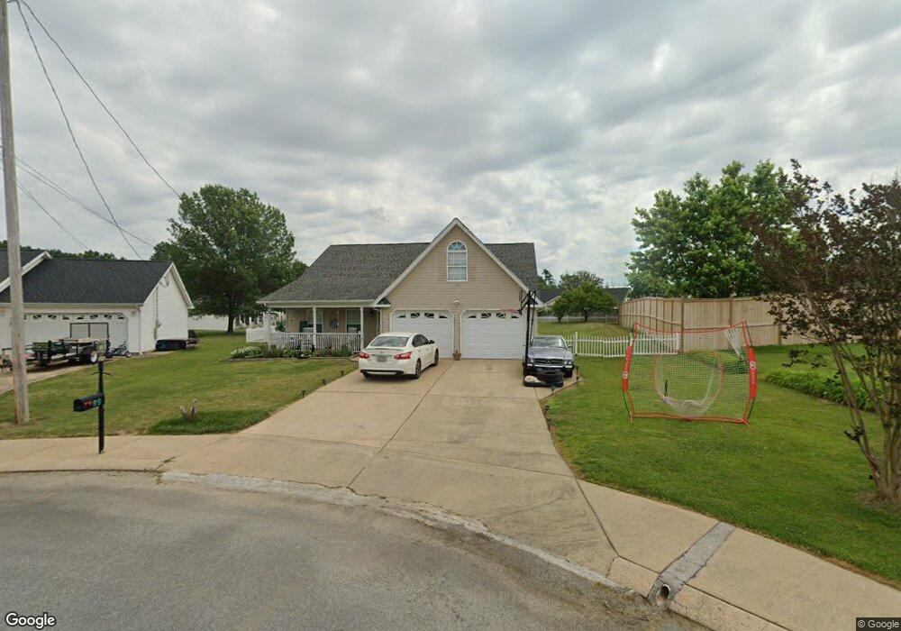
28 Stone Edge Ct Fort Oglethorpe, GA 30742
Estimated Value: $291,000 - $349,000
3
Beds
2
Baths
1,862
Sq Ft
$166/Sq Ft
Est. Value
About This Home
This home is located at 28 Stone Edge Ct, Fort Oglethorpe, GA 30742 and is currently estimated at $309,327, approximately $166 per square foot. 28 Stone Edge Ct is a home located in Catoosa County with nearby schools including West Side Elementary School, Lakeview Middle School, and Lakeview-Fort Oglethorpe High School.
Ownership History
Date
Name
Owned For
Owner Type
Purchase Details
Closed on
May 25, 2007
Sold by
Ferguson Steve
Bought by
Sims Michael K
Current Estimated Value
Home Financials for this Owner
Home Financials are based on the most recent Mortgage that was taken out on this home.
Original Mortgage
$162,118
Outstanding Balance
$98,558
Interest Rate
6.16%
Mortgage Type
New Conventional
Estimated Equity
$210,769
Purchase Details
Closed on
Jul 31, 2000
Bought by
Ferguson Steve
Create a Home Valuation Report for This Property
The Home Valuation Report is an in-depth analysis detailing your home's value as well as a comparison with similar homes in the area
Home Values in the Area
Average Home Value in this Area
Purchase History
| Date | Buyer | Sale Price | Title Company |
|---|---|---|---|
| Sims Michael K | $163,400 | -- | |
| Ferguson Steve | $120,000 | -- |
Source: Public Records
Mortgage History
| Date | Status | Borrower | Loan Amount |
|---|---|---|---|
| Open | Sims Michael K | $162,118 |
Source: Public Records
Tax History Compared to Growth
Tax History
| Year | Tax Paid | Tax Assessment Tax Assessment Total Assessment is a certain percentage of the fair market value that is determined by local assessors to be the total taxable value of land and additions on the property. | Land | Improvement |
|---|---|---|---|---|
| 2024 | $2,750 | $108,042 | $11,000 | $97,042 |
| 2023 | $2,245 | $83,533 | $11,000 | $72,533 |
| 2022 | $1,827 | $68,666 | $11,000 | $57,666 |
| 2021 | $1,730 | $68,666 | $11,000 | $57,666 |
| 2020 | $1,815 | $61,472 | $11,000 | $50,472 |
| 2019 | $1,663 | $59,472 | $9,000 | $50,472 |
| 2018 | $1,864 | $59,472 | $9,000 | $50,472 |
| 2017 | $1,652 | $56,402 | $7,200 | $49,202 |
| 2016 | $1,614 | $52,956 | $7,200 | $45,756 |
| 2015 | -- | $52,956 | $7,200 | $45,756 |
| 2014 | -- | $52,956 | $7,200 | $45,756 |
| 2013 | -- | $50,837 | $6,912 | $43,925 |
Source: Public Records
Map
Nearby Homes
- 351 Franklin Cir
- 124 Colony Cir
- 180 Gem Dr
- 17 Southshore Dr
- 183 McDonald Dr
- 1002 Cedar Creek Dr
- 66 Yellow Brick Rd
- 6 Rocky Ford Rd
- 64 Yellow Brick Rd
- 17 Evergreen Cir
- 239 Flagstone Dr
- 344 Flagstone Dr
- 18 Evergreen Cir
- 14 Evergreen Cir
- 72 Anchor Dr
- 69 Anchor Dr
- 15 Evelyn Dr
- Robie Plan at Evergreen Landing
- Darwin Plan at Evergreen Landing
- Edmon Plan at Evergreen Landing
- 38 Stone Edge Ct
- 103 Spring Place Dr
- 588 Colony Cir
- 89 Spring Place Dr
- 574 Colony Cir
- 602 Colony Cir
- 602 Colony Cir Unit 1
- 518 Colony Cir
- 504 Colony Cir
- 546 Colony Cir
- 490 Colony Cir
- 48 Stone Edge Ct
- 45 Stone Edge Ct
- 478 Colony Cir
- 33 Stone Edge Ct
- 63 Spring Place Dr
- 86 Spring Place Dr
- 464 Colony Cir
- 579 Colony Cir
- 619 Colony Cir