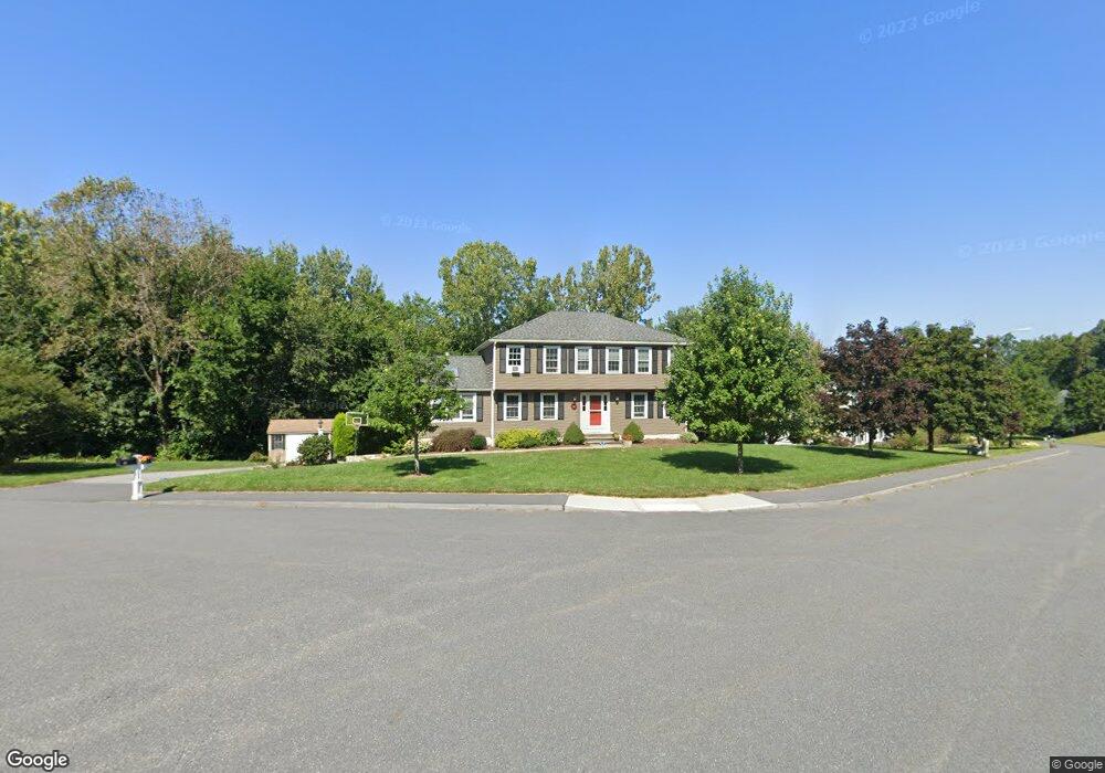
28 Thompson Dr Marlborough, MA 01752
Estimated Value: $784,000 - $860,000
4
Beds
3
Baths
2,388
Sq Ft
$341/Sq Ft
Est. Value
About This Home
This home is located at 28 Thompson Dr, Marlborough, MA 01752 and is currently estimated at $814,764, approximately $341 per square foot. 28 Thompson Dr is a home located in Middlesex County with nearby schools including Marlborough High School, Advanced Math & Science Academy, and New Covenant Christian School.
Ownership History
Date
Name
Owned For
Owner Type
Purchase Details
Closed on
Nov 6, 1992
Sold by
Cerqueira Antonio S
Bought by
Donahue John M and Donahue Gina
Current Estimated Value
Home Financials for this Owner
Home Financials are based on the most recent Mortgage that was taken out on this home.
Original Mortgage
$164,000
Interest Rate
7.99%
Mortgage Type
Purchase Money Mortgage
Create a Home Valuation Report for This Property
The Home Valuation Report is an in-depth analysis detailing your home's value as well as a comparison with similar homes in the area
Home Values in the Area
Average Home Value in this Area
Purchase History
| Date | Buyer | Sale Price | Title Company |
|---|---|---|---|
| Donahue John M | $205,000 | -- |
Source: Public Records
Mortgage History
| Date | Status | Borrower | Loan Amount |
|---|---|---|---|
| Open | Donahue John M | $210,000 | |
| Closed | Donahue John M | $238,000 | |
| Closed | Donahue John M | $164,000 | |
| Closed | Donahue John M | $164,000 |
Source: Public Records
Tax History Compared to Growth
Tax History
| Year | Tax Paid | Tax Assessment Tax Assessment Total Assessment is a certain percentage of the fair market value that is determined by local assessors to be the total taxable value of land and additions on the property. | Land | Improvement |
|---|---|---|---|---|
| 2025 | $7,666 | $777,500 | $270,900 | $506,600 |
| 2024 | $7,400 | $722,700 | $246,300 | $476,400 |
| 2023 | $7,890 | $683,700 | $207,700 | $476,000 |
| 2022 | $7,650 | $583,100 | $198,200 | $384,900 |
| 2021 | $7,491 | $542,800 | $168,600 | $374,200 |
| 2020 | $7,277 | $513,200 | $155,100 | $358,100 |
| 2019 | $7,029 | $499,600 | $152,200 | $347,400 |
| 2018 | $7,109 | $485,900 | $141,800 | $344,100 |
| 2017 | $5,463 | $459,100 | $144,100 | $315,000 |
| 2016 | $6,582 | $429,100 | $144,100 | $285,000 |
| 2015 | $6,714 | $426,000 | $149,600 | $276,400 |
Source: Public Records
Map
Nearby Homes
- 39 Desimone Dr
- 273 W Main St Unit B12
- 30 Broad St Unit 104
- 30A Winter Ave
- 11 Whispering Brook Rd Unit 55
- 102 Liberty St
- 76 Broad St
- 11 Paris St
- 115 W Main St
- 2 Adams St
- 61 Fairmount St Unit 11
- 32 Water St
- 87 Neil St
- 156 Chestnut St
- 3 Madison St
- 111 Howe St
- 110 Pleasant St Unit 401
- 72 Chestnut St
- 53 Mechanic St
- 146 Framingham Rd