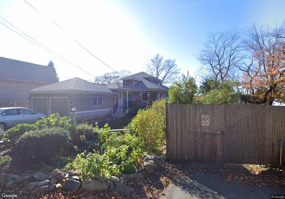
28 Thurston Point Rd Gloucester, MA 01930
Riverview NeighborhoodEstimated Value: $762,000 - $2,443,000
3
Beds
2
Baths
1,500
Sq Ft
$1,132/Sq Ft
Est. Value
About This Home
This home is located at 28 Thurston Point Rd, Gloucester, MA 01930 and is currently estimated at $1,698,314, approximately $1,132 per square foot. 28 Thurston Point Rd is a home located in Essex County with nearby schools including Beeman Memorial, Ralph B O'maley Middle School, and Faith Christian School.
Ownership History
Date
Name
Owned For
Owner Type
Purchase Details
Closed on
Nov 13, 2015
Sold by
Windmark Rt
Bought by
Linda J Rogers Irt
Current Estimated Value
Purchase Details
Closed on
Jul 9, 2003
Sold by
Rogers Linda J
Bought by
Windmark Rt
Create a Home Valuation Report for This Property
The Home Valuation Report is an in-depth analysis detailing your home's value as well as a comparison with similar homes in the area
Home Values in the Area
Average Home Value in this Area
Purchase History
| Date | Buyer | Sale Price | Title Company |
|---|---|---|---|
| Linda J Rogers Irt | -- | -- | |
| Windmark Rt | -- | -- | |
| Rogers Linda J | -- | -- |
Source: Public Records
Mortgage History
| Date | Status | Borrower | Loan Amount |
|---|---|---|---|
| Previous Owner | Rogers Linda J | $310,000 | |
| Previous Owner | Rogers Linda J | $300,000 | |
| Previous Owner | Rogers Linda J | $50,000 |
Source: Public Records
Tax History Compared to Growth
Tax History
| Year | Tax Paid | Tax Assessment Tax Assessment Total Assessment is a certain percentage of the fair market value that is determined by local assessors to be the total taxable value of land and additions on the property. | Land | Improvement |
|---|---|---|---|---|
| 2025 | $20,111 | $2,069,000 | $1,572,900 | $496,100 |
| 2024 | $19,079 | $1,960,800 | $1,456,400 | $504,400 |
| 2023 | $17,801 | $1,680,900 | $1,243,200 | $437,700 |
| 2022 | $17,346 | $1,478,800 | $1,081,300 | $397,500 |
| 2021 | $14,615 | $1,174,800 | $800,500 | $374,300 |
| 2020 | $14,496 | $1,175,700 | $800,500 | $375,200 |
| 2019 | $14,224 | $1,120,900 | $763,200 | $357,700 |
| 2018 | $13,904 | $1,075,300 | $744,600 | $330,700 |
| 2017 | $13,505 | $1,023,900 | $708,900 | $315,000 |
| 2016 | $13,002 | $955,300 | $677,600 | $277,700 |
| 2015 | $12,520 | $917,200 | $662,200 | $255,000 |
Source: Public Records
Map
Nearby Homes
- 49 Thurston Point Rd
- 109 Riverview Rd
- 18 Cherry St
- 188 Atlantic St
- 65 Poplar St
- 30 Atlantic St
- 672 Washington St
- 226 Atlantic St
- 19 Mystic Ave
- 6 Beauport Ave
- 196 Washington St
- 78 Grove St
- 5 Samoset Rd Unit A
- 3 Stone Ct
- 145 Essex Ave Unit 610
- 15 Harvard St
- 40 Sargent St
- 33 Maplewood Ave Unit 21
- 119 Pleasant St
- 8 Summer St Unit 103
- 26 Thurston Point Rd
- 24 Thurston Point Rd
- 23 Thurston Point Rd
- 32 Thurston Point Rd
- 23 Thurston Point Rd
- 21 Thurston Point Rd
- 19 Thurston Point Rd
- 34 Thurston Point Rd
- 2 Honeysuckle Rd
- 18 Juniper Rd
- 4 Honeysuckle Rd
- 22 Thurston Point Rd
- 13 Thurston Point Rd
- 6 Honeysuckle Rd
- 13R Thurston Point Rd
- 25 Thurston Point Rd
- 36 Thurston Point Rd
- 16 Juniper Rd
- 20 Thurston Point Rd
- 27 Thurston Point Rd