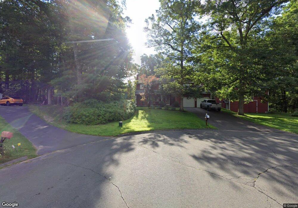
28 Tim Clark Cir Simsbury, CT 06070
Estimated Value: $550,000 - $608,000
4
Beds
3
Baths
2,170
Sq Ft
$268/Sq Ft
Est. Value
About This Home
This home is located at 28 Tim Clark Cir, Simsbury, CT 06070 and is currently estimated at $581,863, approximately $268 per square foot. 28 Tim Clark Cir is a home located in Hartford County with nearby schools including Squadron Line School, Henry James Memorial School, and Simsbury High School.
Ownership History
Date
Name
Owned For
Owner Type
Purchase Details
Closed on
Aug 10, 2020
Sold by
Napolitano Virginia and Napolitano Andrew
Bought by
Krone Christopher and Napolitano Wendy
Current Estimated Value
Purchase Details
Closed on
Jan 30, 1990
Sold by
Rooney Michael
Bought by
Reed Steven
Home Financials for this Owner
Home Financials are based on the most recent Mortgage that was taken out on this home.
Original Mortgage
$130,000
Interest Rate
9.67%
Mortgage Type
Purchase Money Mortgage
Create a Home Valuation Report for This Property
The Home Valuation Report is an in-depth analysis detailing your home's value as well as a comparison with similar homes in the area
Home Values in the Area
Average Home Value in this Area
Purchase History
| Date | Buyer | Sale Price | Title Company |
|---|---|---|---|
| Krone Christopher | -- | None Available | |
| Reed Steven | $245,000 | -- |
Source: Public Records
Mortgage History
| Date | Status | Borrower | Loan Amount |
|---|---|---|---|
| Previous Owner | Reed Steven | $274,400 | |
| Previous Owner | Reed Steven | $116,000 | |
| Previous Owner | Reed Steven | $130,000 |
Source: Public Records
Tax History Compared to Growth
Tax History
| Year | Tax Paid | Tax Assessment Tax Assessment Total Assessment is a certain percentage of the fair market value that is determined by local assessors to be the total taxable value of land and additions on the property. | Land | Improvement |
|---|---|---|---|---|
| 2025 | $10,057 | $294,420 | $80,500 | $213,920 |
| 2024 | $9,807 | $294,420 | $80,500 | $213,920 |
| 2023 | $9,368 | $294,420 | $80,500 | $213,920 |
| 2022 | $8,732 | $226,030 | $87,500 | $138,530 |
| 2021 | $8,732 | $226,030 | $87,500 | $138,530 |
| 2020 | $8,383 | $226,030 | $87,500 | $138,530 |
| 2019 | $8,435 | $226,030 | $87,500 | $138,530 |
| 2018 | $8,496 | $226,030 | $87,500 | $138,530 |
| 2017 | $8,084 | $208,570 | $84,410 | $124,160 |
| 2016 | $7,742 | $208,570 | $84,410 | $124,160 |
| 2015 | $7,742 | $208,570 | $85,260 | $123,310 |
| 2014 | $7,746 | $208,570 | $85,260 | $123,310 |
Source: Public Records
Map
Nearby Homes
- 33 Whitman Dr
- 16 Berkshire Way
- 21 Berkshire Way
- 27 Brettonwood Dr Unit 27
- 14 Brettonwood Dr
- 35 Haven Dr
- 6 Running Pine Rd
- 51 Canton Rd
- 12 Gretel Ln
- 324 Firetown Rd
- 45 Hoskins Rd
- 303 Firetown Rd
- 16 Whytewood Ln
- 5 Anja Dr
- 3 Fairmount Ln
- 31 Hunt Glen Dr
- 26 Winterset Ln
- 14 Hunt Glen Dr Unit 14
- 40 Simsbury Landing Unit 40
- 15 Simsbury Landing Unit 15
- 26 Munnisunk Dr
- 26 Tim Clark Cir
- 27 Tim Clark Cir
- 28 Munnisunk Dr
- 24 Tim Clark Cir
- 25 Tim Clark Cir
- 30 Munnisunk Dr
- 32 Munnisunk Dr
- 34 Munnisunk Dr
- 22 Munnisunk Dr
- 20 Munnisunk Dr
- 23 Tim Clark Cir
- 36 Munnisunk Dr
- 18 Munnisunk Dr
- 38 Munnisunk Dr
- 21 Tim Clark Cir
- 20 Tim Clark Cir
- 33 Munnisunk Dr
- 31 Munnisunk Dr
- 16 Munnisunk Dr