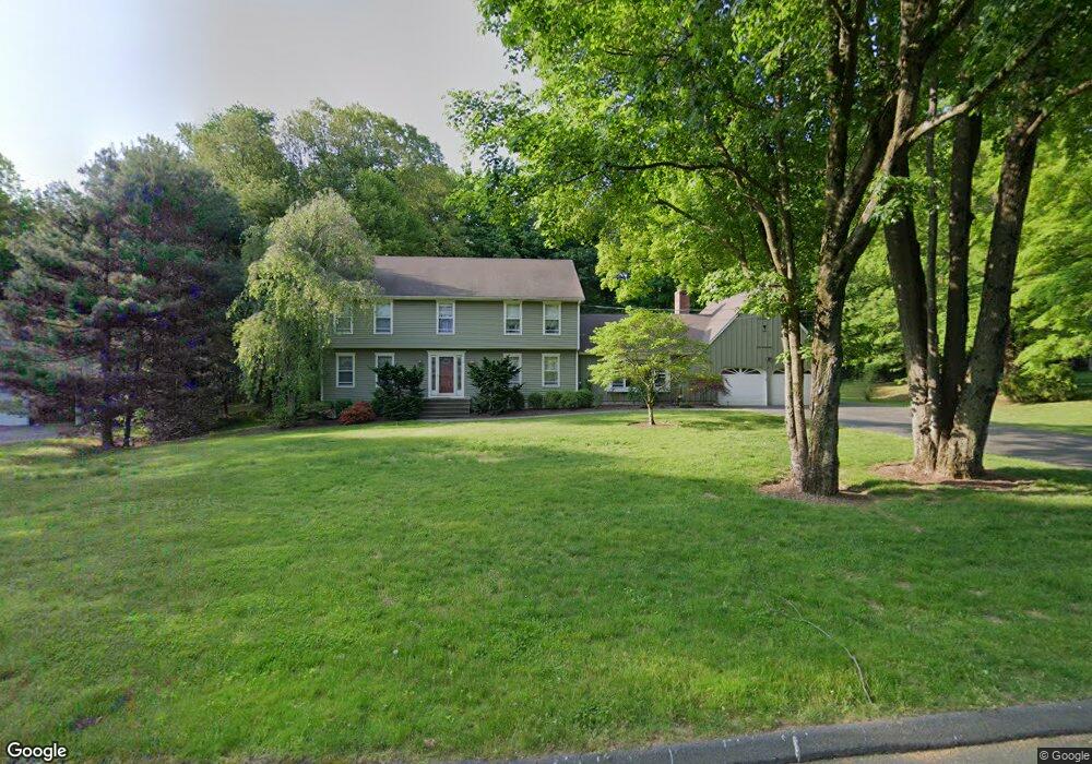
28 Unity Dr Trumbull, CT 06611
Trumbull Center NeighborhoodEstimated Value: $849,710 - $1,190,000
4
Beds
4
Baths
2,928
Sq Ft
$324/Sq Ft
Est. Value
About This Home
This home is located at 28 Unity Dr, Trumbull, CT 06611 and is currently estimated at $947,428, approximately $323 per square foot. 28 Unity Dr is a home located in Fairfield County with nearby schools including Booth Hill School, Hillcrest Middle School, and Trumbull High School.
Ownership History
Date
Name
Owned For
Owner Type
Purchase Details
Closed on
Aug 29, 1988
Sold by
Lambert Jack
Bought by
Barbarotta Alfonso
Current Estimated Value
Home Financials for this Owner
Home Financials are based on the most recent Mortgage that was taken out on this home.
Original Mortgage
$289,600
Interest Rate
10.36%
Create a Home Valuation Report for This Property
The Home Valuation Report is an in-depth analysis detailing your home's value as well as a comparison with similar homes in the area
Home Values in the Area
Average Home Value in this Area
Purchase History
| Date | Buyer | Sale Price | Title Company |
|---|---|---|---|
| Barbarotta Alfonso | $370,000 | -- |
Source: Public Records
Mortgage History
| Date | Status | Borrower | Loan Amount |
|---|---|---|---|
| Open | Barbarotta Alfonso | $1,500,000 | |
| Closed | Barbarotta Alfonso | $244,400 | |
| Closed | Barbarotta Alfonso | $289,600 |
Source: Public Records
Tax History
| Year | Tax Paid | Tax Assessment Tax Assessment Total Assessment is a certain percentage of the fair market value that is determined by local assessors to be the total taxable value of land and additions on the property. | Land | Improvement |
|---|---|---|---|---|
| 2025 | $13,179 | $356,580 | $146,650 | $209,930 |
| 2024 | $12,801 | $356,580 | $146,650 | $209,930 |
| 2023 | $12,605 | $356,580 | $146,650 | $209,930 |
| 2022 | $12,411 | $356,580 | $146,650 | $209,930 |
| 2021 | $10,934 | $327,460 | $139,090 | $188,370 |
| 2020 | $11,774 | $327,460 | $139,090 | $188,370 |
| 2018 | $11,517 | $327,460 | $139,090 | $188,370 |
| 2017 | $11,297 | $327,460 | $139,090 | $188,370 |
| 2016 | $11,086 | $327,460 | $139,090 | $188,370 |
| 2015 | $10,990 | $326,100 | $139,100 | $187,000 |
| 2014 | $10,755 | $326,100 | $139,100 | $187,000 |
Source: Public Records
Map
Nearby Homes
- 40 Puritan Rd
- 9 Sunnyridge Pkwy
- 11 Knollcrest Dr
- 22 Beverly Rd
- 220 Hilltop Cir
- 7 E Lake Rd
- 0 Lot #4 & Lot #5 W Mischa Rd Unit 24138429
- 3 Wheeler Dr
- 2322 Nichols Ave
- 68 Old Dike Rd
- 123 Beverly Dr
- 85 Teeter Rock Rd
- 3699 Broadbridge Ave Unit 101
- 877 White Plains Rd
- 280 Goldbach Dr
- 46 Oakleaf St
- 58 Daniels Farm Rd
- 175 Post Oak Rd
- 285 Hillcrest Rd
- 250 Dayton Rd
- 22 Unity Dr
- 34 Unity Dr
- 31 Unity Dr
- 16 Unity Dr
- 23 Unity Dr
- 30 Partridge Ln
- 53 Rolling Wood Dr
- 49 Rolling Wood Dr
- 7 Unity Dr
- 277 Unity Rd
- 57 Rolling Wood Dr
- 291 Unity Rd
- 45 Rolling Wood Dr
- 38 Partridge Ln
- 12 Unity Dr
- 29 Partridge Ln
- 41 Rolling Wood Dr
- 63 Rolling Wood Dr
- 37 Rolling Wood Dr
- 311 Unity Rd
Your Personal Tour Guide
Ask me questions while you tour the home.