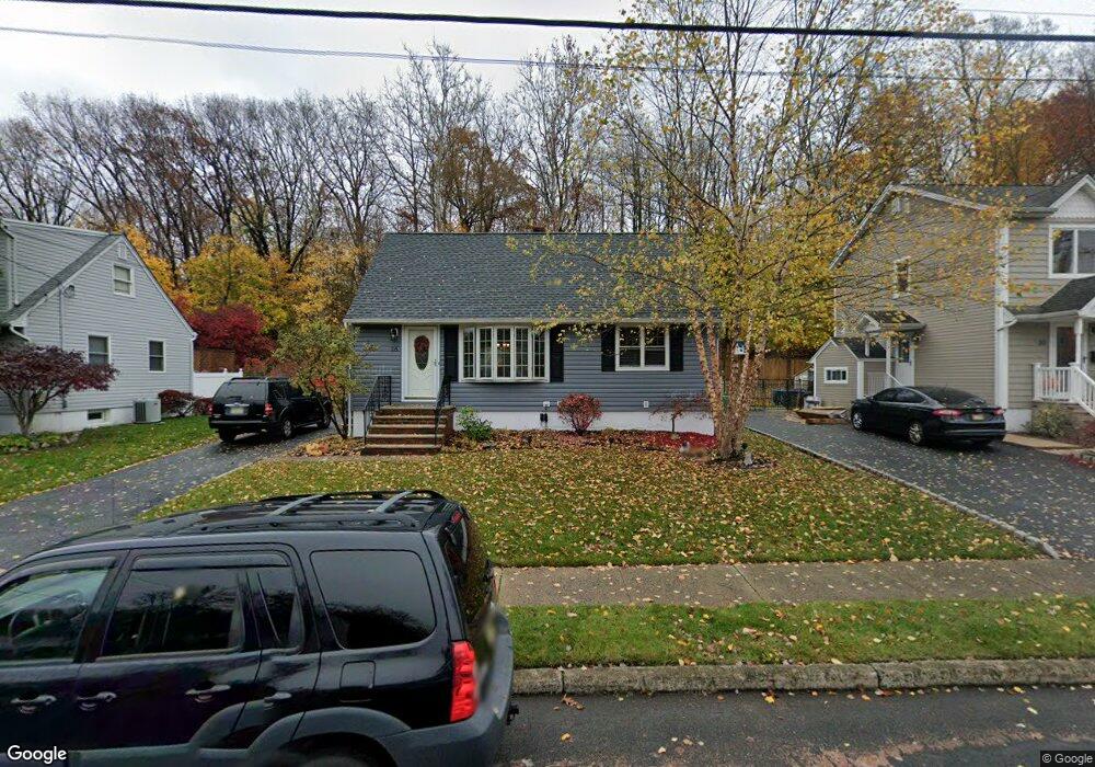
28 Vetrone Dr Woodland Park, NJ 07424
Estimated Value: $488,254 - $534,000
--
Bed
--
Bath
1,305
Sq Ft
$389/Sq Ft
Est. Value
About This Home
This home is located at 28 Vetrone Dr, Woodland Park, NJ 07424 and is currently estimated at $507,814, approximately $389 per square foot. 28 Vetrone Dr is a home located in Passaic County with nearby schools including Charles Olbon School, Memorial Middle School, and Beatrice Gilmore Elementary School.
Ownership History
Date
Name
Owned For
Owner Type
Purchase Details
Closed on
Sep 30, 2004
Sold by
Landi Rocco
Bought by
Berdan Holly and Pacelli James
Current Estimated Value
Home Financials for this Owner
Home Financials are based on the most recent Mortgage that was taken out on this home.
Original Mortgage
$240,000
Outstanding Balance
$119,099
Interest Rate
5.8%
Estimated Equity
$388,715
Purchase Details
Closed on
Aug 19, 2002
Sold by
Ummak Mary
Bought by
Landi Rocco
Home Financials for this Owner
Home Financials are based on the most recent Mortgage that was taken out on this home.
Original Mortgage
$180,000
Interest Rate
6.39%
Purchase Details
Closed on
May 25, 2001
Sold by
Brewer Stephen
Bought by
Drwiega Mary and Kosachook John
Home Financials for this Owner
Home Financials are based on the most recent Mortgage that was taken out on this home.
Original Mortgage
$1,126,750
Interest Rate
7.15%
Create a Home Valuation Report for This Property
The Home Valuation Report is an in-depth analysis detailing your home's value as well as a comparison with similar homes in the area
Home Values in the Area
Average Home Value in this Area
Purchase History
| Date | Buyer | Sale Price | Title Company |
|---|---|---|---|
| Berdan Holly | $300,000 | -- | |
| Landi Rocco | $225,000 | -- | |
| Drwiega Mary | $195,000 | -- | |
| Drwiega Mary | $195,000 | -- |
Source: Public Records
Mortgage History
| Date | Status | Borrower | Loan Amount |
|---|---|---|---|
| Open | Berdan Holly | $240,000 | |
| Previous Owner | Landi Rocco | $180,000 | |
| Previous Owner | Drwiega Mary | $1,126,750 |
Source: Public Records
Tax History Compared to Growth
Tax History
| Year | Tax Paid | Tax Assessment Tax Assessment Total Assessment is a certain percentage of the fair market value that is determined by local assessors to be the total taxable value of land and additions on the property. | Land | Improvement |
|---|---|---|---|---|
| 2025 | $8,143 | $243,300 | $124,700 | $118,600 |
| 2024 | $7,988 | $243,300 | $124,700 | $118,600 |
| 2022 | $8,000 | $243,300 | $124,700 | $118,600 |
| 2021 | $7,895 | $243,300 | $124,700 | $118,600 |
| 2020 | $7,752 | $243,300 | $124,700 | $118,600 |
| 2019 | $7,579 | $243,300 | $124,700 | $118,600 |
| 2018 | $7,691 | $243,300 | $124,700 | $118,600 |
| 2017 | $7,491 | $243,300 | $124,700 | $118,600 |
| 2016 | $7,372 | $243,300 | $124,700 | $118,600 |
| 2015 | $7,211 | $243,300 | $124,700 | $118,600 |
| 2014 | $7,285 | $269,500 | $153,200 | $116,300 |
Source: Public Records
Map
Nearby Homes
- 18 Filippone Way
- 86 Dowling Pkwy
- 113 Hillcrest Ave
- 19 Ryle Park Ave
- 21 Kay Rd
- 21 Passaic Ave
- 29 Kay Rd
- 40 Passaic Ave
- 87 Pompton Ave
- 776 Mcbride Ave
- 26 Winding Way Unit T5
- 26 Winding Way Unit 1905
- 5 Wedgewood Dr
- 11 Woodrow Ave Unit 2
- 11 Woodrow Ave
- 21 Cedarwood Terrace
- 86 Mount Pleasant Ave
- 1 Borrego Dr
- 449 Taft Ave