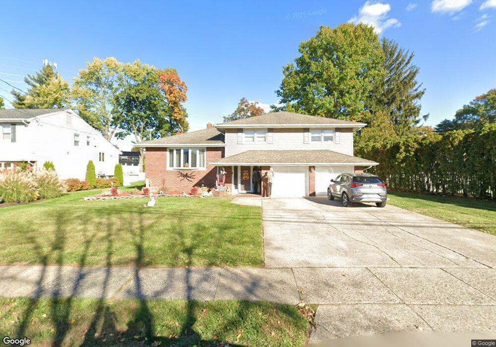
28 Vincent Dr Clifton, NJ 07013
Montclair Heights NeighborhoodEstimated Value: $705,373 - $914,000
--
Bed
--
Bath
2,044
Sq Ft
$413/Sq Ft
Est. Value
About This Home
This home is located at 28 Vincent Dr, Clifton, NJ 07013 and is currently estimated at $844,593, approximately $413 per square foot. 28 Vincent Dr is a home located in Passaic County with nearby schools including Clifton High School, Saint Philip the Apostle Preparatory School, and The Magical Palace of Knowledge.
Ownership History
Date
Name
Owned For
Owner Type
Purchase Details
Closed on
Aug 21, 2002
Sold by
Sellinger Rosemary
Bought by
Lesler Michael
Current Estimated Value
Home Financials for this Owner
Home Financials are based on the most recent Mortgage that was taken out on this home.
Original Mortgage
$290,000
Outstanding Balance
$122,713
Interest Rate
6.55%
Estimated Equity
$721,880
Purchase Details
Closed on
Feb 23, 1998
Sold by
Sellinger Charles and Sellinger Rosemary
Bought by
Sellinger Rosemary
Create a Home Valuation Report for This Property
The Home Valuation Report is an in-depth analysis detailing your home's value as well as a comparison with similar homes in the area
Home Values in the Area
Average Home Value in this Area
Purchase History
| Date | Buyer | Sale Price | Title Company |
|---|---|---|---|
| Lesler Michael | $365,000 | -- | |
| Sellinger Rosemary | -- | -- |
Source: Public Records
Mortgage History
| Date | Status | Borrower | Loan Amount |
|---|---|---|---|
| Open | Lesler Michael | $290,000 |
Source: Public Records
Tax History Compared to Growth
Tax History
| Year | Tax Paid | Tax Assessment Tax Assessment Total Assessment is a certain percentage of the fair market value that is determined by local assessors to be the total taxable value of land and additions on the property. | Land | Improvement |
|---|---|---|---|---|
| 2025 | $17,321 | $291,800 | $157,500 | $134,300 |
| 2024 | $16,907 | $291,800 | $157,500 | $134,300 |
| 2022 | $16,662 | $291,800 | $157,500 | $134,300 |
| 2021 | $15,976 | $291,800 | $157,500 | $134,300 |
| 2020 | $16,029 | $291,800 | $157,500 | $134,300 |
| 2019 | $15,915 | $291,800 | $157,500 | $134,300 |
| 2018 | $15,824 | $291,800 | $157,500 | $134,300 |
| 2017 | $15,652 | $291,800 | $157,500 | $134,300 |
| 2016 | $15,349 | $291,800 | $157,500 | $134,300 |
| 2015 | $15,200 | $291,800 | $157,500 | $134,300 |
| 2014 | $14,801 | $290,100 | $157,500 | $132,600 |
Source: Public Records
Map
Nearby Homes
- 65 Macarthur Dr
- 36 Independence Ct
- 605 Grove St Unit 4
- 605 Grove St Unit 11
- 50 Edwards Rd
- 109 Churchill Dr
- 565 Grove St Unit B12
- 68 Doherty Dr
- 167 Rolling Hills Rd
- 43 Graydon Terrace
- 54 Doherty Dr
- 77 Huemmer Terrace
- 33 Graydon Terrace
- 119 Highview Dr
- 41 Pino Ct
- 479 Grove St
- 15 Scott Terrace
- 70 Anderson Dr
- 1243 Valley Rd