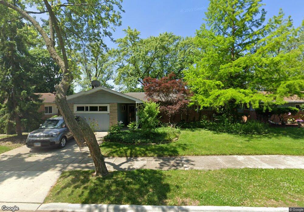
28 W Rocket Cir Park Forest, IL 60466
Estimated Value: $172,163 - $235,000
4
Beds
2
Baths
1,905
Sq Ft
$104/Sq Ft
Est. Value
About This Home
This home is located at 28 W Rocket Cir, Park Forest, IL 60466 and is currently estimated at $197,291, approximately $103 per square foot. 28 W Rocket Cir is a home located in Cook County with nearby schools including Michelle Obama School of Technology, Mohawk Primary Center, and Barack Obama School of Leadership and STEM.
Ownership History
Date
Name
Owned For
Owner Type
Purchase Details
Closed on
Dec 29, 2009
Sold by
Sparenberg Lenore L
Bought by
Tolly Ambie L
Current Estimated Value
Purchase Details
Closed on
Aug 19, 2006
Sold by
Tolly Ambie L
Bought by
Tolly Ambie L and Sparenberg Lenore L
Purchase Details
Closed on
Sep 19, 1997
Sold by
Sparenberg Lenore
Bought by
Tolly Ambie L
Home Financials for this Owner
Home Financials are based on the most recent Mortgage that was taken out on this home.
Original Mortgage
$63,750
Interest Rate
7.54%
Create a Home Valuation Report for This Property
The Home Valuation Report is an in-depth analysis detailing your home's value as well as a comparison with similar homes in the area
Home Values in the Area
Average Home Value in this Area
Purchase History
| Date | Buyer | Sale Price | Title Company |
|---|---|---|---|
| Tolly Ambie L | $20,000 | None Available | |
| Tolly Ambie L | -- | None Available | |
| Tolly Ambie L | -- | Nations Title Agency |
Source: Public Records
Mortgage History
| Date | Status | Borrower | Loan Amount |
|---|---|---|---|
| Previous Owner | Tolly Ambie L | $63,750 |
Source: Public Records
Tax History Compared to Growth
Tax History
| Year | Tax Paid | Tax Assessment Tax Assessment Total Assessment is a certain percentage of the fair market value that is determined by local assessors to be the total taxable value of land and additions on the property. | Land | Improvement |
|---|---|---|---|---|
| 2024 | $9,286 | $14,712 | $2,520 | $12,192 |
| 2023 | $7,320 | $16,000 | $2,520 | $13,480 |
| 2022 | $7,320 | $8,864 | $2,340 | $6,524 |
| 2021 | $7,302 | $8,864 | $2,340 | $6,524 |
| 2020 | $6,931 | $8,864 | $2,340 | $6,524 |
| 2019 | $7,059 | $9,915 | $2,160 | $7,755 |
| 2018 | $6,797 | $9,915 | $2,160 | $7,755 |
| 2017 | $10,336 | $9,915 | $2,160 | $7,755 |
| 2016 | $5,142 | $9,453 | $1,980 | $7,473 |
| 2015 | $6,635 | $9,453 | $1,980 | $7,473 |
| 2014 | $6,492 | $9,453 | $1,980 | $7,473 |
| 2013 | $6,199 | $9,967 | $1,980 | $7,987 |
Source: Public Records
Map
Nearby Homes
- 433 Lakewood Blvd
- 417 Lakewood Blvd
- 453 Lakewood Blvd
- 270 Green St
- 280 Rich Rd
- 300 Meota St
- 218 Marquette St
- 308 Shabbona Dr
- 500 Lakewood Blvd
- 142 Marquette St
- 314 Meota St
- 318 Marquette St
- 323 Windsor St
- 3 Minocqua Ct
- 131 Sauk Trail
- 308 Minocqua St
- 277 Minocqua St
- 29 Cunningham Ln
- 226 S Orchard Dr
- 270 Minocqua St
- 26 W Rocket Cir
- 30 W Rocket Cir
- 24 W Rocket Cir
- 32 W Rocket Cir
- 22 W Rocket Cir
- 25 W Rocket Cir
- 23 W Rocket Cir
- 27 W Rocket Cir
- 21 W Rocket Cir
- 34 W Rocket Cir
- 19 W Rocket Cir
- 20 W Rocket Cir
- 29 W Rocket Cir
- 209 Gold St
- 207 Gold St
- 24 E Rocket Cir
- 18 W Rocket Cir
- 36 W Rocket Cir
- 22 E Rocket Cir
- 20 E Rocket Cir