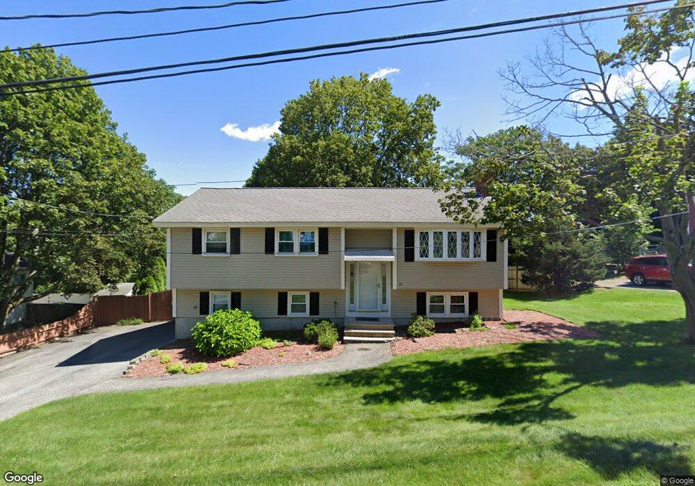
28 William Ave Woburn, MA 01801
Downtown Woburn NeighborhoodEstimated Value: $709,000 - $800,000
2
Beds
2
Baths
1,044
Sq Ft
$729/Sq Ft
Est. Value
About This Home
This home is located at 28 William Ave, Woburn, MA 01801 and is currently estimated at $761,583, approximately $729 per square foot. 28 William Ave is a home located in Middlesex County with nearby schools including Goodyear Elementary School, John F. Kennedy Middle School, and Woburn High School.
Ownership History
Date
Name
Owned For
Owner Type
Purchase Details
Closed on
Mar 31, 2017
Sold by
Bishop John E and Bishop Stacie
Bought by
Bishop John E
Current Estimated Value
Home Financials for this Owner
Home Financials are based on the most recent Mortgage that was taken out on this home.
Original Mortgage
$276,000
Outstanding Balance
$229,295
Interest Rate
4.15%
Mortgage Type
New Conventional
Estimated Equity
$532,288
Purchase Details
Closed on
Jun 29, 1995
Sold by
Churchill Jeffrey A and Churchill Kathleen E
Bought by
Bishop John E
Create a Home Valuation Report for This Property
The Home Valuation Report is an in-depth analysis detailing your home's value as well as a comparison with similar homes in the area
Home Values in the Area
Average Home Value in this Area
Purchase History
| Date | Buyer | Sale Price | Title Company |
|---|---|---|---|
| Bishop John E | -- | -- | |
| Bishop John E | -- | -- | |
| Bishop John E | -- | -- | |
| Bishop John E | $165,000 | -- |
Source: Public Records
Mortgage History
| Date | Status | Borrower | Loan Amount |
|---|---|---|---|
| Open | Bishop John E | $276,000 | |
| Closed | Bishop John E | $276,000 | |
| Previous Owner | Bishop John E | $135,000 | |
| Previous Owner | Bishop John E | $150,000 |
Source: Public Records
Tax History Compared to Growth
Tax History
| Year | Tax Paid | Tax Assessment Tax Assessment Total Assessment is a certain percentage of the fair market value that is determined by local assessors to be the total taxable value of land and additions on the property. | Land | Improvement |
|---|---|---|---|---|
| 2025 | $5,661 | $662,900 | $369,000 | $293,900 |
| 2024 | $5,202 | $645,400 | $351,500 | $293,900 |
| 2023 | $5,042 | $579,500 | $319,500 | $260,000 |
| 2022 | $4,834 | $517,600 | $278,000 | $239,600 |
| 2021 | $4,617 | $494,900 | $264,800 | $230,100 |
| 2020 | $4,549 | $488,100 | $264,800 | $223,300 |
| 2019 | $4,303 | $452,900 | $252,200 | $200,700 |
| 2018 | $5,750 | $417,100 | $231,500 | $185,600 |
| 2017 | $3,962 | $398,600 | $220,500 | $178,100 |
| 2016 | $3,778 | $375,900 | $206,200 | $169,700 |
| 2015 | $3,668 | $360,700 | $192,700 | $168,000 |
| 2014 | $3,539 | $339,000 | $192,700 | $146,300 |
Source: Public Records
Map
Nearby Homes
- 3 Frank St
- 18 Carmen Terrace
- 18 Central St
- 13 Fremont St Unit 13
- 3 Laurel St
- 35 Grape St
- 51 Vernon St
- 6 Stratton Dr Unit 404
- 6 Stratton Dr Unit 410
- 1 Boline Place
- 18 Gardner Ave
- 19 Mason Way Unit 75
- 2 Mason Way Unit 6524
- 6 Mason Way Unit 6324
- 10 Mason Way Unit 61
- 295 Salem St Unit 69
- 2 Archer Dr Unit 1
- 14 Grant Rd
- 2 Stratton Dr Unit 1109
- 62 Jefferson Ave
- 26 William Ave
- 30 William Ave
- 0 Tremont St
- 19 William Ave
- 24 William Ave
- 17 William Ave
- 2 Tremont St
- 22 William Ave
- 17 Henry Ave
- 239 Montvale Ave
- 220 Montvale Ave
- 15 William Ave
- 251 Montvale Ave
- 5 Tremont St Unit 2
- 18 William Ave
- 1 Nashua St
- 253 Montvale Ave
- 6 Tremont St
- 3 Tremont St
- 3 Tremont St Unit 1