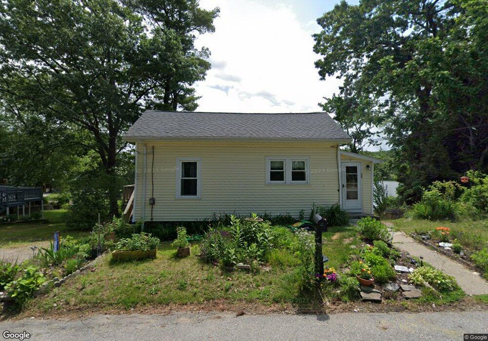
28 Wilson Rd Millbury, MA 01527
Estimated Value: $340,000 - $556,655
2
Beds
1
Bath
1,040
Sq Ft
$444/Sq Ft
Est. Value
About This Home
This home is located at 28 Wilson Rd, Millbury, MA 01527 and is currently estimated at $461,664, approximately $443 per square foot. 28 Wilson Rd is a home located in Worcester County with nearby schools including Elmwood Street Elementary School, Raymond E. Shaw Elementary School, and Millbury Junior/Senior High School.
Ownership History
Date
Name
Owned For
Owner Type
Purchase Details
Closed on
Nov 9, 2010
Sold by
Lomartire Marc C
Bought by
Marlborough Ronald J and Marlborough Denise M
Current Estimated Value
Home Financials for this Owner
Home Financials are based on the most recent Mortgage that was taken out on this home.
Original Mortgage
$157,000
Outstanding Balance
$104,323
Interest Rate
4.41%
Mortgage Type
Purchase Money Mortgage
Estimated Equity
$357,341
Create a Home Valuation Report for This Property
The Home Valuation Report is an in-depth analysis detailing your home's value as well as a comparison with similar homes in the area
Home Values in the Area
Average Home Value in this Area
Purchase History
| Date | Buyer | Sale Price | Title Company |
|---|---|---|---|
| Marlborough Ronald J | $140,000 | -- | |
| Marlborough Ronald J | $140,000 | -- |
Source: Public Records
Mortgage History
| Date | Status | Borrower | Loan Amount |
|---|---|---|---|
| Open | Marlborough Ronald J | $15,000 | |
| Open | Marlborough Ronald J | $157,000 | |
| Closed | Marlborough Ronald J | $157,000 |
Source: Public Records
Tax History Compared to Growth
Tax History
| Year | Tax Paid | Tax Assessment Tax Assessment Total Assessment is a certain percentage of the fair market value that is determined by local assessors to be the total taxable value of land and additions on the property. | Land | Improvement |
|---|---|---|---|---|
| 2025 | $7,513 | $561,068 | $338,068 | $223,000 |
| 2024 | $6,885 | $520,392 | $313,092 | $207,300 |
| 2023 | $5,048 | $349,376 | $162,076 | $187,300 |
| 2022 | $4,929 | $328,576 | $162,076 | $166,500 |
| 2021 | $2,868 | $321,576 | $162,076 | $159,500 |
| 2020 | $4,366 | $284,800 | $135,000 | $149,800 |
| 2019 | $3,920 | $247,300 | $122,700 | $124,600 |
| 2018 | $3,783 | $231,500 | $122,700 | $108,800 |
| 2017 | $3,684 | $224,200 | $122,700 | $101,500 |
| 2016 | $3,494 | $212,300 | $122,700 | $89,600 |
| 2015 | $3,587 | $217,900 | $130,600 | $87,300 |
| 2014 | $2,902 | $169,700 | $94,700 | $75,000 |
Source: Public Records
Map
Nearby Homes
- 90 Macarthur Dr
- 12 Alstead Path
- 3 May St
- 2 Diane St
- 86 Wheelock Ave
- 1 Broadmeadow Ave
- 1 Pineland Ave
- 64 Millbury Ave
- 11 Westview Ave
- 123 Riverlin St
- 52 Clearview Terrace Unit 39
- 12 Irene Ct
- 330 Millbury Ave
- 15 Clearview Terrace Unit 68
- 90 Park Hill Ave
- 15 Rayburn Dr
- 497 Massasoit Rd
- 17 Atwood Ave
- 46 John Dr Unit 46
- 5 Edward Dr