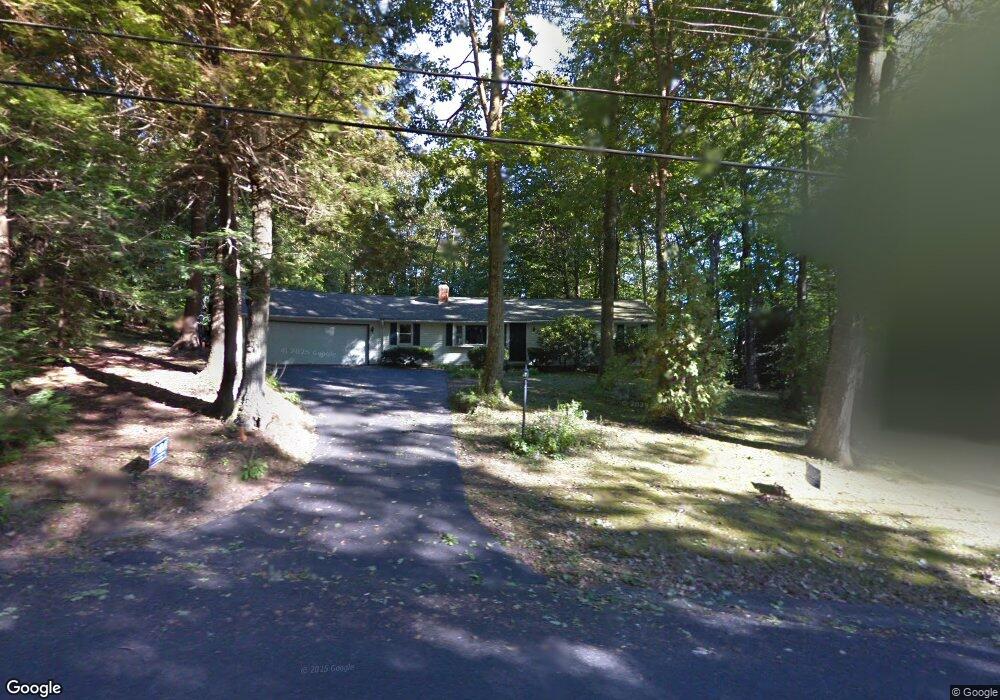
28 Woodland Dr Harwinton, CT 06791
Estimated Value: $314,000 - $452,000
4
Beds
1
Bath
1,248
Sq Ft
$306/Sq Ft
Est. Value
About This Home
This home is located at 28 Woodland Dr, Harwinton, CT 06791 and is currently estimated at $381,613, approximately $305 per square foot. 28 Woodland Dr is a home located in Litchfield County with nearby schools including Harwinton Consolidated School, Har-Bur Middle School, and Lewis S. Mills High School.
Ownership History
Date
Name
Owned For
Owner Type
Purchase Details
Closed on
Sep 24, 1997
Sold by
Rizzo Virginia J
Bought by
Baxter Dennis J
Current Estimated Value
Home Financials for this Owner
Home Financials are based on the most recent Mortgage that was taken out on this home.
Original Mortgage
$113,200
Interest Rate
7.47%
Mortgage Type
Unknown
Create a Home Valuation Report for This Property
The Home Valuation Report is an in-depth analysis detailing your home's value as well as a comparison with similar homes in the area
Home Values in the Area
Average Home Value in this Area
Purchase History
| Date | Buyer | Sale Price | Title Company |
|---|---|---|---|
| Baxter Dennis J | $141,500 | -- | |
| Baxter Dennis J | $141,500 | -- |
Source: Public Records
Mortgage History
| Date | Status | Borrower | Loan Amount |
|---|---|---|---|
| Open | Baxter Dennis J | $50,000 | |
| Closed | Baxter Dennis J | $50,000 | |
| Closed | Baxter Dennis J | $67,393 | |
| Closed | Baxter Dennis J | $113,200 |
Source: Public Records
Tax History Compared to Growth
Tax History
| Year | Tax Paid | Tax Assessment Tax Assessment Total Assessment is a certain percentage of the fair market value that is determined by local assessors to be the total taxable value of land and additions on the property. | Land | Improvement |
|---|---|---|---|---|
| 2025 | $4,893 | $212,750 | $63,570 | $149,180 |
| 2024 | $4,872 | $212,750 | $63,570 | $149,180 |
| 2023 | $4,364 | $149,440 | $45,400 | $104,040 |
| 2022 | $4,259 | $149,440 | $45,400 | $104,040 |
| 2021 | $4,289 | $149,440 | $45,400 | $104,040 |
| 2020 | $4,184 | $149,440 | $45,400 | $104,040 |
| 2019 | $4,184 | $149,440 | $45,400 | $104,040 |
| 2018 | $4,201 | $150,020 | $51,150 | $98,870 |
| 2017 | $4,171 | $150,020 | $51,150 | $98,870 |
| 2016 | $4,171 | $150,020 | $51,150 | $98,870 |
| 2015 | $4,096 | $150,020 | $51,150 | $98,870 |
| 2014 | $4,036 | $150,020 | $51,150 | $98,870 |
Source: Public Records
Map
Nearby Homes
- 164 Birge Park Rd
- 74 Pine Ridge Dr
- 73 Shirley Rd
- 21 Oak Meadow Ln
- 51 Bradford Rd
- 111 Oxbow Dr
- 69 Sunrise Dr
- 21 South Rd
- 144 Morningside Dr
- 33 Dawn Ave
- 410 Circle Dr
- 325 Circle Dr
- 175 Ramstein Rd
- 29 Hannah Way
- 141 Highfield Dr
- 157 Edgewood Dr
- 178 Edgewood Dr
- 595 Torringford St
- 29 Branch Rd
- 100 Nutmeg Dr
- 21 Woodland Dr
- 29 Woodland Dr
- 34 Woodland Dr
- 22 Woodland Dr
- 38 Woodland Dr
- 15 Woodland Dr
- 37 Woodland Dr
- 24 Beechwood Dr
- 20 Beechwood Dr
- 14 Woodland Dr
- 30 Beechwood Dr
- 27 Beechwood Dr
- 43 Woodland Dr
- 14 Beechwood Dr
- 23 Beechwood Dr
- 50 Woodland Dr
- 34 Beechwood Dr
- 40 Beechwood Dr
- 33 Beechwood Dr
- 204 Lead Mine Brook Rd