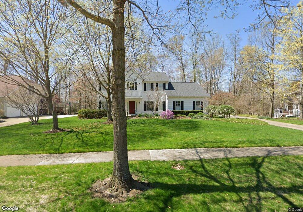
280 Ash Grove Cir Aurora, OH 44202
Estimated Value: $540,006 - $643,000
4
Beds
3
Baths
2,674
Sq Ft
$229/Sq Ft
Est. Value
About This Home
This home is located at 280 Ash Grove Cir, Aurora, OH 44202 and is currently estimated at $612,752, approximately $229 per square foot. 280 Ash Grove Cir is a home located in Portage County with nearby schools including Miller Elementary School, Craddock/Miller Elementary School, and Leighton Elementary School.
Ownership History
Date
Name
Owned For
Owner Type
Purchase Details
Closed on
Jun 13, 2018
Sold by
Toomey Nancy M and Toomey Family Revocable Living
Bought by
Toomey Nancy M
Current Estimated Value
Purchase Details
Closed on
May 9, 2016
Sold by
Toomey William S & Nancy M (Trustees)
Bought by
Toomey Nancy M
Home Financials for this Owner
Home Financials are based on the most recent Mortgage that was taken out on this home.
Interest Rate
3.61%
Purchase Details
Closed on
Mar 28, 2001
Sold by
Toomey William S
Bought by
Toomey William S and Toomey Nancy M
Purchase Details
Closed on
Sep 30, 1992
Bought by
Toomey William S and Toomey Nancy
Create a Home Valuation Report for This Property
The Home Valuation Report is an in-depth analysis detailing your home's value as well as a comparison with similar homes in the area
Home Values in the Area
Average Home Value in this Area
Purchase History
| Date | Buyer | Sale Price | Title Company |
|---|---|---|---|
| Toomey Nancy M | -- | None Available | |
| Toomey Nancy M | -- | -- | |
| Toomey William S | -- | -- | |
| Toomey William S | $220,000 | -- |
Source: Public Records
Mortgage History
| Date | Status | Borrower | Loan Amount |
|---|---|---|---|
| Closed | Toomey Nancy M | -- |
Source: Public Records
Tax History
| Year | Tax Paid | Tax Assessment Tax Assessment Total Assessment is a certain percentage of the fair market value that is determined by local assessors to be the total taxable value of land and additions on the property. | Land | Improvement |
|---|---|---|---|---|
| 2024 | $6,746 | $160,720 | $28,000 | $132,720 |
| 2023 | $6,534 | $128,170 | $28,000 | $100,170 |
| 2021 | $5,971 | $128,170 | $28,000 | $100,170 |
| 2020 | $5,697 | $115,120 | $28,000 | $87,120 |
| 2019 | $5,743 | $115,120 | $28,000 | $87,120 |
| 2017 | $5,432 | $100,210 | $28,000 | $72,210 |
| 2016 | $4,894 | $100,210 | $28,000 | $72,210 |
Source: Public Records
Map
Nearby Homes
- 180 Beaumont Trail
- 909 Grand View Ln Unit 909
- 739 Grand View Ln Unit 739
- 436 Cochran Rd
- 975 Colony Dr
- V/L W Garfield Rd
- 515 Woodview Trail
- 543 Sherwood Dr
- 915 Cimarron Oval
- 800 Windward Dr Unit 37
- 885 Sunrise Cir
- 429-53 Honeysuckle Path
- 405 Club Dr W
- 9924 Pebble Beach Cove
- 196 Chisholm Ct
- 682 Arbor Way
- 504-9 Concord Downs Cir Unit 9
- 510-11 Concord Downs Cir Unit 1K
- 0 Aurora Hill Dr Unit 3956102
- 702-22 Fairington Dr
- 260 Ash Grove Cir
- 835 Lake Trail
- 250 Ash Grove Cir
- 279 Ash Grove Cir
- 289 Ash Grove Cir
- 259 Ash Grove Cir
- 244 Ash Grove Cir
- 301 Ash Grove Cir
- 830 Lake Trail
- 840 Lake Trail
- 820 Lake Trail
- 246 Ash Grove Cir
- 810 Lake Trail
- 251 Ash Grove Cir
- 250 Hedgecliff Dr
- 327 Cochran Rd
- 248 Ash Grove Cir
- 785 Lake Trail
- 249 Ash Grove Cir
- 305 High Bluff