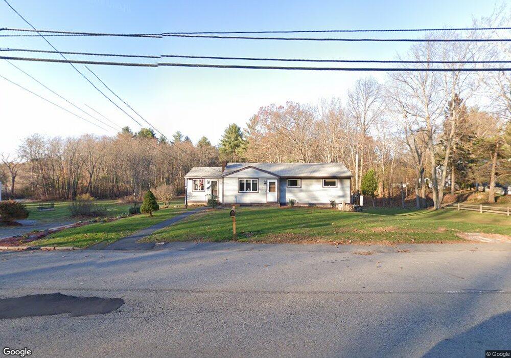
280 Dale St North Andover, MA 01845
Estimated Value: $581,000 - $838,000
3
Beds
1
Bath
1,444
Sq Ft
$484/Sq Ft
Est. Value
About This Home
This home is located at 280 Dale St, North Andover, MA 01845 and is currently estimated at $698,346, approximately $483 per square foot. 280 Dale St is a home located in Essex County with nearby schools including Franklin Elementary School, North Andover Middle School, and North Andover High School.
Create a Home Valuation Report for This Property
The Home Valuation Report is an in-depth analysis detailing your home's value as well as a comparison with similar homes in the area
Home Values in the Area
Average Home Value in this Area
Tax History Compared to Growth
Tax History
| Year | Tax Paid | Tax Assessment Tax Assessment Total Assessment is a certain percentage of the fair market value that is determined by local assessors to be the total taxable value of land and additions on the property. | Land | Improvement |
|---|---|---|---|---|
| 2025 | $6,690 | $594,100 | $344,400 | $249,700 |
| 2024 | $6,391 | $576,300 | $326,300 | $250,000 |
| 2023 | $6,187 | $505,500 | $275,600 | $229,900 |
| 2022 | $6,166 | $455,700 | $250,300 | $205,400 |
| 2021 | $5,889 | $415,600 | $226,800 | $188,800 |
| 2020 | $5,528 | $402,300 | $226,800 | $175,500 |
| 2019 | $5,395 | $402,300 | $226,800 | $175,500 |
| 2018 | $6,656 | $458,100 | $282,600 | $175,500 |
| 2017 | $4,337 | $303,700 | $142,700 | $161,000 |
| 2016 | $4,078 | $285,800 | $141,800 | $144,000 |
| 2015 | $4,015 | $279,000 | $139,500 | $139,500 |
Source: Public Records
Map
Nearby Homes
- 378 Salem St
- 75 Thistle Rd
- 45 Thistle Rd
- 65 Saile Way
- 141 Cortland Dr Unit 141
- 141 Cortland Dr
- 121 Cortland Dr
- 495 Johnson St
- 479 Stevens St
- 447 Stevens St
- 80 Sandra Ln
- 3 Great Pond Rd
- 116 Mill Pond
- 115 Mill Pond
- 112 Mill Pond
- 174 Chestnut St Unit 14
- 98 Mill Pond
- 124 Quail Run Rd
- 136 Quail Run Rd
- 16 Court St