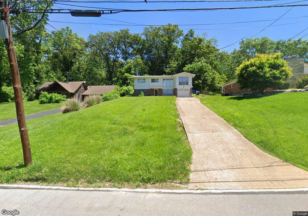
280 Day Dr Saint Louis, MO 63135
Estimated Value: $160,000 - $221,000
4
Beds
2
Baths
2,200
Sq Ft
$85/Sq Ft
Est. Value
About This Home
This home is located at 280 Day Dr, Saint Louis, MO 63135 and is currently estimated at $186,713, approximately $84 per square foot. 280 Day Dr is a home located in St. Louis County with nearby schools including Griffith Elementary School, Ferguson Middle School, and McCluer High School.
Ownership History
Date
Name
Owned For
Owner Type
Purchase Details
Closed on
Apr 13, 2022
Sold by
Sherlann Bell
Bought by
Irons Shaurice L
Current Estimated Value
Purchase Details
Closed on
Apr 4, 2012
Sold by
Kirschner Hester V
Bought by
Bell Sherlann
Home Financials for this Owner
Home Financials are based on the most recent Mortgage that was taken out on this home.
Original Mortgage
$78,530
Interest Rate
3.92%
Mortgage Type
New Conventional
Purchase Details
Closed on
Apr 21, 1999
Sold by
Kirschner Hester V
Bought by
Kirschner Hester and Hester V Kirschner Revocable Living Tr
Create a Home Valuation Report for This Property
The Home Valuation Report is an in-depth analysis detailing your home's value as well as a comparison with similar homes in the area
Home Values in the Area
Average Home Value in this Area
Purchase History
| Date | Buyer | Sale Price | Title Company |
|---|---|---|---|
| Irons Shaurice L | -- | None Listed On Document | |
| Bell Sherlann | $77,500 | Investors Title Co Clayton | |
| Kirschner Hester | -- | -- |
Source: Public Records
Mortgage History
| Date | Status | Borrower | Loan Amount |
|---|---|---|---|
| Previous Owner | Bell Sherlann | $78,530 |
Source: Public Records
Tax History Compared to Growth
Tax History
| Year | Tax Paid | Tax Assessment Tax Assessment Total Assessment is a certain percentage of the fair market value that is determined by local assessors to be the total taxable value of land and additions on the property. | Land | Improvement |
|---|---|---|---|---|
| 2025 | $2,142 | $32,680 | $4,120 | $28,560 |
| 2024 | $2,142 | $29,660 | $3,420 | $26,240 |
| 2023 | $2,130 | $29,660 | $3,420 | $26,240 |
| 2022 | $1,799 | $21,790 | $3,420 | $18,370 |
| 2021 | $1,741 | $21,790 | $3,420 | $18,370 |
| 2020 | $1,547 | $17,370 | $3,400 | $13,970 |
| 2019 | $1,518 | $17,370 | $3,400 | $13,970 |
| 2018 | $2,037 | $20,890 | $3,140 | $17,750 |
| 2017 | $1,996 | $20,890 | $3,140 | $17,750 |
| 2016 | $1,572 | $16,120 | $3,140 | $12,980 |
| 2015 | $1,582 | $16,120 | $3,140 | $12,980 |
| 2014 | $1,623 | $16,360 | $1,920 | $14,440 |
Source: Public Records
Map
Nearby Homes
- 506 Averill Ave
- 410 Argent Ave
- 1209 Chambers Rd
- 339 Wedge Dr
- 514 La Motte Ln
- 408 Coppinger Dr
- 818 Robert Ave
- 208 Coppinger Dr
- 1330 Chambers Rd
- 315 Coppinger Dr
- 931 Thatcher Ave
- 57 Forestwood Dr
- 324 Ames Place
- 539 Coppinger Dr
- 310 Ames Place
- 926 Westwold Ave
- 50 Fenwick Dr
- 610 Superior Dr
- 309 N Floridale Ave
- 125 Forestwood Dr